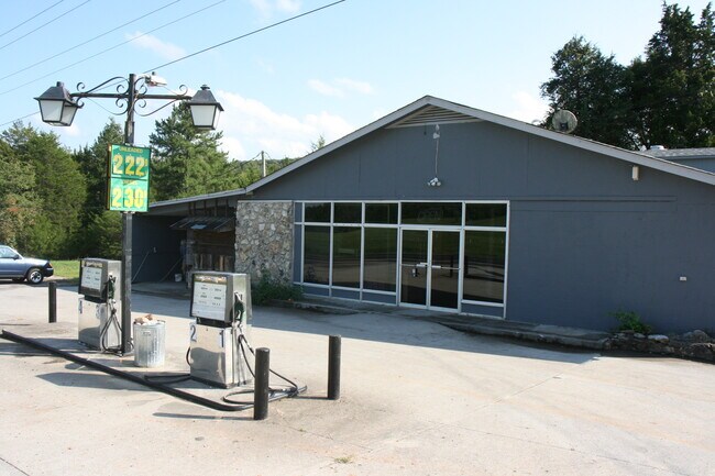
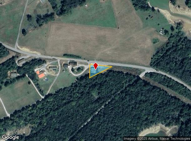
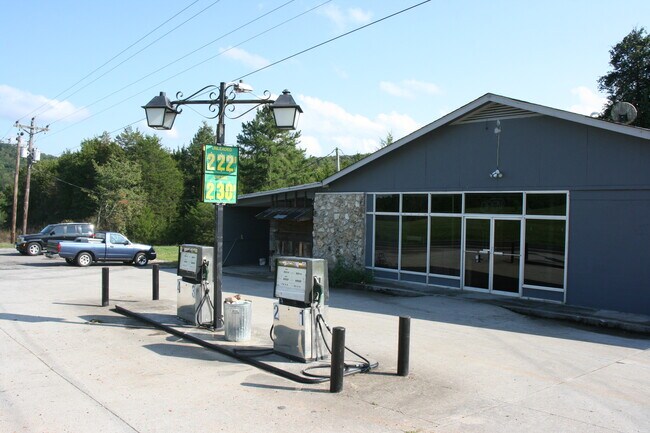
Property Record
225 Sharps Chapel Rd, New Tazewell, TN 37825
NEARBY LISTINGS FOR SALE OR LEASE
-
-
View all New Tazewell listings for sale on LoopNet.com
Property Detail
225 Sharps Chapel Rd
Knoxville, TN
James Harness S/D
021O-B-023.00
DISTRICT: 05, COUNTY AREA: F06
Storebuilding
Union
X
Tennessee
47025C0325E
23
2024
0.50 AC
2025
Union County
040300
Knoxville
3,192 SF
DEMOGRAPHICS near 225 Sharps Chapel Rd
1 Mile
3 Mile
5 Mile
2024 Total Population
419
2,754
5,691
2029 Population
457
2,984
6,132
Pop Growth 2024-2029
+ 9.07%
+ 8.35%
+ 7.75%
Average Age
46
44
43
2024 Total Households
178
1,140
2,307
HH Growth 2024-2029
+ 8.99%
+ 8.33%
+ 7.76%
Median Household Inc
$57,856
$51,801
$50,855
Avg Household Size
2.30
2.40
2.40
2024 Avg HH Vehicles
2.00
2.00
2.00
Median Home Value
$204,348
$176,922
$171,533
Median Year Built
1994
1992
1992
Nearby Places
Map Layers
Map Styles
 Street
 Aerial
- Restaurants
- Banks
- Shops
- Fitness
- Groceries
SALE & LEASE HISTORY
LISTING DATE
SALE/LEASE

Nov 01, 2020
For Sale
Nearby Properties
Address
Land Use
TOTAL SIZE
Lot Size
Zoning
Address
Land Use
TOTAL SIZE
Lot Size
Zoning
3,864 SF
Address
Land Use
TOTAL SIZE
Lot Size
Zoning
9,170 SF
2 AC
Address
Land Use
TOTAL SIZE
Lot Size
Zoning
Address
Land Use
TOTAL SIZE
Lot Size
Zoning
7,040 SF
7.50 AC
Address
Land Use
TOTAL SIZE
Lot Size
Zoning
Address
Land Use
TOTAL SIZE
Lot Size
Zoning
Address
Land Use
TOTAL SIZE
Lot Size
Zoning
6,478 SF
0.67 AC
Address
Land Use
TOTAL SIZE
Lot Size
Zoning
Address
Land Use
TOTAL SIZE
Lot Size
Zoning
2,704 SF
5.20 AC
Address
Land Use
TOTAL SIZE
Lot Size
Zoning
122.97 AC
Address
Land Use
TOTAL SIZE
Lot Size
Zoning
4,684 SF
0.74 AC
Address
Land Use
TOTAL SIZE
Lot Size
Zoning
4,172 SF
1 AC
Address
Land Use
TOTAL SIZE
Lot Size
Zoning
2,769 SF
0.75 AC
Address
Land Use
TOTAL SIZE
Lot Size
Zoning
3,756 SF
1.57 AC
Address
Land Use
TOTAL SIZE
Lot Size
Zoning
2,120 SF
0.57 AC
Address
Land Use
TOTAL SIZE
Lot Size
Zoning
3,014 SF
2.73 AC
Address
Land Use
TOTAL SIZE
Lot Size
Zoning
14.80 AC
Address
Land Use
TOTAL SIZE
Lot Size
Zoning
2,880 SF
20 AC
Address
Land Use
TOTAL SIZE
Lot Size
Zoning
4.40 AC
Address
Land Use
TOTAL SIZE
Lot Size
Zoning
2,688 SF
0.56 AC
Address
Land Use
TOTAL SIZE
Lot Size
Zoning
Address
Land Use
TOTAL SIZE
Lot Size
Zoning
Address
Land Use
TOTAL SIZE
Lot Size
Zoning
2,880 SF
63.49 AC
Address
Land Use
TOTAL SIZE
Lot Size
Zoning
1.07 AC
Address
Land Use
TOTAL SIZE
Lot Size
Zoning
1.09 AC
Address
Land Use
TOTAL SIZE
Lot Size
Zoning
2,764 SF
1.12 AC
Address
Land Use
TOTAL SIZE
Lot Size
Zoning
Address
Land Use
TOTAL SIZE
Lot Size
Zoning
2,252 SF
2.64 AC
Address
Land Use
TOTAL SIZE
Lot Size
Zoning
1.32 AC
Address
Land Use
TOTAL SIZE
Lot Size
Zoning
1.01 AC
The World's #1 Commercial Real Estate Marketplace
Connect with us
© 2025 CoStar Group
The information above has been obtained from sources believed reliable. While we do not doubt its accuracy we have not verified it and make no guarantee, warranty or representation about it. It is your responsibility to independently confirm its accuracy and completeness. Any projections, opinions, assumptions, or estimates used are for example only and do not represent the current or future performance of the property. The value of this transaction to you depends on tax and other factors which should be evaluated by your tax, financial, and legal advisors. You and your advisors should conduct a careful, independent investigation of the property to determine to your satisfaction the suitability of the property for your needs.