Property Record
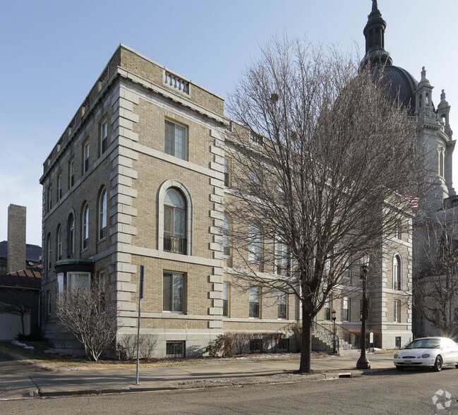
225 Summit Ave, Saint Paul, MN 55102

NEARBY LISTINGS FOR SALE OR LEASE
Property Detail
225 Summit Ave
Minneapolis-St. Paul-Bloomington, MN-WI
Auditors Subdivision,No.5 St.
01-28-23-11-0028
AUDITORS SUBDIVISION,NO.5 ST. PART OF SUMMIT AVE VAC ADJ AND LOT ...LOT 5 AND S 25 FT OF LOT 6
Religious
Ramsey
X
Minnesota
27037C0050E
...,5
2024
3.35 AC
2025
Suburban St Paul
034000
Minneapolis/St Paul
81,840 SF
DEMOGRAPHICS near 225 Summit Ave
1 Mile
3 Mile
5 Mile
2024 Total Population
27,668
169,058
360,369
2029 Population
27,371
165,040
352,681
Pop Growth 2024-2029
(1.07%)
(2.38%)
(2.13%)
Average Age
40
37
38
2024 Total Households
14,043
67,698
143,986
HH Growth 2024-2029
(0.94%)
(2.37%)
(2.13%)
Median Household Inc
$57,605
$64,422
$67,574
Avg Household Size
1.80
2.30
2.40
2024 Avg HH Vehicles
1.00
2.00
2.00
Median Home Value
$303,196
$262,856
$281,638
Median Year Built
1964
1949
1956
Nearby Places
Map Layers
Map Styles
 Street
 Aerial
- Restaurants
- Banks
- Shops
- Fitness
- Groceries
PUBLIC TRANSPORTATION
TRANSIT/SUBWAY
Capitol / Rice St Station (METRO Green Line - Metro Transit)
DRIVE
WALK
Distance
Capitol / Rice St Station (METRO Green Line - Metro Transit)
1 min
13 min
0.7 mi
10Th St Station (METRO Green Line - Metro Transit)
DRIVE
WALK
Distance
10Th St Station (METRO Green Line - Metro Transit)
2 min
14 min
0.7 mi
Robert St Station (METRO Green Line - Metro Transit)
DRIVE
WALK
Distance
Robert St Station (METRO Green Line - Metro Transit)
2 min
16 min
0.9 mi
Western Ave Station (METRO Green Line - Metro Transit)
DRIVE
WALK
Distance
Western Ave Station (METRO Green Line - Metro Transit)
2 min
18 min
1.0 mi
Central Station (METRO Green Line - Metro Transit)
DRIVE
WALK
Distance
Central Station (METRO Green Line - Metro Transit)
3 min
20 min
1.1 mi
COMMUTER RAIL
St. Paul-Minneapolis (Empire Builder - Amtrak)
DRIVE
WALK
Distance
St. Paul-Minneapolis (Empire Builder - Amtrak)
3 min
1.6 mi
Target Field Station (Northstar Corridor - Northstar Commuter Rail)
DRIVE
WALK
Distance
Target Field Station (Northstar Corridor - Northstar Commuter Rail)
18 min
9.7 mi
AIRPORT
Minneapolis-St Paul International/Wold-Chamberlain
DRIVE
WALK
Distance
Minneapolis-St Paul International/Wold-Chamberlain
15 min
9.3 mi
Freight Ports
Port Milwaukee
DRIVE
WALK
Distance
Port Milwaukee
363 min
330.2 mi
Nearby Properties
Address
Land Use
TOTAL SIZE
Lot Size
Zoning
Address
Land Use
TOTAL SIZE
Lot Size
Zoning
384,515 SF
18.04 AC
Address
Land Use
TOTAL SIZE
Lot Size
Zoning
84,316 SF
40.83 AC
Address
Land Use
TOTAL SIZE
Lot Size
Zoning
384,515 SF
1.33 AC
Address
Land Use
TOTAL SIZE
Lot Size
Zoning
582,896 SF
14 AC
Address
Land Use
TOTAL SIZE
Lot Size
Zoning
825,463 SF
7.04 AC
Address
Land Use
TOTAL SIZE
Lot Size
Zoning
124,932 SF
9.68 AC
Address
Land Use
TOTAL SIZE
Lot Size
Zoning
63.12 AC
Address
Land Use
TOTAL SIZE
Lot Size
Zoning
646,900 SF
7.66 AC
Address
Land Use
TOTAL SIZE
Lot Size
Zoning
32,854 SF
5.55 AC
Address
Land Use
TOTAL SIZE
Lot Size
Zoning
404,491 SF
27.01 AC
Address
Land Use
TOTAL SIZE
Lot Size
Zoning
18.24 AC
Address
Land Use
TOTAL SIZE
Lot Size
Zoning
408.23 AC
Address
Land Use
TOTAL SIZE
Lot Size
Zoning
420,177 SF
2.13 AC
Address
Land Use
TOTAL SIZE
Lot Size
Zoning
395,419 SF
2.73 AC
Address
Land Use
TOTAL SIZE
Lot Size
Zoning
516,325 SF
16.81 AC
Address
Land Use
TOTAL SIZE
Lot Size
Zoning
759,622 SF
2.66 AC
Address
Land Use
TOTAL SIZE
Lot Size
Zoning
786,042 SF
2.10 AC
Address
Land Use
TOTAL SIZE
Lot Size
Zoning
643,305 SF
1.93 AC
Address
Land Use
TOTAL SIZE
Lot Size
Zoning
7.41 AC
Address
Land Use
TOTAL SIZE
Lot Size
Zoning
793,465 SF
1.93 AC
Address
Land Use
TOTAL SIZE
Lot Size
Zoning
68,748 SF
21.59 AC
Address
Land Use
TOTAL SIZE
Lot Size
Zoning
3,050 SF
58.60 AC
Address
Land Use
TOTAL SIZE
Lot Size
Zoning
329,070 SF
5.75 AC
Address
Land Use
TOTAL SIZE
Lot Size
Zoning
160,800 SF
5.05 AC
Address
Land Use
TOTAL SIZE
Lot Size
Zoning
393,443 SF
3.75 AC
Address
Land Use
TOTAL SIZE
Lot Size
Zoning
260,739 SF
3.04 AC
Address
Land Use
TOTAL SIZE
Lot Size
Zoning
445,437 SF
7.80 AC
Address
Land Use
TOTAL SIZE
Lot Size
Zoning
265,736 SF
6.67 AC
Address
Land Use
TOTAL SIZE
Lot Size
Zoning
3.13 AC
Address
Land Use
TOTAL SIZE
Lot Size
Zoning
455,628 SF
2.81 AC
The World's #1 Commercial Real Estate Marketplace
Connect with us
© 2025 CoStar Group
The information above has been obtained from sources believed reliable. While we do not doubt its accuracy we have not verified it and make no guarantee, warranty or representation about it. It is your responsibility to independently confirm its accuracy and completeness. Any projections, opinions, assumptions, or estimates used are for example only and do not represent the current or future performance of the property. The value of this transaction to you depends on tax and other factors which should be evaluated by your tax, financial, and legal advisors. You and your advisors should conduct a careful, independent investigation of the property to determine to your satisfaction the suitability of the property for your needs.