Property Record
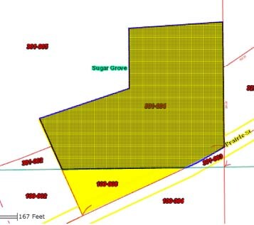
225 W Prairie St, Sugar Grove, IL 60554
NEARBY LISTINGS FOR SALE OR LEASE
Property Detail
225 W Prairie St
14-21-301-004
None
Commercialnec
PT OF THE SW 1/4 OF SEC 21-38-7 DESC IN DOC 94K063187 DATED 08-12-94 (EX PT DESC IN DOC 2005K005556)
X
Kane
17089C0315J
Illinois
2024
4.75 AC
2024
Western East/West Corr
854504
Chicago
1,777 SF
Chicago-Naperville-Elgin, IL-IN-WI
DEMOGRAPHICS near 225 W Prairie St
1 Mile
3 Mile
5 Mile
2024 Total Population
2,914
14,897
51,138
2029 Population
2,925
15,267
52,952
Pop Growth 2024-2029
+ 0.38%
+ 2.48%
+ 3.55%
Average Age
40
39
39
2024 Total Households
1,067
5,207
17,760
HH Growth 2024-2029
+ 0.19%
+ 2.42%
+ 3.23%
Median Household Inc
$112,933
$109,387
$102,095
Avg Household Size
2.70
2.90
2.80
2024 Avg HH Vehicles
2.00
2.00
2.00
Median Home Value
$276,102
$279,435
$264,322
Median Year Built
1986
2002
2000
Nearby Places
Map Layers
Map Styles
 Street
 Aerial
- Restaurants
- Banks
- Shops
- Fitness
- Groceries
PUBLIC TRANSPORTATION
COMMUTER RAIL
Aurora Station (Burlington Northern-Santa Fe Railway Line - Northeast Illinois Regional Commuter Railroad (Metra))
DRIVE
WALK
Distance
Aurora Station (Burlington Northern-Santa Fe Railway Line - Northeast Illinois Regional Commuter Railroad (Metra))
18 min
8.4 mi
Freight Ports
Port Milwaukee
DRIVE
WALK
Distance
Port Milwaukee
142 min
115.6 mi
Nearby Properties
Address
Land Use
TOTAL SIZE
Lot Size
Zoning
Address
Land Use
TOTAL SIZE
Lot Size
Zoning
0.13 AC
Address
Land Use
TOTAL SIZE
Lot Size
Zoning
Address
Land Use
TOTAL SIZE
Lot Size
Zoning
1.14 AC
Address
Land Use
TOTAL SIZE
Lot Size
Zoning
Address
Land Use
TOTAL SIZE
Lot Size
Zoning
36,200 SF
5.84 AC
Address
Land Use
TOTAL SIZE
Lot Size
Zoning
Address
Land Use
TOTAL SIZE
Lot Size
Zoning
Address
Land Use
TOTAL SIZE
Lot Size
Zoning
Address
Land Use
TOTAL SIZE
Lot Size
Zoning
91,579 SF
22.83 AC
Address
Land Use
TOTAL SIZE
Lot Size
Zoning
1,200 SF
1 AC
Address
Land Use
TOTAL SIZE
Lot Size
Zoning
46,284 SF
4.84 AC
Address
Land Use
TOTAL SIZE
Lot Size
Zoning
45,000 SF
3.04 AC
Address
Land Use
TOTAL SIZE
Lot Size
Zoning
Address
Land Use
TOTAL SIZE
Lot Size
Zoning
Address
Land Use
TOTAL SIZE
Lot Size
Zoning
Address
Land Use
TOTAL SIZE
Lot Size
Zoning
40,000 SF
2.92 AC
Address
Land Use
TOTAL SIZE
Lot Size
Zoning
1,128 SF
1.78 AC
Address
Land Use
TOTAL SIZE
Lot Size
Zoning
39,543 SF
1 AC
Address
Land Use
TOTAL SIZE
Lot Size
Zoning
44,000 SF
0.80 AC
Address
Land Use
TOTAL SIZE
Lot Size
Zoning
Address
Land Use
TOTAL SIZE
Lot Size
Zoning
Address
Land Use
TOTAL SIZE
Lot Size
Zoning
14,592 SF
1.82 AC
Address
Land Use
TOTAL SIZE
Lot Size
Zoning
30,108 SF
2 AC
Address
Land Use
TOTAL SIZE
Lot Size
Zoning
15,964 SF
2 AC
Address
Land Use
TOTAL SIZE
Lot Size
Zoning
36.35 AC
Address
Land Use
TOTAL SIZE
Lot Size
Zoning
39.61 AC
Address
Land Use
TOTAL SIZE
Lot Size
Zoning
20,000 SF
2 AC
Address
Land Use
TOTAL SIZE
Lot Size
Zoning
42,850 SF
2.02 AC
Address
Land Use
TOTAL SIZE
Lot Size
Zoning
24,375 SF
1.95 AC
Address
Land Use
TOTAL SIZE
Lot Size
Zoning
The World's #1 Commercial Real Estate Marketplace
Connect with us
© 2025 CoStar Group
The information above has been obtained from sources believed reliable. While we do not doubt its accuracy we have not verified it and make no guarantee, warranty or representation about it. It is your responsibility to independently confirm its accuracy and completeness. Any projections, opinions, assumptions, or estimates used are for example only and do not represent the current or future performance of the property. The value of this transaction to you depends on tax and other factors which should be evaluated by your tax, financial, and legal advisors. You and your advisors should conduct a careful, independent investigation of the property to determine to your satisfaction the suitability of the property for your needs.