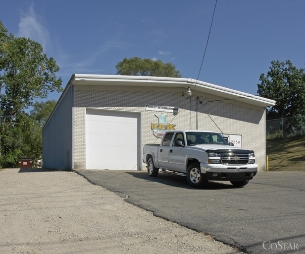
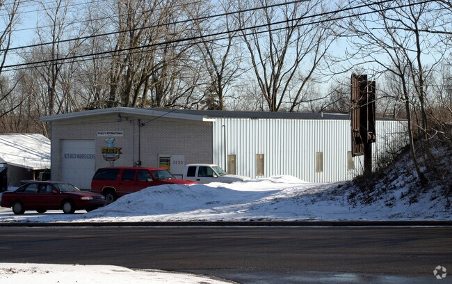
Property Record
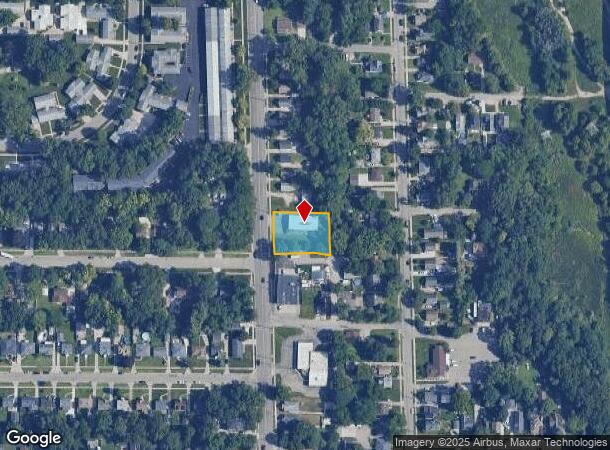
2250 Clyde Park Ave Sw, Wyoming, MI 49509
NEARBY LISTINGS FOR SALE OR LEASE
Property Detail
2250 Clyde Park Ave Sw
41-17-12-151-038
Ft To Beg Clyde Park Add
Warehouse
411712151038 LOTS 12 13 & 14 BLK 3 EX THAT PART OF LOT 14 COM AT SE COR OF SD LOT TH S 89D 56M 35S W ALONG S LINE OF SD LOT
X
Kent
26081C0416D
Michigan
2024
0.42 AC
2025
Central Grand Rapids
004000
West Michigan
3,200 SF
Grand Rapids-Wyoming, MI
DEMOGRAPHICS near 2250 Clyde Park Ave Sw
1 Mile
3 Mile
5 Mile
2024 Total Population
16,981
118,208
280,964
2029 Population
16,941
118,746
282,417
Pop Growth 2024-2029
(0.24%)
+ 0.46%
+ 0.52%
Average Age
33
35
37
2024 Total Households
5,110
43,670
109,509
HH Growth 2024-2029
(0.14%)
+ 0.58%
+ 0.57%
Median Household Inc
$48,105
$54,395
$62,333
Avg Household Size
3.10
2.60
2.40
2024 Avg HH Vehicles
2.00
2.00
2.00
Median Home Value
$121,830
$155,611
$196,765
Median Year Built
1950
1953
1958
Nearby Places
Map Layers
Map Styles
 Street
 Aerial
- Restaurants
- Banks
- Shops
- Fitness
- Groceries
PUBLIC TRANSPORTATION
COMMUTER RAIL
DRIVE
WALK
Distance
6 min
3.2 mi
AIRPORT
Gerald R Ford International
DRIVE
WALK
Distance
Gerald R Ford International
23 min
11.5 mi
Nearby Properties
Address
Land Use
TOTAL SIZE
Lot Size
Zoning
Address
Land Use
TOTAL SIZE
Lot Size
Zoning
265,905 SF
1.99 AC
TN-CC
Address
Land Use
TOTAL SIZE
Lot Size
Zoning
138,122 SF
1.01 AC
TN-CC
Address
Land Use
TOTAL SIZE
Lot Size
Zoning
398,607 SF
33.51 AC
R4
Address
Land Use
TOTAL SIZE
Lot Size
Zoning
164,591 SF
1.28 AC
TN-CC
Address
Land Use
TOTAL SIZE
Lot Size
Zoning
Address
Land Use
TOTAL SIZE
Lot Size
Zoning
201,100 SF
0.90 AC
TN-CC
Address
Land Use
TOTAL SIZE
Lot Size
Zoning
88,327 SF
2.74 AC
TN-CC
Address
Land Use
TOTAL SIZE
Lot Size
Zoning
87.39 AC
I2
Address
Land Use
TOTAL SIZE
Lot Size
Zoning
269,990 SF
1.28 AC
TN-CC
Address
Land Use
TOTAL SIZE
Lot Size
Zoning
3.31 AC
TN-CC
Address
Land Use
TOTAL SIZE
Lot Size
Zoning
269,990 SF
1.28 AC
TN-CC
Address
Land Use
TOTAL SIZE
Lot Size
Zoning
3.31 AC
TN-CC
Address
Land Use
TOTAL SIZE
Lot Size
Zoning
536,296 SF
26.16 AC
SD-IT
Address
Land Use
TOTAL SIZE
Lot Size
Zoning
179,436 SF
24.94 AC
I2
Address
Land Use
TOTAL SIZE
Lot Size
Zoning
212,353 SF
16.52 AC
R4
Address
Land Use
TOTAL SIZE
Lot Size
Zoning
348,367 SF
12.15 AC
SD-IT
Address
Land Use
TOTAL SIZE
Lot Size
Zoning
29.13 AC
Address
Land Use
TOTAL SIZE
Lot Size
Zoning
293,441 SF
18 AC
I-1
Address
Land Use
TOTAL SIZE
Lot Size
Zoning
251,562 SF
15.56 AC
MZ
Address
Land Use
TOTAL SIZE
Lot Size
Zoning
31,365 SF
TN-TCC
Address
Land Use
TOTAL SIZE
Lot Size
Zoning
162,228 SF
14.31 AC
R4
Address
Land Use
TOTAL SIZE
Lot Size
Zoning
135,254 SF
0.26 AC
TN-CC
Address
Land Use
TOTAL SIZE
Lot Size
Zoning
131,004 SF
0.64 AC
TN-CC
Address
Land Use
TOTAL SIZE
Lot Size
Zoning
89,565 SF
0.16 AC
TN-CC
Address
Land Use
TOTAL SIZE
Lot Size
Zoning
122,570 SF
1.17 AC
TN-TCC
Address
Land Use
TOTAL SIZE
Lot Size
Zoning
123,066 SF
0.30 AC
TN-CC
Address
Land Use
TOTAL SIZE
Lot Size
Zoning
106,284 SF
0.59 AC
TN-CC
Address
Land Use
TOTAL SIZE
Lot Size
Zoning
174,256 SF
10.83 AC
SD-IT
Address
Land Use
TOTAL SIZE
Lot Size
Zoning
Address
Land Use
TOTAL SIZE
Lot Size
Zoning
248,360 SF
7.03 AC
SD-IT
The World's #1 Commercial Real Estate Marketplace
Connect with us
© 2025 CoStar Group
The information above has been obtained from sources believed reliable. While we do not doubt its accuracy we have not verified it and make no guarantee, warranty or representation about it. It is your responsibility to independently confirm its accuracy and completeness. Any projections, opinions, assumptions, or estimates used are for example only and do not represent the current or future performance of the property. The value of this transaction to you depends on tax and other factors which should be evaluated by your tax, financial, and legal advisors. You and your advisors should conduct a careful, independent investigation of the property to determine to your satisfaction the suitability of the property for your needs.