Property Record
2250 Griffin Rd, Lakeland, FL 33810


NEARBY LISTINGS FOR SALE OR LEASE
Property Detail
2250 Griffin Rd
23-28-03-000000-012010
Alameda Heights
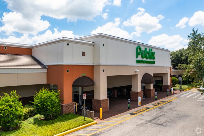
Regionalshoppingcenterormallwithanchorstore
ETAIL CENTER PARCEL DESC AS: BEG 232.44 FT W OF NE COR OF SE1/4 OF NE1/4 S 114.33 FT S 07 DEG 15 MIN 13 SEC W 84.8 FT SWLY ALONG CURVE 55.82 FT S 44 DEG 39 MIN 32 SEC W 273.87 FT SWLY ALONG CURVE 27.17 FT S 36 DEG 39 MIN 15 SEC W 50.93 FT S 63 DEG 07
A
Polk
12105C0303G
Florida
2024
10.70 AC
2025
Polk County
012001
Tampa/St Petersburg
63,674 SF
Lakeland-Winter Haven, FL
DEMOGRAPHICS near 2250 Griffin Rd
1 Mile
3 Mile
5 Mile
2024 Total Population
6,603
55,175
132,703
2029 Population
7,923
66,040
158,368
Pop Growth 2024-2029
+ 19.99%
+ 19.69%
+ 19.34%
Average Age
39
40
40
2024 Total Households
2,392
21,478
51,836
HH Growth 2024-2029
+ 19.86%
+ 19.63%
+ 19.62%
Median Household Inc
$60,515
$47,059
$51,595
Avg Household Size
2.70
2.40
2.40
2024 Avg HH Vehicles
2.00
2.00
2.00
Median Home Value
$228,504
$172,604
$187,435
Median Year Built
1999
1985
1985
Nearby Places
Map Layers
Map Styles
 Street
 Aerial
- Restaurants
- Banks
- Shops
- Fitness
- Groceries
PUBLIC TRANSPORTATION
AIRPORT
Tampa International
DRIVE
WALK
Distance
Tampa International
50 min
39.1 mi
SALE & LEASE HISTORY
LISTING DATE
SALE/LEASE

Sep 25, 2016
For Lease
Nearby Properties
Address
Land Use
TOTAL SIZE
Lot Size
Zoning
Address
Land Use
TOTAL SIZE
Lot Size
Zoning
2,325,080 SF
27.05 AC
PUD
Address
Land Use
TOTAL SIZE
Lot Size
Zoning
1,091,160 SF
133.41 AC
PUD
Address
Land Use
TOTAL SIZE
Lot Size
Zoning
363,693 SF
22.54 AC
R2
Address
Land Use
TOTAL SIZE
Lot Size
Zoning
333,455 SF
11.90 AC
Address
Land Use
TOTAL SIZE
Lot Size
Zoning
1,004,426 SF
93.42 AC
C4
Address
Land Use
TOTAL SIZE
Lot Size
Zoning
279,726 SF
19.09 AC
C3
Address
Land Use
TOTAL SIZE
Lot Size
Zoning
246,838 SF
24.57 AC
PUD
Address
Land Use
TOTAL SIZE
Lot Size
Zoning
568,801 SF
37.13 AC
C4
Address
Land Use
TOTAL SIZE
Lot Size
Zoning
762,259 SF
24.95 AC
PUD
Address
Land Use
TOTAL SIZE
Lot Size
Zoning
208,898 SF
17.62 AC
PUD
Address
Land Use
TOTAL SIZE
Lot Size
Zoning
297,600 SF
27.53 AC
XX
Address
Land Use
TOTAL SIZE
Lot Size
Zoning
309,334 SF
41.64 AC
Address
Land Use
TOTAL SIZE
Lot Size
Zoning
84,824 SF
163.73 AC
I2
Address
Land Use
TOTAL SIZE
Lot Size
Zoning
258,946 SF
11.73 AC
O3
Address
Land Use
TOTAL SIZE
Lot Size
Zoning
79,697 SF
6.37 AC
C2
Address
Land Use
TOTAL SIZE
Lot Size
Zoning
169,546 SF
14.40 AC
PUD
Address
Land Use
TOTAL SIZE
Lot Size
Zoning
226,953 SF
34.42 AC
Address
Land Use
TOTAL SIZE
Lot Size
Zoning
425,986 SF
45.72 AC
C5
Address
Land Use
TOTAL SIZE
Lot Size
Zoning
171,525 SF
40.58 AC
RC
Address
Land Use
TOTAL SIZE
Lot Size
Zoning
682,828 SF
36.01 AC
Address
Land Use
TOTAL SIZE
Lot Size
Zoning
115,608 SF
11.44 AC
RC
Address
Land Use
TOTAL SIZE
Lot Size
Zoning
156,987 SF
51.52 AC
Address
Land Use
TOTAL SIZE
Lot Size
Zoning
101,501 SF
16.54 AC
Address
Land Use
TOTAL SIZE
Lot Size
Zoning
180,802 SF
76.35 AC
Address
Land Use
TOTAL SIZE
Lot Size
Zoning
210,000 SF
12.91 AC
Address
Land Use
TOTAL SIZE
Lot Size
Zoning
292,124 SF
29.70 AC
PUD
Address
Land Use
TOTAL SIZE
Lot Size
Zoning
210,000 SF
13.28 AC
Address
Land Use
TOTAL SIZE
Lot Size
Zoning
87,975 SF
5.45 AC
O1
Address
Land Use
TOTAL SIZE
Lot Size
Zoning
226,634 SF
27.21 AC
C3
Address
Land Use
TOTAL SIZE
Lot Size
Zoning
183,800 SF
19.26 AC
The World's #1 Commercial Real Estate Marketplace
Connect with us
© 2025 CoStar Group
The information above has been obtained from sources believed reliable. While we do not doubt its accuracy we have not verified it and make no guarantee, warranty or representation about it. It is your responsibility to independently confirm its accuracy and completeness. Any projections, opinions, assumptions, or estimates used are for example only and do not represent the current or future performance of the property. The value of this transaction to you depends on tax and other factors which should be evaluated by your tax, financial, and legal advisors. You and your advisors should conduct a careful, independent investigation of the property to determine to your satisfaction the suitability of the property for your needs.