Property Record
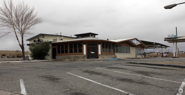
2250 W Main St, Barstow, CA 92311


NEARBY LISTINGS FOR SALE OR LEASE
Property Detail
2250 W Main St
0182-221-04
PTN NE 1/4 NW 1/4 SEC 11 TP 9N R 2W LYING SLY AND WLY OF STATE HGWY EX COM AT A PT ON S LI SD HGWY AND W LI NE 1/4 NW 1/4 SD SEC TH ELY ALG SLY LI SD HGWY 180 FT TH S 800 FT M/L TO A PT ON S LI SD NE 1/4 NW 1/4 TH ALG SD S LI WLYTO A PT IN W LI SD NE
Servicestation
San Bernardino
X
California
06071C3918J
18.35 AC
2024
Mojave River Valley
2025
Inland Empire (California)
011801
Riverside-San Bernardino-Ontario, CA
4,231 SF
DEMOGRAPHICS near 2250 W Main St
1 Mile
3 Mile
5 Mile
2024 Total Population
2,660
26,702
37,305
2029 Population
2,769
27,599
38,596
Pop Growth 2024-2029
+ 4.10%
+ 3.36%
+ 3.46%
Average Age
37
35
35
2024 Total Households
923
9,184
12,953
HH Growth 2024-2029
+ 4.12%
+ 3.39%
+ 3.48%
Median Household Inc
$62,987
$52,140
$53,282
Avg Household Size
2.80
2.80
2.80
2024 Avg HH Vehicles
2.00
2.00
2.00
Median Home Value
$114,458
$183,757
$164,505
Median Year Built
1969
1973
1972
Nearby Places
Map Layers
Map Styles
 Street
 Aerial
- Restaurants
- Banks
- Shops
- Fitness
- Groceries
PUBLIC TRANSPORTATION
COMMUTER RAIL
Barstow (Southwest Chief - Amtrak)
DRIVE
WALK
Distance
Barstow (Southwest Chief - Amtrak)
5 min
2.7 mi
Freight Ports
Port of Long Beach
DRIVE
WALK
Distance
Port of Long Beach
147 min
126.9 mi
Nearby Properties
Address
Land Use
TOTAL SIZE
Lot Size
Zoning
Address
Land Use
TOTAL SIZE
Lot Size
Zoning
82,869 SF
19.81 AC
Address
Land Use
TOTAL SIZE
Lot Size
Zoning
65,916 SF
1.97 AC
Address
Land Use
TOTAL SIZE
Lot Size
Zoning
123,706 SF
13.95 AC
Address
Land Use
TOTAL SIZE
Lot Size
Zoning
80,658 SF
7.18 AC
Address
Land Use
TOTAL SIZE
Lot Size
Zoning
16,895 SF
15.95 AC
Address
Land Use
TOTAL SIZE
Lot Size
Zoning
33,068 SF
1.41 AC
Address
Land Use
TOTAL SIZE
Lot Size
Zoning
49,167 SF
1.03 AC
Address
Land Use
TOTAL SIZE
Lot Size
Zoning
96,403 SF
5.24 AC
Address
Land Use
TOTAL SIZE
Lot Size
Zoning
4,247 SF
8.77 AC
Address
Land Use
TOTAL SIZE
Lot Size
Zoning
14,015 SF
11.20 AC
Address
Land Use
TOTAL SIZE
Lot Size
Zoning
3,000 SF
1.25 AC
Address
Land Use
TOTAL SIZE
Lot Size
Zoning
65,367 SF
7.49 AC
Address
Land Use
TOTAL SIZE
Lot Size
Zoning
34,106 SF
3.37 AC
Address
Land Use
TOTAL SIZE
Lot Size
Zoning
70,580 SF
6.06 AC
Address
Land Use
TOTAL SIZE
Lot Size
Zoning
Address
Land Use
TOTAL SIZE
Lot Size
Zoning
351,550 SF
29.38 AC
Address
Land Use
TOTAL SIZE
Lot Size
Zoning
32,832 SF
3.40 AC
Address
Land Use
TOTAL SIZE
Lot Size
Zoning
213,202 SF
25.02 AC
Address
Land Use
TOTAL SIZE
Lot Size
Zoning
30,380 SF
2.79 AC
Address
Land Use
TOTAL SIZE
Lot Size
Zoning
7,505 SF
1.38 AC
Address
Land Use
TOTAL SIZE
Lot Size
Zoning
64,728 SF
4.50 AC
Address
Land Use
TOTAL SIZE
Lot Size
Zoning
7,808 SF
117.11 AC
RL10AP
Address
Land Use
TOTAL SIZE
Lot Size
Zoning
804 SF
55.30 AC
RL5
Address
Land Use
TOTAL SIZE
Lot Size
Zoning
14,798 SF
1.93 AC
RS1
Address
Land Use
TOTAL SIZE
Lot Size
Zoning
672 SF
4.61 AC
Address
Land Use
TOTAL SIZE
Lot Size
Zoning
16,498 SF
3.62 AC
Address
Land Use
TOTAL SIZE
Lot Size
Zoning
17,322 SF
2.12 AC
Address
Land Use
TOTAL SIZE
Lot Size
Zoning
7,668 SF
3.47 AC
Address
Land Use
TOTAL SIZE
Lot Size
Zoning
22,997 SF
4.37 AC
Address
Land Use
TOTAL SIZE
Lot Size
Zoning
18,609 SF
3.99 AC
The World's #1 Commercial Real Estate Marketplace
Connect with us
© 2025 CoStar Group
The information above has been obtained from sources believed reliable. While we do not doubt its accuracy we have not verified it and make no guarantee, warranty or representation about it. It is your responsibility to independently confirm its accuracy and completeness. Any projections, opinions, assumptions, or estimates used are for example only and do not represent the current or future performance of the property. The value of this transaction to you depends on tax and other factors which should be evaluated by your tax, financial, and legal advisors. You and your advisors should conduct a careful, independent investigation of the property to determine to your satisfaction the suitability of the property for your needs.