Property Record
2250 W Wetmore Rd, Tucson, AZ 85705
NEARBY LISTINGS FOR SALE OR LEASE
Property Detail
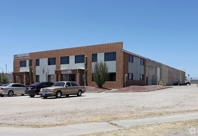
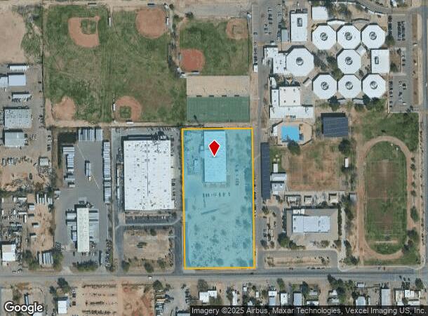
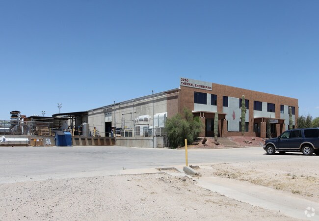
2250 W Wetmore Rd
103-05-0330
Null
Warehouse
E330 W660 E1510 S700 S2 NE4 EXC PTN LYG WITHIN WETMORE RD 4.96 AC FW 5.30 AC SEC 21-13-13
X
Pima
04019C1667L
Arizona
2025
4.96 AC
2025
NW Tucson/Oro Valley
004512
Tucson
24,100 SF
Tucson, AZ
DEMOGRAPHICS near 2250 W Wetmore Rd
1 Mile
3 Mile
5 Mile
2024 Total Population
8,438
70,598
187,903
2029 Population
8,758
73,077
194,751
Pop Growth 2024-2029
+ 3.79%
+ 3.51%
+ 3.64%
Average Age
40
40
39
2024 Total Households
3,424
30,234
83,339
HH Growth 2024-2029
+ 3.86%
+ 3.53%
+ 3.72%
Median Household Inc
$34,571
$47,801
$48,517
Avg Household Size
2.40
2.20
2.10
2024 Avg HH Vehicles
2.00
2.00
2.00
Median Home Value
$87,239
$190,792
$249,512
Median Year Built
1980
1983
1981
Nearby Places
Map Layers
Map Styles
 Street
 Aerial
- Restaurants
- Banks
- Shops
- Fitness
- Groceries
PUBLIC TRANSPORTATION
COMMUTER RAIL
DRIVE
WALK
Distance
13 min
7.1 mi
AIRPORT
Tucson International
DRIVE
WALK
Distance
Tucson International
26 min
14.6 mi
Nearby Properties
Address
Land Use
TOTAL SIZE
Lot Size
Zoning
Address
Land Use
TOTAL SIZE
Lot Size
Zoning
134,710 SF
9.59 AC
I1
Address
Land Use
TOTAL SIZE
Lot Size
Zoning
373,270 SF
12.62 AC
SP
Address
Land Use
TOTAL SIZE
Lot Size
Zoning
65,294 SF
9.58 AC
SR
Address
Land Use
TOTAL SIZE
Lot Size
Zoning
106,852 SF
19.50 AC
I1
Address
Land Use
TOTAL SIZE
Lot Size
Zoning
451,596 SF
18.92 AC
C3
Address
Land Use
TOTAL SIZE
Lot Size
Zoning
35,300 SF
5.20 AC
SR
Address
Land Use
TOTAL SIZE
Lot Size
Zoning
39,508 SF
7.29 AC
MU
Address
Land Use
TOTAL SIZE
Lot Size
Zoning
27,678 SF
64.08 AC
R2
Address
Land Use
TOTAL SIZE
Lot Size
Zoning
1,216,456 SF
28.73 AC
Address
Land Use
TOTAL SIZE
Lot Size
Zoning
288,815 SF
14.96 AC
Address
Land Use
TOTAL SIZE
Lot Size
Zoning
139,733 SF
9.80 AC
C3
Address
Land Use
TOTAL SIZE
Lot Size
Zoning
290,039 SF
1.98 AC
C3
Address
Land Use
TOTAL SIZE
Lot Size
Zoning
122,413 SF
21.85 AC
I1
Address
Land Use
TOTAL SIZE
Lot Size
Zoning
177,018 SF
16.78 AC
C2
Address
Land Use
TOTAL SIZE
Lot Size
Zoning
375,887 SF
28.70 AC
CR4
Address
Land Use
TOTAL SIZE
Lot Size
Zoning
310,258 SF
17.11 AC
TR
Address
Land Use
TOTAL SIZE
Lot Size
Zoning
12,962 SF
2.80 AC
C3
Address
Land Use
TOTAL SIZE
Lot Size
Zoning
19,892 SF
3.36 AC
CB1
Address
Land Use
TOTAL SIZE
Lot Size
Zoning
250,488 SF
28.62 AC
R2
Address
Land Use
TOTAL SIZE
Lot Size
Zoning
319,196 SF
18.26 AC
TR
Address
Land Use
TOTAL SIZE
Lot Size
Zoning
209,967 SF
14.19 AC
Address
Land Use
TOTAL SIZE
Lot Size
Zoning
36,100 SF
2.42 AC
I1
Address
Land Use
TOTAL SIZE
Lot Size
Zoning
21,000 SF
9.34 AC
Address
Land Use
TOTAL SIZE
Lot Size
Zoning
311,175 SF
13.09 AC
SP
Address
Land Use
TOTAL SIZE
Lot Size
Zoning
279,055 SF
18.03 AC
CR4
Address
Land Use
TOTAL SIZE
Lot Size
Zoning
103,121 SF
12.39 AC
Address
Land Use
TOTAL SIZE
Lot Size
Zoning
60,148 SF
13.63 AC
SP
Address
Land Use
TOTAL SIZE
Lot Size
Zoning
324,571 SF
7.80 AC
C3
Address
Land Use
TOTAL SIZE
Lot Size
Zoning
241,436 SF
9.49 AC
SR
The World's #1 Commercial Real Estate Marketplace
Connect with us
© 2025 CoStar Group
The information above has been obtained from sources believed reliable. While we do not doubt its accuracy we have not verified it and make no guarantee, warranty or representation about it. It is your responsibility to independently confirm its accuracy and completeness. Any projections, opinions, assumptions, or estimates used are for example only and do not represent the current or future performance of the property. The value of this transaction to you depends on tax and other factors which should be evaluated by your tax, financial, and legal advisors. You and your advisors should conduct a careful, independent investigation of the property to determine to your satisfaction the suitability of the property for your needs.