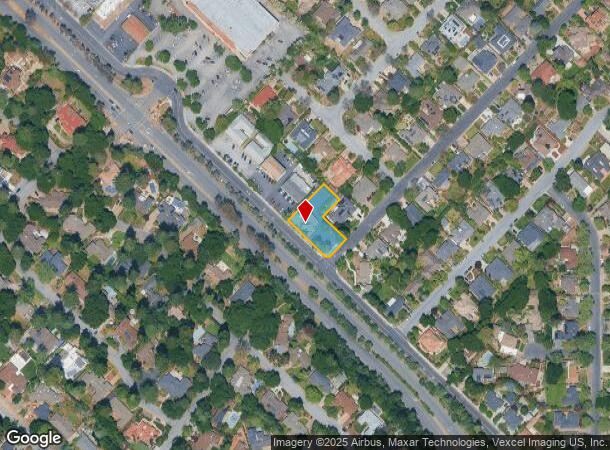
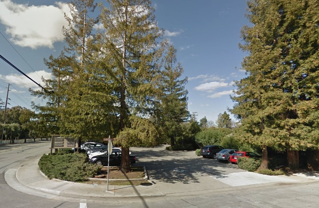
Property Record
2251 Grant Rd, Los Altos, CA 94024


This Property Is For Sale
NEARBY LISTINGS FOR SALE OR LEASE
Property Detail
2251 Grant Rd
318-16-008
Churton Manor
Financialbuilding
Santa Clara
X
California
06087C0050E
0.45 AC
2024
Los Altos
2025
South Bay/San Jose
510002
San Jose-Sunnyvale-Santa Clara, CA
5,458 SF
DEMOGRAPHICS near 2251 Grant Rd
1 mile
3 mile
5 mile
2024 Total Population
14,075
133,818
376,071
2029 Population
13,516
128,736
364,505
Pop Growth 2024-2029
(3.97%)
(3.80%)
(3.08%)
Average Age
45
41
40
2024 Total Households
4,944
46,958
139,292
HH Growth 2024-2029
(4.21%)
(4.05%)
(3.22%)
Median Household Inc
$222,923
$206,726
$187,352
Avg Household Size
2.80
2.80
2.60
2024 Avg HH Vehicles
2.00
2.00
2.00
Median Home Value
$1,144,941
$1,142,005
$1,136,103
Median Year Built
1964
1968
1971
Nearby Places
Map Layers
Map Styles
 Street
 Aerial
Transit
 Traffic
 Biking
Places
Listings with unknown addresses are not visible on the map
- Restaurants
- Banks
- Shops
- Fitness
- Groceries
PUBLIC TRANSPORTATION
COMMUTER RAIL
Mountain View (Caltrain - Caltrain (Caltrain))
Drive
Walk
Distance
Mountain View (Caltrain - Caltrain (Caltrain))
9 min
5.3 mi
Drive
Walk
Distance
9 min
5.3 mi
AIRPORT
Norman Y Mineta San Jose International
Drive
Walk
Distance
Norman Y Mineta San Jose International
19 min
12.5 mi
San Francisco International
Drive
Walk
Distance
San Francisco International
39 min
30.3 mi
Metro Oakland International
Drive
Walk
Distance
Metro Oakland International
52 min
39.0 mi
Freight Ports
Port of Redwood City
Drive
Walk
Distance
Port of Redwood City
24 min
17.1 mi
Nearby Properties
Address
Land Use
TOTAL SIZE
Lot Size
Zoning
Address
Land Use
TOTAL SIZE
Lot Size
Zoning
196,100 SF
1.32 AC
PCMR
Address
Land Use
TOTAL SIZE
Lot Size
Zoning
211,024 SF
9.92 AC
P
Address
Land Use
TOTAL SIZE
Lot Size
Zoning
381,064 SF
20.42 AC
R322
Address
Land Use
TOTAL SIZE
Lot Size
Zoning
141,232 SF
7.98 AC
P(CGM
Address
Land Use
TOTAL SIZE
Lot Size
Zoning
161,956 SF
1.30 AC
PD
Address
Land Use
TOTAL SIZE
Lot Size
Zoning
135,840 SF
1.54 AC
PD
Address
Land Use
TOTAL SIZE
Lot Size
Zoning
77,375 SF
8.41 AC
P(ML)
Address
Land Use
TOTAL SIZE
Lot Size
Zoning
103,910 SF
6.68 AC
P
Address
Land Use
TOTAL SIZE
Lot Size
Zoning
182,558 SF
0.84 AC
PD
Address
Land Use
TOTAL SIZE
Lot Size
Zoning
183,074 SF
0.84 AC
PD
Address
Land Use
TOTAL SIZE
Lot Size
Zoning
50,244 SF
6.35 AC
P(ML)
Address
Land Use
TOTAL SIZE
Lot Size
Zoning
133,631 SF
4.12 AC
C2
Address
Land Use
TOTAL SIZE
Lot Size
Zoning
152,462 SF
10.12 AC
R3
Address
Land Use
TOTAL SIZE
Lot Size
Zoning
76.50 AC
A-D1
Address
Land Use
TOTAL SIZE
Lot Size
Zoning
174,723 SF
2.30 AC
P(38)
Address
Land Use
TOTAL SIZE
Lot Size
Zoning
116,450 SF
3.24 AC
RO
Address
Land Use
TOTAL SIZE
Lot Size
Zoning
12.81 AC
APD
Address
Land Use
TOTAL SIZE
Lot Size
Zoning
202,714 SF
15.03 AC
CGRG
Address
Land Use
TOTAL SIZE
Lot Size
Zoning
163,422 SF
6.95 AC
R3
Address
Land Use
TOTAL SIZE
Lot Size
Zoning
139,607 SF
1.29 AC
PD
Address
Land Use
TOTAL SIZE
Lot Size
Zoning
0.01 AC
P(30)
Address
Land Use
TOTAL SIZE
Lot Size
Zoning
208,850 SF
1.31 AC
C
Address
Land Use
TOTAL SIZE
Lot Size
Zoning
137,640 SF
6.89 AC
R3
Address
Land Use
TOTAL SIZE
Lot Size
Zoning
328,292 SF
19.72 AC
R322
Address
Land Use
TOTAL SIZE
Lot Size
Zoning
91,000 SF
4.15 AC
PCMR
Address
Land Use
TOTAL SIZE
Lot Size
Zoning
Address
Land Use
TOTAL SIZE
Lot Size
Zoning
80,000 SF
4.64 AC
0/ITR
Address
Land Use
TOTAL SIZE
Lot Size
Zoning
4.45 AC
CU
Address
Land Use
TOTAL SIZE
Lot Size
Zoning
144,135 SF
1.67 AC
APD
Address
Land Use
TOTAL SIZE
Lot Size
Zoning
0.34 AC
R1-7.
The World's #1 Commercial Real Estate Marketplace
Connect with us
© 2026 CoStar Group
The information above has been obtained from sources believed reliable. While we do not doubt its accuracy we have not verified it and make no guarantee, warranty or representation about it. It is your responsibility to independently confirm its accuracy and completeness. Any projections, opinions, assumptions, or estimates used are for example only and do not represent the current or future performance of the property. The value of this transaction to you depends on tax and other factors which should be evaluated by your tax, financial, and legal advisors. You and your advisors should conduct a careful, independent investigation of the property to determine to your satisfaction the suitability of the property for your needs.