Property Record
2251 N Brook Dr, Mckinney, TX 75072


Property Detail
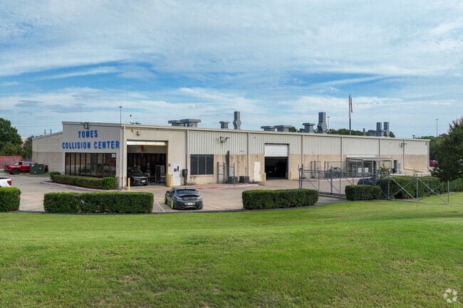
2251 N Brook Dr
Dallas-Fort Worth-Arlington, TX
NORTH BROOK, BLK Q, LOT 1R; * AMENDING *
R-2087-00Q-001R-1
COLLIN
Commercialnec
Texas
AE The base floodplain where base flood elevations are provided. AE Zones are now used on new format FIRMs instead of A1-A30 Zones.
1r
2025
5.32 AC
2025
McKinney
030608
Dallas/Ft Worth
27,888 SF
NEARBY LISTINGS FOR SALE OR LEASE
DEMOGRAPHICS near 2251 N Brook Dr
1 mile
3 mile
5 mile
2025 Total Population
12,151
92,704
213,912
2030 Population
13,966
105,897
244,862
Pop Growth 2025-2030
+ 14.94%
+ 14.23%
+ 14.47%
Average Age
39
39
38
2025 Total Households
4,894
33,734
75,105
HH Growth 2025-2030
+ 15.10%
+ 14.43%
+ 14.75%
Median Household Inc
$92,415
$99,387
$121,358
Avg Household Size
2.40
2.70
2.80
2025 Avg HH Vehicles
2.00
2.00
2.00
Median Home Value
$433,743
$465,608
$537,343
Median Year Built
1994
2000
2006
Nearby Places
Map Layers
Map Styles
 Street
 Aerial
Transit
 Traffic
 Biking
Places
Listings with unknown addresses are not visible on the map
- Restaurants
- Banks
- Shops
- Fitness
- Groceries
PUBLIC TRANSPORTATION
AIRPORT
Dallas Love Field
Drive
Walk
Distance
Dallas Love Field
42 min
32.8 mi
Dallas-Fort Worth International
Drive
Walk
Distance
Dallas-Fort Worth International
41 min
35.1 mi
Nearby Properties
Address
Land Use
TOTAL SIZE
Lot Size
Zoning
Address
Land Use
TOTAL SIZE
Lot Size
Zoning
1,826,199 SF
117.79 AC
Address
Land Use
TOTAL SIZE
Lot Size
Zoning
638,539 SF
42.76 AC
Address
Land Use
TOTAL SIZE
Lot Size
Zoning
755,827 SF
52.76 AC
O
Address
Land Use
TOTAL SIZE
Lot Size
Zoning
691,265 SF
53.52 AC
Address
Land Use
TOTAL SIZE
Lot Size
Zoning
582,987 SF
63.07 AC
Address
Land Use
TOTAL SIZE
Lot Size
Zoning
518,353 SF
28.51 AC
MF-M
Address
Land Use
TOTAL SIZE
Lot Size
Zoning
475,847 SF
16.34 AC
RG-18
Address
Land Use
TOTAL SIZE
Lot Size
Zoning
291,577 SF
69.24 AC
APTTOWNH
Address
Land Use
TOTAL SIZE
Lot Size
Zoning
260,340 SF
18.64 AC
RG-18
Address
Land Use
TOTAL SIZE
Lot Size
Zoning
879,029 SF
50.26 AC
ML
Address
Land Use
TOTAL SIZE
Lot Size
Zoning
727,459 SF
48.83 AC
Address
Land Use
TOTAL SIZE
Lot Size
Zoning
725,223 SF
46.60 AC
Address
Land Use
TOTAL SIZE
Lot Size
Zoning
356,096 SF
19.50 AC
MF-M
Address
Land Use
TOTAL SIZE
Lot Size
Zoning
301,764 SF
20.88 AC
MF
Address
Land Use
TOTAL SIZE
Lot Size
Zoning
337,121 SF
9.39 AC
Address
Land Use
TOTAL SIZE
Lot Size
Zoning
321,982 SF
22.83 AC
SFR
Address
Land Use
TOTAL SIZE
Lot Size
Zoning
272,853 SF
17.32 AC
PD/ML
Address
Land Use
TOTAL SIZE
Lot Size
Zoning
1,708,448 SF
85.24 AC
Address
Land Use
TOTAL SIZE
Lot Size
Zoning
197,115 SF
10.37 AC
MF-M
Address
Land Use
TOTAL SIZE
Lot Size
Zoning
281,420 SF
9.43 AC
PD/ML
Address
Land Use
TOTAL SIZE
Lot Size
Zoning
196,145 SF
18.05 AC
Address
Land Use
TOTAL SIZE
Lot Size
Zoning
201,484 SF
48.39 AC
PD/ML
Address
Land Use
TOTAL SIZE
Lot Size
Zoning
244,257 SF
8.01 AC
AG
Address
Land Use
TOTAL SIZE
Lot Size
Zoning
216,591 SF
33.51 AC
Address
Land Use
TOTAL SIZE
Lot Size
Zoning
232,400 SF
13.32 AC
RG-18
Address
Land Use
TOTAL SIZE
Lot Size
Zoning
193,037 SF
12.35 AC
MF-M
Address
Land Use
TOTAL SIZE
Lot Size
Zoning
244,074 SF
13.97 AC
Address
Land Use
TOTAL SIZE
Lot Size
Zoning
131,417 SF
12 AC
AG
Address
Land Use
TOTAL SIZE
Lot Size
Zoning
151,317 SF
11.58 AC
Address
Land Use
TOTAL SIZE
Lot Size
Zoning
304,565 SF
19.09 AC
COMM
The World's #1 Commercial Real Estate Marketplace
Connect with us
© 2026 CoStar Group
The information above has been obtained from sources believed reliable. While we do not doubt its accuracy we have not verified it and make no guarantee, warranty or representation about it. It is your responsibility to independently confirm its accuracy and completeness. Any projections, opinions, assumptions, or estimates used are for example only and do not represent the current or future performance of the property. The value of this transaction to you depends on tax and other factors which should be evaluated by your tax, financial, and legal advisors. You and your advisors should conduct a careful, independent investigation of the property to determine to your satisfaction the suitability of the property for your needs.