Property Record
22512 Curtis Pl, California City, CA 93505

NEARBY LISTINGS FOR SALE OR LEASE
Property Detail
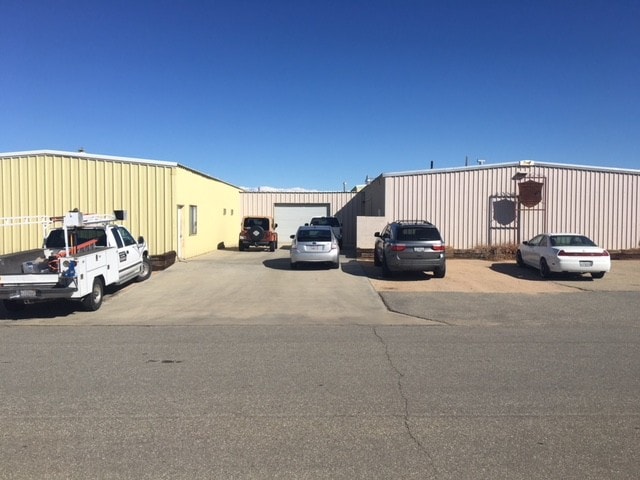
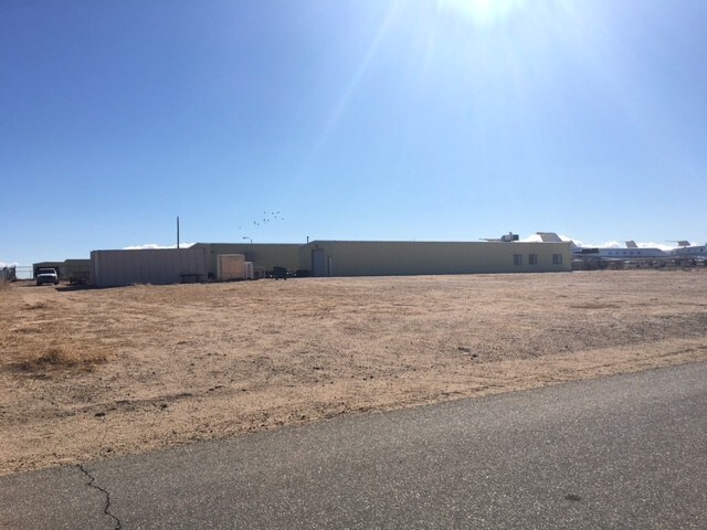
22512 Curtis Pl
Bakersfield-Delano, CA
Tract 2528
216-170-14-00-4
TRACT 2528 , BLOCK , LOT 523
Lightindustrial
Kern
X
California
06029C2920E
523
2024
0.30 AC
2025
NE Outlying Kern County
005508
Bakersfield
4,920 SF
DEMOGRAPHICS near 22512 Curtis Pl
1 Mile
3 Mile
5 Mile
2024 Total Population
31
3,796
14,881
2029 Population
31
3,859
15,068
Pop Growth 2024-2029
0.00%
+ 1.66%
+ 1.26%
Average Age
34
36
37
2024 Total Households
10
1,339
4,750
HH Growth 2024-2029
+ 10.00%
+ 1.57%
+ 1.22%
Median Household Inc
$24,999
$34,529
$41,920
Avg Household Size
2.90
2.90
2.80
2024 Avg HH Vehicles
2.00
2.00
2.00
Median Home Value
$174,999
$168,338
$203,204
Median Year Built
1989
1989
1992
Nearby Places
Map Layers
Map Styles
 Street
 Aerial
- Restaurants
- Banks
- Shops
- Fitness
- Groceries
SALE & LEASE HISTORY
LISTING DATE
SALE/LEASE

May 10, 2018
For Sale
Dec 28, 2017
For Sale
Nearby Properties
Address
Land Use
TOTAL SIZE
Lot Size
Zoning
Address
Land Use
TOTAL SIZE
Lot Size
Zoning
Address
Land Use
TOTAL SIZE
Lot Size
Zoning
10 AC
M-1
Address
Land Use
TOTAL SIZE
Lot Size
Zoning
37,400 SF
80 AC
M-1
Address
Land Use
TOTAL SIZE
Lot Size
Zoning
30,900 SF
9.89 AC
M-1
Address
Land Use
TOTAL SIZE
Lot Size
Zoning
4,000 SF
2 AC
M1
Address
Land Use
TOTAL SIZE
Lot Size
Zoning
16,140 SF
9.66 AC
CC
Address
Land Use
TOTAL SIZE
Lot Size
Zoning
6,820 SF
0.52 AC
M1
Address
Land Use
TOTAL SIZE
Lot Size
Zoning
0.70 AC
C-2
Address
Land Use
TOTAL SIZE
Lot Size
Zoning
20 AC
M-1
Address
Land Use
TOTAL SIZE
Lot Size
Zoning
9.78 AC
O/RA
Address
Land Use
TOTAL SIZE
Lot Size
Zoning
2.04 AC
M-1
Address
Land Use
TOTAL SIZE
Lot Size
Zoning
Address
Land Use
TOTAL SIZE
Lot Size
Zoning
65,967 SF
5 AC
M-1
Address
Land Use
TOTAL SIZE
Lot Size
Zoning
10 AC
M-1
Address
Land Use
TOTAL SIZE
Lot Size
Zoning
2.49 AC
M-1
Address
Land Use
TOTAL SIZE
Lot Size
Zoning
2.05 AC
M-1
Address
Land Use
TOTAL SIZE
Lot Size
Zoning
2.50 AC
M1
Address
Land Use
TOTAL SIZE
Lot Size
Zoning
9,610 SF
0.75 AC
C2
Address
Land Use
TOTAL SIZE
Lot Size
Zoning
3,500 SF
1 AC
M-1
Address
Land Use
TOTAL SIZE
Lot Size
Zoning
4,033 SF
2 AC
C2
Address
Land Use
TOTAL SIZE
Lot Size
Zoning
2,880 SF
0.53 AC
C1
Address
Land Use
TOTAL SIZE
Lot Size
Zoning
158.18 AC
O/RA
Address
Land Use
TOTAL SIZE
Lot Size
Zoning
4,900 SF
1.85 AC
M1
Address
Land Use
TOTAL SIZE
Lot Size
Zoning
8.32 AC
M-1
Address
Land Use
TOTAL SIZE
Lot Size
Zoning
5,624 SF
0.29 AC
C2
Address
Land Use
TOTAL SIZE
Lot Size
Zoning
3,016 SF
0.29 AC
RM1/RM2
Address
Land Use
TOTAL SIZE
Lot Size
Zoning
6,032 SF
0.29 AC
RM1/RM2
Address
Land Use
TOTAL SIZE
Lot Size
Zoning
6,750 SF
0.50 AC
C2
Address
Land Use
TOTAL SIZE
Lot Size
Zoning
14,600 SF
5 AC
M1
The World's #1 Commercial Real Estate Marketplace
Connect with us
© 2026 CoStar Group
The information above has been obtained from sources believed reliable. While we do not doubt its accuracy we have not verified it and make no guarantee, warranty or representation about it. It is your responsibility to independently confirm its accuracy and completeness. Any projections, opinions, assumptions, or estimates used are for example only and do not represent the current or future performance of the property. The value of this transaction to you depends on tax and other factors which should be evaluated by your tax, financial, and legal advisors. You and your advisors should conduct a careful, independent investigation of the property to determine to your satisfaction the suitability of the property for your needs.