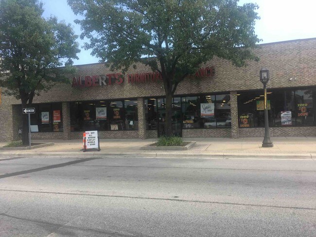
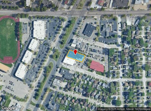
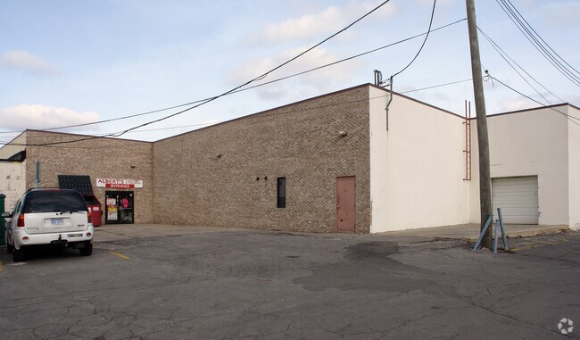
Property Record
22522 Gratiot Ave, Eastpointe, MI 48021
NEARBY LISTINGS FOR SALE OR LEASE
Property Detail
22522 Gratiot Ave
Detroit-Warren-Dearborn, MI
Assessors Plat #15 Sub
02-14-31-128-009
ASSESSORS PLAT NO 15 LOTS 234 EAST DETROIT PUBLIC SCHOOLS
Wholesaleoutletdiscountstore
Macomb
X
Michigan
26163C0130F
234-235
2025
0.38 AC
2025
Macomb East
258700
Detroit
13,570 SF
DEMOGRAPHICS near 22522 Gratiot Ave
1 Mile
3 Mile
5 Mile
2024 Total Population
21,643
155,637
375,354
2029 Population
21,367
154,624
372,510
Pop Growth 2024-2029
(1.28%)
(0.65%)
(0.76%)
Average Age
37
37
39
2024 Total Households
8,175
59,066
147,760
HH Growth 2024-2029
(1.31%)
(0.80%)
(0.89%)
Median Household Inc
$49,625
$50,773
$51,636
Avg Household Size
2.60
2.60
2.50
2024 Avg HH Vehicles
2.00
2.00
2.00
Median Home Value
$89,148
$112,110
$133,446
Median Year Built
1953
1955
1956
Nearby Places
Map Layers
Map Styles
 Street
 Aerial
- Restaurants
- Banks
- Shops
- Fitness
- Groceries
PUBLIC TRANSPORTATION
AIRPORT
Windsor International
DRIVE
WALK
Distance
Windsor International
46 min
21.5 mi
Detroit Metro Wayne County
DRIVE
WALK
Distance
Detroit Metro Wayne County
49 min
31.0 mi
SALE & LEASE HISTORY
LISTING DATE
SALE/LEASE

Oct 29, 2019
For Sale
Aug 14, 2017
For Sale
Apr 02, 2019
For Sale
Nearby Properties
Address
Land Use
TOTAL SIZE
Lot Size
Zoning
Address
Land Use
TOTAL SIZE
Lot Size
Zoning
1,034,990 SF
28.60 AC
Address
Land Use
TOTAL SIZE
Lot Size
Zoning
260,164 SF
Address
Land Use
TOTAL SIZE
Lot Size
Zoning
238,144 SF
12.15 AC
MZ
Address
Land Use
TOTAL SIZE
Lot Size
Zoning
450,958 SF
Address
Land Use
TOTAL SIZE
Lot Size
Zoning
661,151 SF
37.28 AC
MZ
Address
Land Use
TOTAL SIZE
Lot Size
Zoning
323,858 SF
20.66 AC
R-3
Address
Land Use
TOTAL SIZE
Lot Size
Zoning
182,866 SF
5.08 AC
PD
Address
Land Use
TOTAL SIZE
Lot Size
Zoning
401,671 SF
19.40 AC
MZ
Address
Land Use
TOTAL SIZE
Lot Size
Zoning
362,350 SF
22.39 AC
M-2
Address
Land Use
TOTAL SIZE
Lot Size
Zoning
89,970 SF
2.86 AC
RM-1
Address
Land Use
TOTAL SIZE
Lot Size
Zoning
162,597 SF
17.94 AC
C-2
Address
Land Use
TOTAL SIZE
Lot Size
Zoning
166,064 SF
6.33 AC
M-3
Address
Land Use
TOTAL SIZE
Lot Size
Zoning
103,069 SF
11.41 AC
B-3
Address
Land Use
TOTAL SIZE
Lot Size
Zoning
92,800 SF
6.71 AC
R-3
Address
Land Use
TOTAL SIZE
Lot Size
Zoning
105,354 SF
2.33 AC
B-3
Address
Land Use
TOTAL SIZE
Lot Size
Zoning
75,284 SF
0.87 AC
C
Address
Land Use
TOTAL SIZE
Lot Size
Zoning
167,589 SF
16.80 AC
B-3
Address
Land Use
TOTAL SIZE
Lot Size
Zoning
119,898 SF
14.65 AC
B-2
Address
Land Use
TOTAL SIZE
Lot Size
Zoning
133,611 SF
11.74 AC
B-3
Address
Land Use
TOTAL SIZE
Lot Size
Zoning
136,270 SF
3.42 AC
LI
Address
Land Use
TOTAL SIZE
Lot Size
Zoning
180,834 SF
17.97 AC
M-3
Address
Land Use
TOTAL SIZE
Lot Size
Zoning
40,951 SF
42.61 AC
M-2
Address
Land Use
TOTAL SIZE
Lot Size
Zoning
91,739 SF
6.54 AC
B-2
Address
Land Use
TOTAL SIZE
Lot Size
Zoning
182,800 SF
7.86 AC
M-3
Address
Land Use
TOTAL SIZE
Lot Size
Zoning
30,244 SF
2.06 AC
B-1
Address
Land Use
TOTAL SIZE
Lot Size
Zoning
165,232 SF
6.56 AC
M-2
Address
Land Use
TOTAL SIZE
Lot Size
Zoning
116,778 SF
12.98 AC
MZ
Address
Land Use
TOTAL SIZE
Lot Size
Zoning
252,633 SF
10.78 AC
M-2
Address
Land Use
TOTAL SIZE
Lot Size
Zoning
28,300 SF
11.49 AC
I-1
Address
Land Use
TOTAL SIZE
Lot Size
Zoning
154,377 SF
8.07 AC
M-3
The World's #1 Commercial Real Estate Marketplace
Connect with us
© 2026 CoStar Group
The information above has been obtained from sources believed reliable. While we do not doubt its accuracy we have not verified it and make no guarantee, warranty or representation about it. It is your responsibility to independently confirm its accuracy and completeness. Any projections, opinions, assumptions, or estimates used are for example only and do not represent the current or future performance of the property. The value of this transaction to you depends on tax and other factors which should be evaluated by your tax, financial, and legal advisors. You and your advisors should conduct a careful, independent investigation of the property to determine to your satisfaction the suitability of the property for your needs.