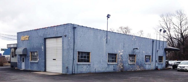
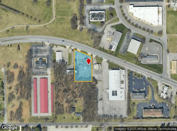
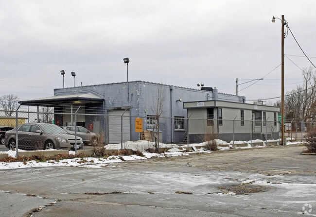
Property Record
22522 Us Highway 20, South Bend, IN 46628
NEARBY LISTINGS FOR SALE OR LEASE
Property Detail
22522 Us Highway 20
71-03-33-376-001.000-008
IRREG TR S SIDE LINC HWY BEG 1105E & 428.31 N OF SW COR 33-38-2E 1.22 AC
Commercialnec
St Joseph
X
Indiana
18141C0183D
1.22 AC
2023
Outlying St Joseph County
2024
South Bend/Mishawaka
011100
South Bend-Mishawaka, IN-MI
3,200 SF
DEMOGRAPHICS near 22522 Us Highway 20
1 Mile
3 Mile
5 Mile
2024 Total Population
3,614
49,867
112,993
2029 Population
3,579
50,130
113,623
Pop Growth 2024-2029
(0.97%)
+ 0.53%
+ 0.56%
Average Age
37
36
37
2024 Total Households
1,413
18,271
41,617
HH Growth 2024-2029
(1.06%)
+ 0.36%
+ 0.59%
Median Household Inc
$34,856
$41,898
$50,814
Avg Household Size
2.40
2.50
2.40
2024 Avg HH Vehicles
1.00
2.00
2.00
Median Home Value
$77,499
$88,159
$133,819
Median Year Built
1955
1954
1957
Nearby Places
Map Layers
Map Styles
 Street
 Aerial
- Restaurants
- Banks
- Shops
- Fitness
- Groceries
PUBLIC TRANSPORTATION
TRANSIT/SUBWAY
South Bend Airport Station (South Shore Line - Northern Indiana Commuter Transportation District (South Shore Line))
DRIVE
WALK
Distance
South Bend Airport Station (South Shore Line - Northern Indiana Commuter Transportation District (South Shore Line))
3 min
15 min
0.8 mi
COMMUTER RAIL
South Bend Airport Station (South Shore Line - Northern Indiana Commuter Transportation District (South Shore Line))
DRIVE
WALK
Distance
South Bend Airport Station (South Shore Line - Northern Indiana Commuter Transportation District (South Shore Line))
3 min
15 min
0.8 mi
DRIVE
WALK
Distance
5 min
2.3 mi
AIRPORT
South Bend International
DRIVE
WALK
Distance
South Bend International
12 min
2.7 mi
Nearby Properties
Address
Land Use
TOTAL SIZE
Lot Size
Zoning
Address
Land Use
TOTAL SIZE
Lot Size
Zoning
538,338 SF
0.01 AC
Address
Land Use
TOTAL SIZE
Lot Size
Zoning
25,756 SF
337.40 AC
Address
Land Use
TOTAL SIZE
Lot Size
Zoning
356,520 SF
28.07 AC
Address
Land Use
TOTAL SIZE
Lot Size
Zoning
128,298 SF
0.84 AC
Address
Land Use
TOTAL SIZE
Lot Size
Zoning
747,842 SF
30.05 AC
Address
Land Use
TOTAL SIZE
Lot Size
Zoning
142,065 SF
44 SF
Address
Land Use
TOTAL SIZE
Lot Size
Zoning
159,834 SF
44 SF
Address
Land Use
TOTAL SIZE
Lot Size
Zoning
544,872 SF
70.95 AC
Address
Land Use
TOTAL SIZE
Lot Size
Zoning
178,111 SF
44 SF
Address
Land Use
TOTAL SIZE
Lot Size
Zoning
213,400 SF
44 SF
Address
Land Use
TOTAL SIZE
Lot Size
Zoning
225,000 SF
19.59 AC
Address
Land Use
TOTAL SIZE
Lot Size
Zoning
111,803 SF
7.45 AC
Address
Land Use
TOTAL SIZE
Lot Size
Zoning
165,725 SF
0.01 AC
Address
Land Use
TOTAL SIZE
Lot Size
Zoning
100,368 SF
44 SF
Address
Land Use
TOTAL SIZE
Lot Size
Zoning
214,657 SF
131 SF
Address
Land Use
TOTAL SIZE
Lot Size
Zoning
79,451 SF
87 SF
Address
Land Use
TOTAL SIZE
Lot Size
Zoning
4,428 SF
0.02 AC
Address
Land Use
TOTAL SIZE
Lot Size
Zoning
203,750 SF
22.36 AC
Address
Land Use
TOTAL SIZE
Lot Size
Zoning
255,684 SF
23.71 AC
Address
Land Use
TOTAL SIZE
Lot Size
Zoning
181,494 SF
1.19 AC
Address
Land Use
TOTAL SIZE
Lot Size
Zoning
92,456 SF
44 SF
Address
Land Use
TOTAL SIZE
Lot Size
Zoning
84,398 SF
44 SF
Address
Land Use
TOTAL SIZE
Lot Size
Zoning
58,213 SF
87 SF
Address
Land Use
TOTAL SIZE
Lot Size
Zoning
143,917 SF
87 SF
Address
Land Use
TOTAL SIZE
Lot Size
Zoning
85,928 SF
7.83 AC
Address
Land Use
TOTAL SIZE
Lot Size
Zoning
266,881 SF
26.20 AC
Address
Land Use
TOTAL SIZE
Lot Size
Zoning
75,901 SF
7.68 AC
Address
Land Use
TOTAL SIZE
Lot Size
Zoning
59,586 SF
44 SF
Address
Land Use
TOTAL SIZE
Lot Size
Zoning
17,176 SF
73 AC
Address
Land Use
TOTAL SIZE
Lot Size
Zoning
74,400 SF
1.13 AC
The World's #1 Commercial Real Estate Marketplace
Connect with us
© 2025 CoStar Group
The information above has been obtained from sources believed reliable. While we do not doubt its accuracy we have not verified it and make no guarantee, warranty or representation about it. It is your responsibility to independently confirm its accuracy and completeness. Any projections, opinions, assumptions, or estimates used are for example only and do not represent the current or future performance of the property. The value of this transaction to you depends on tax and other factors which should be evaluated by your tax, financial, and legal advisors. You and your advisors should conduct a careful, independent investigation of the property to determine to your satisfaction the suitability of the property for your needs.