Property Record
2255 E Sunset Rd, Las Vegas, NV 89119
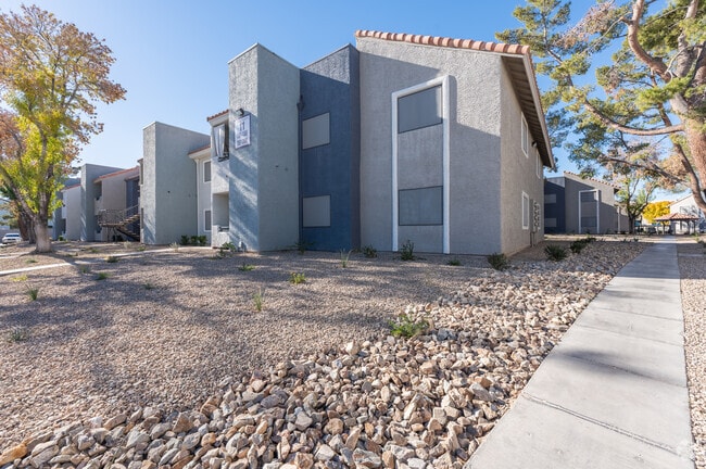

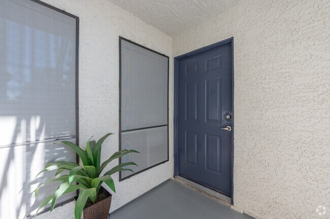

Property Detail
2255 E Sunset Rd
177-02-501-018
PARCEL MAP FILE 36 PAGE 57 LOT 2 & LOT 3 PT LOT 4 & PT GOV LOTS 1,2
Apartment
Clark
R4
Nevada
B and X Area of moderate flood hazard, usually the area between the limits of the 100-year and 500-year floods.
2
2026
16.76 AC
2026
South Las Vegas
002847
Las Vegas
3,040 SF
Las Vegas-Henderson-North Las Vegas, NV
NEARBY LISTINGS FOR SALE OR LEASE
-
-
View all Las Vegas listings for sale on LoopNet.com
DEMOGRAPHICS near 2255 E Sunset Rd
1 mile
3 mile
5 mile
2025 Total Population
6,979
124,163
390,931
2030 Population
7,165
129,749
408,600
Pop Growth 2025-2030
+ 2.67%
+ 4.50%
+ 4.52%
Average Age
41
42
41
2025 Total Households
3,082
51,243
162,185
HH Growth 2025-2030
+ 2.60%
+ 4.54%
+ 4.60%
Median Household Inc
$57,814
$72,147
$69,842
Avg Household Size
2.20
2.30
2.30
2025 Avg HH Vehicles
2.00
2.00
2.00
Median Home Value
$388,757
$440,748
$431,004
Median Year Built
1992
1989
1992
Nearby Places
Map Layers
Map Styles
 Street
 Aerial
Layers
 Traffic
 Biking
Places
Listings with unknown addresses are not visible on the map
- Restaurants
- Banks
- Shops
- Fitness
- Groceries
PUBLIC TRANSPORTATION
AIRPORT
Harry Reid International
Drive
Walk
Distance
Harry Reid International
8 min
3.5 mi
Boulder City Municipal
Drive
Walk
Distance
Boulder City Municipal
30 min
19.9 mi
Freight Ports
Port of Long Beach
Drive
Walk
Distance
Port of Long Beach
312 min
278.0 mi
Nearby Properties
Address
Land Use
TOTAL SIZE
Lot Size
Zoning
Address
Land Use
TOTAL SIZE
Lot Size
Zoning
79.03 AC
PF
Address
Land Use
TOTAL SIZE
Lot Size
Zoning
76.93 AC
PF
Address
Land Use
TOTAL SIZE
Lot Size
Zoning
321,990 SF
76.15 AC
PF
Address
Land Use
TOTAL SIZE
Lot Size
Zoning
56.95 AC
PF
Address
Land Use
TOTAL SIZE
Lot Size
Zoning
459,983 SF
12.65 AC
M1
Address
Land Use
TOTAL SIZE
Lot Size
Zoning
44.69 AC
PF
Address
Land Use
TOTAL SIZE
Lot Size
Zoning
50,000 SF
72.01 AC
PF
Address
Land Use
TOTAL SIZE
Lot Size
Zoning
399,206 SF
22.06 AC
MD
Address
Land Use
TOTAL SIZE
Lot Size
Zoning
402,610 SF
15.51 AC
R3
Address
Land Use
TOTAL SIZE
Lot Size
Zoning
95,928 SF
3.71 AC
C:U-V
Address
Land Use
TOTAL SIZE
Lot Size
Zoning
342,768 SF
28.30 AC
H1
Address
Land Use
TOTAL SIZE
Lot Size
Zoning
9,164 SF
22.81 AC
R3
Address
Land Use
TOTAL SIZE
Lot Size
Zoning
148.64 AC
PF
Address
Land Use
TOTAL SIZE
Lot Size
Zoning
8,891 SF
11.59 AC
Address
Land Use
TOTAL SIZE
Lot Size
Zoning
313,868 SF
21.37 AC
H1
Address
Land Use
TOTAL SIZE
Lot Size
Zoning
18.75 AC
PF
Address
Land Use
TOTAL SIZE
Lot Size
Zoning
160 AC
PF
Address
Land Use
TOTAL SIZE
Lot Size
Zoning
125,393 SF
12.33 AC
Address
Land Use
TOTAL SIZE
Lot Size
Zoning
6,295 SF
13.58 AC
R3
Address
Land Use
TOTAL SIZE
Lot Size
Zoning
181,573 SF
7.68 AC
Address
Land Use
TOTAL SIZE
Lot Size
Zoning
152.76 AC
PF
Address
Land Use
TOTAL SIZE
Lot Size
Zoning
13,128 SF
47.47 AC
PF
Address
Land Use
TOTAL SIZE
Lot Size
Zoning
129,948 SF
23.61 AC
Address
Land Use
TOTAL SIZE
Lot Size
Zoning
100.43 AC
PF
Address
Land Use
TOTAL SIZE
Lot Size
Zoning
266,782 SF
8.83 AC
Address
Land Use
TOTAL SIZE
Lot Size
Zoning
13,589 SF
56.80 AC
PF
Address
Land Use
TOTAL SIZE
Lot Size
Zoning
520 SF
3.99 AC
RE
Address
Land Use
TOTAL SIZE
Lot Size
Zoning
303,540 SF
4.99 AC
Address
Land Use
TOTAL SIZE
Lot Size
Zoning
213,048 SF
13.60 AC
Address
Land Use
TOTAL SIZE
Lot Size
Zoning
72,280 SF
5.46 AC
H1
The World's #1 Commercial Real Estate Marketplace
Connect with us
© 2026 CoStar Group
The information above has been obtained from sources believed reliable. While we do not doubt its accuracy we have not verified it and make no guarantee, warranty or representation about it. It is your responsibility to independently confirm its accuracy and completeness. Any projections, opinions, assumptions, or estimates used are for example only and do not represent the current or future performance of the property. The value of this transaction to you depends on tax and other factors which should be evaluated by your tax, financial, and legal advisors. You and your advisors should conduct a careful, independent investigation of the property to determine to your satisfaction the suitability of the property for your needs.