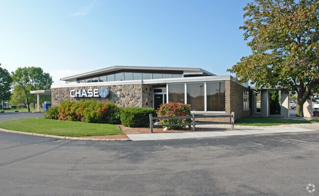
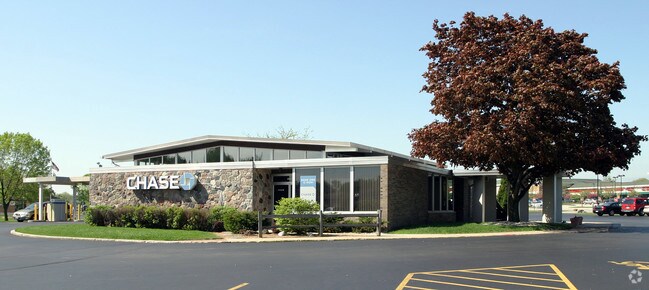
Property Record
2255 N Calhoun Rd, Brookfield, WI 53005

NEARBY LISTINGS FOR SALE OR LEASE
Property Detail
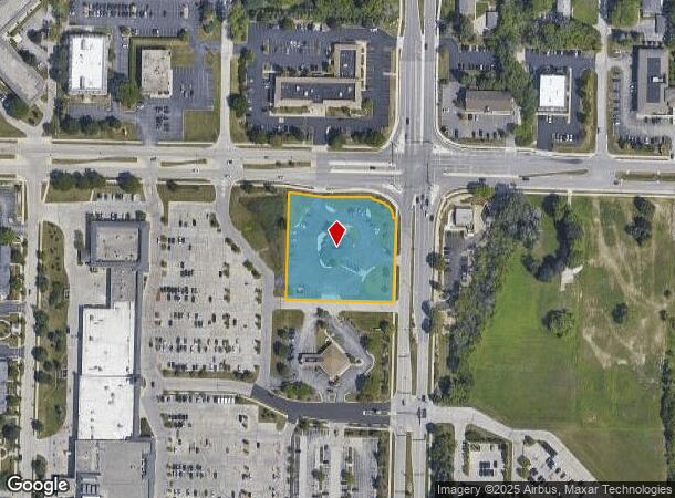
2255 N Calhoun Rd
Milwaukee-Waukesha-West Allis, WI
Country Brook Estates Addn No 1
BRC-1089-997-001
PT NE1/4 SEC 21 T7N R20E COM AT NE COR, TH W 340 FT, TH S 340 FT TH E 340 FT, TH N 340 FT EXC THAT PART TAKEN BY COUNTY FOR ROAD ROW REC 1-8-20 DOC #4446445
Commercialnec
Waukesha
X
Wisconsin
55133C0217H
1.74 AC
2024
Brookfield/New Berlin
2024
Milwaukee/Madison
201205
DEMOGRAPHICS near 2255 N Calhoun Rd
1 Mile
3 Mile
5 Mile
2024 Total Population
6,621
50,486
121,327
2029 Population
6,953
53,030
124,992
Pop Growth 2024-2029
+ 5.01%
+ 5.04%
+ 3.02%
Average Age
43
43
43
2024 Total Households
2,575
19,637
50,361
HH Growth 2024-2029
+ 5.13%
+ 5.14%
+ 2.92%
Median Household Inc
$105,734
$111,606
$94,803
Avg Household Size
2.50
2.50
2.40
2024 Avg HH Vehicles
2.00
2.00
2.00
Median Home Value
$418,539
$391,968
$339,175
Median Year Built
1981
1978
1973
Nearby Places
Map Layers
Map Styles
 Street
 Aerial
- Restaurants
- Banks
- Shops
- Fitness
- Groceries
PUBLIC TRANSPORTATION
AIRPORT
General Mitchell International
DRIVE
WALK
Distance
General Mitchell International
33 min
19.1 mi
Freight Ports
Port Milwaukee
DRIVE
WALK
Distance
Port Milwaukee
26 min
16.2 mi
Nearby Properties
Address
Land Use
TOTAL SIZE
Lot Size
Zoning
Address
Land Use
TOTAL SIZE
Lot Size
Zoning
19.44 AC
Address
Land Use
TOTAL SIZE
Lot Size
Zoning
24.46 AC
Address
Land Use
TOTAL SIZE
Lot Size
Zoning
19.25 AC
Address
Land Use
TOTAL SIZE
Lot Size
Zoning
19.44 AC
Address
Land Use
TOTAL SIZE
Lot Size
Zoning
4.54 AC
Address
Land Use
TOTAL SIZE
Lot Size
Zoning
12.50 AC
Address
Land Use
TOTAL SIZE
Lot Size
Zoning
20.02 AC
Address
Land Use
TOTAL SIZE
Lot Size
Zoning
Address
Land Use
TOTAL SIZE
Lot Size
Zoning
34.31 AC
Address
Land Use
TOTAL SIZE
Lot Size
Zoning
17.45 AC
Address
Land Use
TOTAL SIZE
Lot Size
Zoning
10.48 AC
Address
Land Use
TOTAL SIZE
Lot Size
Zoning
Address
Land Use
TOTAL SIZE
Lot Size
Zoning
7.20 AC
Address
Land Use
TOTAL SIZE
Lot Size
Zoning
Address
Land Use
TOTAL SIZE
Lot Size
Zoning
19.44 AC
Address
Land Use
TOTAL SIZE
Lot Size
Zoning
Address
Land Use
TOTAL SIZE
Lot Size
Zoning
Address
Land Use
TOTAL SIZE
Lot Size
Zoning
21.87 AC
Address
Land Use
TOTAL SIZE
Lot Size
Zoning
3.55 AC
Address
Land Use
TOTAL SIZE
Lot Size
Zoning
4.79 AC
Address
Land Use
TOTAL SIZE
Lot Size
Zoning
4.53 AC
Address
Land Use
TOTAL SIZE
Lot Size
Zoning
Address
Land Use
TOTAL SIZE
Lot Size
Zoning
Address
Land Use
TOTAL SIZE
Lot Size
Zoning
11.34 AC
Address
Land Use
TOTAL SIZE
Lot Size
Zoning
13.14 AC
Address
Land Use
TOTAL SIZE
Lot Size
Zoning
Address
Land Use
TOTAL SIZE
Lot Size
Zoning
3.48 AC
Address
Land Use
TOTAL SIZE
Lot Size
Zoning
16.79 AC
Address
Land Use
TOTAL SIZE
Lot Size
Zoning
10.41 AC
Address
Land Use
TOTAL SIZE
Lot Size
Zoning
4.94 AC
The World's #1 Commercial Real Estate Marketplace
Connect with us
© 2025 CoStar Group
The information above has been obtained from sources believed reliable. While we do not doubt its accuracy we have not verified it and make no guarantee, warranty or representation about it. It is your responsibility to independently confirm its accuracy and completeness. Any projections, opinions, assumptions, or estimates used are for example only and do not represent the current or future performance of the property. The value of this transaction to you depends on tax and other factors which should be evaluated by your tax, financial, and legal advisors. You and your advisors should conduct a careful, independent investigation of the property to determine to your satisfaction the suitability of the property for your needs.