Property Record
2256 4Th St, Tucker, GA 30084

NEARBY LISTINGS FOR SALE OR LEASE
Property Detail
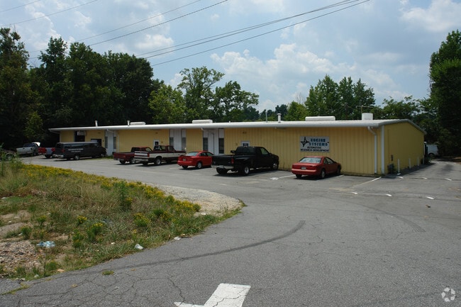
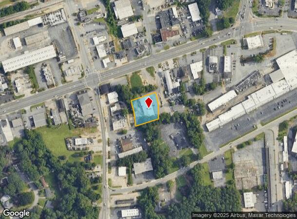
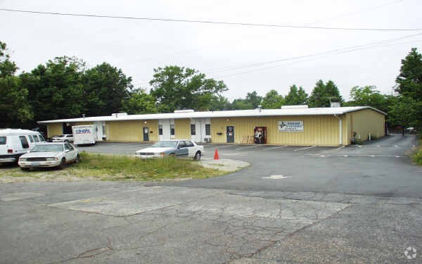
2256 4Th St
18-214-09-005
DeKalb
Autorepair
Georgia
X
5
13089C0077L
0.66 AC
2025
Stone Mtn/Clarkston
2025
Atlanta
021824
Atlanta-Sandy Springs-Roswell, GA
9,000 SF
DEMOGRAPHICS near 2256 4Th St
1 Mile
3 Mile
5 Mile
2024 Total Population
6,782
91,781
261,883
2029 Population
6,754
92,464
264,100
Pop Growth 2024-2029
(0.41%)
+ 0.74%
+ 0.85%
Average Age
41
38
37
2024 Total Households
2,656
35,096
95,909
HH Growth 2024-2029
(0.53%)
+ 0.66%
+ 0.71%
Median Household Inc
$84,302
$65,635
$60,625
Avg Household Size
2.40
2.50
2.70
2024 Avg HH Vehicles
2.00
2.00
2.00
Median Home Value
$300,467
$311,251
$299,564
Median Year Built
1974
1979
1979
Nearby Places
Map Layers
Map Styles
 Street
 Aerial
- Restaurants
- Banks
- Shops
- Fitness
- Groceries
PUBLIC TRANSPORTATION
AIRPORT
Hartsfield - Jackson Atlanta International
DRIVE
WALK
Distance
Hartsfield - Jackson Atlanta International
36 min
25.0 mi
Nearby Properties
Address
Land Use
TOTAL SIZE
Lot Size
Zoning
Address
Land Use
TOTAL SIZE
Lot Size
Zoning
656,837 SF
88.74 AC
RM100
Address
Land Use
TOTAL SIZE
Lot Size
Zoning
377,506 SF
8.70 AC
X
Address
Land Use
TOTAL SIZE
Lot Size
Zoning
208,608 SF
20.89 AC
OI: OFFICE
Address
Land Use
TOTAL SIZE
Lot Size
Zoning
179,762 SF
4.96 AC
C1
Address
Land Use
TOTAL SIZE
Lot Size
Zoning
273,492 SF
23.08 AC
RM
Address
Land Use
TOTAL SIZE
Lot Size
Zoning
819,703 SF
55.80 AC
M
Address
Land Use
TOTAL SIZE
Lot Size
Zoning
503,480 SF
50.04 AC
RM150
Address
Land Use
TOTAL SIZE
Lot Size
Zoning
228,504 SF
15.57 AC
M
Address
Land Use
TOTAL SIZE
Lot Size
Zoning
321,956 SF
26.87 AC
RM13
Address
Land Use
TOTAL SIZE
Lot Size
Zoning
334,795 SF
42.50 AC
RM13
Address
Land Use
TOTAL SIZE
Lot Size
Zoning
257,050 SF
26.17 AC
RM13
Address
Land Use
TOTAL SIZE
Lot Size
Zoning
70,929 SF
6.64 AC
C1: LOCAL
Address
Land Use
TOTAL SIZE
Lot Size
Zoning
355,421 SF
7.03 AC
X
Address
Land Use
TOTAL SIZE
Lot Size
Zoning
375,436 SF
33.24 AC
RM10
Address
Land Use
TOTAL SIZE
Lot Size
Zoning
185,066 SF
25.53 AC
O-1
Address
Land Use
TOTAL SIZE
Lot Size
Zoning
313,420 SF
12.74 AC
X
Address
Land Use
TOTAL SIZE
Lot Size
Zoning
587,493 SF
29.79 AC
X
Address
Land Use
TOTAL SIZE
Lot Size
Zoning
284,236 SF
22.25 AC
RM100
Address
Land Use
TOTAL SIZE
Lot Size
Zoning
169,005 SF
11.81 AC
O-1
Address
Land Use
TOTAL SIZE
Lot Size
Zoning
276,262 SF
22.17 AC
RM13
Address
Land Use
TOTAL SIZE
Lot Size
Zoning
367,517 SF
34.61 AC
RM13
Address
Land Use
TOTAL SIZE
Lot Size
Zoning
180,586 SF
8.70 AC
X
Address
Land Use
TOTAL SIZE
Lot Size
Zoning
228,361 SF
19.21 AC
RM100
Address
Land Use
TOTAL SIZE
Lot Size
Zoning
89,362 SF
13.99 AC
M
Address
Land Use
TOTAL SIZE
Lot Size
Zoning
337,746 SF
29.94 AC
RM100
Address
Land Use
TOTAL SIZE
Lot Size
Zoning
170,933 SF
15.39 AC
X
Address
Land Use
TOTAL SIZE
Lot Size
Zoning
306,723 SF
21.81 AC
RM
Address
Land Use
TOTAL SIZE
Lot Size
Zoning
480,302 SF
34.46 AC
RM85
Address
Land Use
TOTAL SIZE
Lot Size
Zoning
358,818 SF
22.41 AC
RM100
Address
Land Use
TOTAL SIZE
Lot Size
Zoning
299,798 SF
17.20 AC
X
The World's #1 Commercial Real Estate Marketplace
Connect with us
© 2025 CoStar Group
The information above has been obtained from sources believed reliable. While we do not doubt its accuracy we have not verified it and make no guarantee, warranty or representation about it. It is your responsibility to independently confirm its accuracy and completeness. Any projections, opinions, assumptions, or estimates used are for example only and do not represent the current or future performance of the property. The value of this transaction to you depends on tax and other factors which should be evaluated by your tax, financial, and legal advisors. You and your advisors should conduct a careful, independent investigation of the property to determine to your satisfaction the suitability of the property for your needs.