Property Record
2257 State Route 430, Mansfield, OH 44903

NEARBY LISTINGS FOR SALE OR LEASE
Property Detail
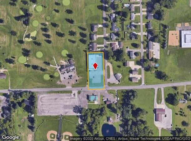
2257 State Route 430
021-17-028-07-000
NW 1.092 AC & 0.103 R/O/W
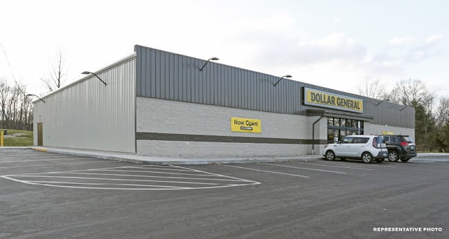
Storebuilding
Richland
X
Ohio
39139C0175E
1.29 AC
2024
Richland County
2024
Cleveland
000600
Mansfield, OH
9,170 SF
DEMOGRAPHICS near 2257 State Route 430
1 Mile
3 Mile
5 Mile
2024 Total Population
1,661
12,764
40,808
2029 Population
1,649
12,763
40,981
Pop Growth 2024-2029
(0.72%)
(0.01%)
+ 0.42%
Average Age
42
42
40
2024 Total Households
690
5,268
15,006
HH Growth 2024-2029
(0.72%)
(0.04%)
+ 0.46%
Median Household Inc
$60,795
$53,429
$42,679
Avg Household Size
2.30
2.30
2.20
2024 Avg HH Vehicles
2.00
2.00
2.00
Median Home Value
$155,477
$131,278
$113,212
Median Year Built
1973
1966
1960
Nearby Places
Map Layers
Map Styles
 Street
 Aerial
- Restaurants
- Banks
- Shops
- Fitness
- Groceries
SALE & LEASE HISTORY
LISTING DATE
SALE/LEASE

Jan 31, 2019
For Sale
Nearby Properties
Address
Land Use
TOTAL SIZE
Lot Size
Zoning
Address
Land Use
TOTAL SIZE
Lot Size
Zoning
114,931 SF
17.86 AC
Address
Land Use
TOTAL SIZE
Lot Size
Zoning
107,456 SF
50.78 AC
Address
Land Use
TOTAL SIZE
Lot Size
Zoning
28,638 SF
24.86 AC
Address
Land Use
TOTAL SIZE
Lot Size
Zoning
30,306 SF
5.63 AC
Address
Land Use
TOTAL SIZE
Lot Size
Zoning
43,356 SF
5.30 AC
Address
Land Use
TOTAL SIZE
Lot Size
Zoning
70,665 SF
10.56 AC
Address
Land Use
TOTAL SIZE
Lot Size
Zoning
46,040 SF
8.57 AC
Address
Land Use
TOTAL SIZE
Lot Size
Zoning
28,157 SF
5.31 AC
Address
Land Use
TOTAL SIZE
Lot Size
Zoning
84,336 SF
6.42 AC
Address
Land Use
TOTAL SIZE
Lot Size
Zoning
27,816 SF
12.42 AC
Address
Land Use
TOTAL SIZE
Lot Size
Zoning
2,525 SF
0.61 AC
Address
Land Use
TOTAL SIZE
Lot Size
Zoning
38,986 SF
2 AC
Address
Land Use
TOTAL SIZE
Lot Size
Zoning
4,361 SF
2 AC
Address
Land Use
TOTAL SIZE
Lot Size
Zoning
39,476 SF
38.10 AC
Address
Land Use
TOTAL SIZE
Lot Size
Zoning
11.23 AC
Address
Land Use
TOTAL SIZE
Lot Size
Zoning
15,896 SF
2.07 AC
Address
Land Use
TOTAL SIZE
Lot Size
Zoning
25,751 SF
18.16 AC
Address
Land Use
TOTAL SIZE
Lot Size
Zoning
8,825 SF
7.65 AC
Address
Land Use
TOTAL SIZE
Lot Size
Zoning
2,200 SF
5.14 AC
Address
Land Use
TOTAL SIZE
Lot Size
Zoning
22.60 AC
Address
Land Use
TOTAL SIZE
Lot Size
Zoning
1,798 SF
0.95 AC
Address
Land Use
TOTAL SIZE
Lot Size
Zoning
10,075 SF
110.19 AC
Address
Land Use
TOTAL SIZE
Lot Size
Zoning
2,808 SF
0.86 AC
Address
Land Use
TOTAL SIZE
Lot Size
Zoning
3,048 SF
1.13 AC
Address
Land Use
TOTAL SIZE
Lot Size
Zoning
140.46 AC
Address
Land Use
TOTAL SIZE
Lot Size
Zoning
14,974 SF
10.12 AC
Address
Land Use
TOTAL SIZE
Lot Size
Zoning
146.29 AC
Address
Land Use
TOTAL SIZE
Lot Size
Zoning
15,360 SF
7.98 AC
Address
Land Use
TOTAL SIZE
Lot Size
Zoning
130.51 AC
The World's #1 Commercial Real Estate Marketplace
Connect with us
© 2026 CoStar Group
The information above has been obtained from sources believed reliable. While we do not doubt its accuracy we have not verified it and make no guarantee, warranty or representation about it. It is your responsibility to independently confirm its accuracy and completeness. Any projections, opinions, assumptions, or estimates used are for example only and do not represent the current or future performance of the property. The value of this transaction to you depends on tax and other factors which should be evaluated by your tax, financial, and legal advisors. You and your advisors should conduct a careful, independent investigation of the property to determine to your satisfaction the suitability of the property for your needs.