Property Record
226 W Tracker Rd, Nixa, MO 65714

NEARBY LISTINGS FOR SALE OR LEASE
-
-
View all Nixa listings for sale on LoopNet.com
Property Detail
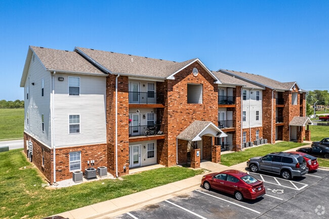
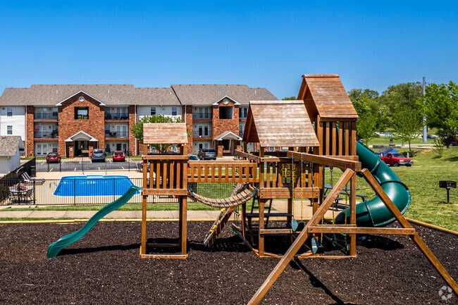
226 W Tracker Rd
Springfield, MO
Southernwood Condominium Final Plat
10-0.1-12-002-002-001.001
SOUTHERNWOOD CONDOMINIUM FINAL PLAT
Condominium
Christian
X
Missouri
29043C0058D
1d
2024
5.81 AC
2025
Christian County
020202
Springfield
21,505 SF
DEMOGRAPHICS near 226 W Tracker Rd
1 mile
3 mile
5 mile
2024 Total Population
6,092
33,531
75,969
2029 Population
6,876
37,829
83,185
Pop Growth 2024-2029
+ 12.87%
+ 12.82%
+ 9.50%
Average Age
40
40
40
2024 Total Households
2,466
12,870
29,731
HH Growth 2024-2029
+ 12.94%
+ 12.88%
+ 9.42%
Median Household Inc
$67,862
$73,693
$76,211
Avg Household Size
2.40
2.60
2.50
2024 Avg HH Vehicles
2.00
2.00
2.00
Median Home Value
$178,905
$232,412
$251,572
Median Year Built
1991
1997
1996
Nearby Places
Map Layers
Map Styles
 Street
 Aerial
Transit
 Traffic
 Biking
Places
Listings with unknown addresses are not visible on the map
- Restaurants
- Banks
- Shops
- Fitness
- Groceries
PUBLIC TRANSPORTATION
AIRPORT
Springfield-Branson Ntl
Drive
Walk
Distance
Springfield-Branson Ntl
36 min
19.7 mi
Freight Ports
Tulsa Port of Inola
Drive
Walk
Distance
Tulsa Port of Inola
199 min
177.4 mi
Nearby Properties
Address
Land Use
TOTAL SIZE
Lot Size
Zoning
Address
Land Use
TOTAL SIZE
Lot Size
Zoning
6,164 SF
62.43 AC
Address
Land Use
TOTAL SIZE
Lot Size
Zoning
192,607 SF
26.20 AC
Address
Land Use
TOTAL SIZE
Lot Size
Zoning
5,310 SF
12.27 AC
Address
Land Use
TOTAL SIZE
Lot Size
Zoning
5,360 SF
9.71 AC
Address
Land Use
TOTAL SIZE
Lot Size
Zoning
1,836 SF
35.65 AC
Address
Land Use
TOTAL SIZE
Lot Size
Zoning
68,882 SF
39.87 AC
Address
Land Use
TOTAL SIZE
Lot Size
Zoning
30,049 SF
5.01 AC
Address
Land Use
TOTAL SIZE
Lot Size
Zoning
21,597 SF
18 AC
Address
Land Use
TOTAL SIZE
Lot Size
Zoning
4,894 SF
10.80 AC
Address
Land Use
TOTAL SIZE
Lot Size
Zoning
9,841 SF
7.17 AC
Address
Land Use
TOTAL SIZE
Lot Size
Zoning
92,462 SF
19.78 AC
Address
Land Use
TOTAL SIZE
Lot Size
Zoning
1,640 SF
24.20 AC
Address
Land Use
TOTAL SIZE
Lot Size
Zoning
6,875 SF
6.56 AC
Address
Land Use
TOTAL SIZE
Lot Size
Zoning
54,519 SF
18.56 AC
Address
Land Use
TOTAL SIZE
Lot Size
Zoning
53,597 SF
39.40 AC
Address
Land Use
TOTAL SIZE
Lot Size
Zoning
11,830 SF
10 AC
Address
Land Use
TOTAL SIZE
Lot Size
Zoning
15,785 SF
3.99 AC
Address
Land Use
TOTAL SIZE
Lot Size
Zoning
11,600 SF
18.75 AC
Address
Land Use
TOTAL SIZE
Lot Size
Zoning
1,768 SF
9.46 AC
Address
Land Use
TOTAL SIZE
Lot Size
Zoning
18,055 SF
7 AC
Address
Land Use
TOTAL SIZE
Lot Size
Zoning
6,006 SF
9.93 AC
Address
Land Use
TOTAL SIZE
Lot Size
Zoning
25,749 SF
39.26 AC
Address
Land Use
TOTAL SIZE
Lot Size
Zoning
2,400 SF
8.51 AC
Address
Land Use
TOTAL SIZE
Lot Size
Zoning
9,483 SF
4.71 AC
Address
Land Use
TOTAL SIZE
Lot Size
Zoning
14,500 SF
19.22 AC
Address
Land Use
TOTAL SIZE
Lot Size
Zoning
13,940 SF
3.43 AC
Address
Land Use
TOTAL SIZE
Lot Size
Zoning
6,176 SF
5.45 AC
Address
Land Use
TOTAL SIZE
Lot Size
Zoning
6,620 SF
10 AC
The World's #1 Commercial Real Estate Marketplace
Connect with us
© 2026 CoStar Group
The information above has been obtained from sources believed reliable. While we do not doubt its accuracy we have not verified it and make no guarantee, warranty or representation about it. It is your responsibility to independently confirm its accuracy and completeness. Any projections, opinions, assumptions, or estimates used are for example only and do not represent the current or future performance of the property. The value of this transaction to you depends on tax and other factors which should be evaluated by your tax, financial, and legal advisors. You and your advisors should conduct a careful, independent investigation of the property to determine to your satisfaction the suitability of the property for your needs.