Property Record
2260 Hutton Rd, Nipomo, CA 93444

Save to a Folder
{{folder.Name}}
{{folder.ListingIds.length}} Properties
{{folder.ListingIds.length}} Property
Create a New Folder
Property Detail
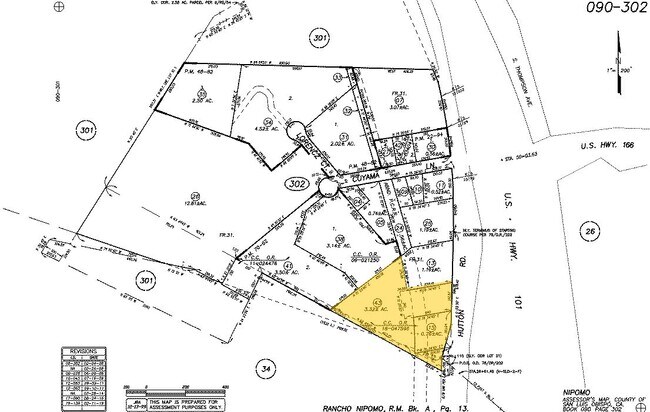
2260 Hutton Rd
San Luis Obispo-Paso Robles, CA
RHO NIPOMO PTN LTS 31 &32
090-302-043
SAN LUIS OBISPO
Commercialacreage
California
CS
31,32
A Areas with a 1% annual chance of flooding and a 26% chance of flooding over the life of a 30-year mortgage.
3.32 AC
2024
South 101 Corridor
2025
San Luis Obispo/Paso Robles
012306
NEARBY LISTINGS FOR SALE OR LEASE
DEMOGRAPHICS near 2260 Hutton Rd
1 mile
3 mile
5 mile
2025 Total Population
4,447
53,101
112,790
2030 Population
4,377
52,320
112,022
Pop Growth 2025-2030
(1.57%)
(1.47%)
(0.68%)
Average Age
35
35
34
2025 Total Households
1,092
13,207
29,876
HH Growth 2025-2030
(1.65%)
(1.61%)
(0.81%)
Median Household Inc
$118,822
$81,165
$80,359
Avg Household Size
3.80
3.70
3.60
2025 Avg HH Vehicles
3.00
2.00
2.00
Median Home Value
$586,427
$497,352
$577,499
Median Year Built
1997
1975
1979
Nearby Places
Map Layers
Map Styles
 Street
 Aerial
Layers
 Traffic
 Biking
Places
Listings with unknown addresses are not visible on the map
- Restaurants
- Banks
- Shops
- Fitness
- Groceries
PUBLIC TRANSPORTATION
AIRPORT
San Luis County Regional
Drive
Walk
Distance
San Luis County Regional
33 min
22.3 mi
Freight Ports
The Port of Hueneme
Drive
Walk
Distance
The Port of Hueneme
138 min
105.4 mi
Nearby Properties
Address
Land Use
TOTAL SIZE
Lot Size
Zoning
Address
Land Use
TOTAL SIZE
Lot Size
Zoning
14.93 AC
Address
Land Use
TOTAL SIZE
Lot Size
Zoning
4.40 AC
Address
Land Use
TOTAL SIZE
Lot Size
Zoning
3.79 AC
Address
Land Use
TOTAL SIZE
Lot Size
Zoning
1.38 AC
Address
Land Use
TOTAL SIZE
Lot Size
Zoning
Address
Land Use
TOTAL SIZE
Lot Size
Zoning
1.32 AC
Address
Land Use
TOTAL SIZE
Lot Size
Zoning
1.44 AC
Address
Land Use
TOTAL SIZE
Lot Size
Zoning
4.51 AC
Address
Land Use
TOTAL SIZE
Lot Size
Zoning
Address
Land Use
TOTAL SIZE
Lot Size
Zoning
1.05 AC
Address
Land Use
TOTAL SIZE
Lot Size
Zoning
1.47 AC
Address
Land Use
TOTAL SIZE
Lot Size
Zoning
2,991 SF
1.30 AC
Address
Land Use
TOTAL SIZE
Lot Size
Zoning
3.94 AC
Address
Land Use
TOTAL SIZE
Lot Size
Zoning
1.23 AC
Address
Land Use
TOTAL SIZE
Lot Size
Zoning
Address
Land Use
TOTAL SIZE
Lot Size
Zoning
3.95 AC
Address
Land Use
TOTAL SIZE
Lot Size
Zoning
3.04 AC
Address
Land Use
TOTAL SIZE
Lot Size
Zoning
Address
Land Use
TOTAL SIZE
Lot Size
Zoning
1.20 AC
Address
Land Use
TOTAL SIZE
Lot Size
Zoning
Address
Land Use
TOTAL SIZE
Lot Size
Zoning
2.24 AC
Address
Land Use
TOTAL SIZE
Lot Size
Zoning
Address
Land Use
TOTAL SIZE
Lot Size
Zoning
87.44 AC
AGII40
Address
Land Use
TOTAL SIZE
Lot Size
Zoning
Address
Land Use
TOTAL SIZE
Lot Size
Zoning
1.29 AC
Address
Land Use
TOTAL SIZE
Lot Size
Zoning
1.07 AC
Address
Land Use
TOTAL SIZE
Lot Size
Zoning
2.89 AC
Address
Land Use
TOTAL SIZE
Lot Size
Zoning
1.60 AC
Address
Land Use
TOTAL SIZE
Lot Size
Zoning
Address
Land Use
TOTAL SIZE
Lot Size
Zoning
The World's #1 Commercial Real Estate Marketplace
Connect with us
© 2026 CoStar Group
The information above has been obtained from sources believed reliable. While we do not doubt its accuracy we have not verified it and make no guarantee, warranty or representation about it. It is your responsibility to independently confirm its accuracy and completeness. Any projections, opinions, assumptions, or estimates used are for example only and do not represent the current or future performance of the property. The value of this transaction to you depends on tax and other factors which should be evaluated by your tax, financial, and legal advisors. You and your advisors should conduct a careful, independent investigation of the property to determine to your satisfaction the suitability of the property for your needs.