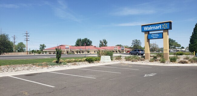
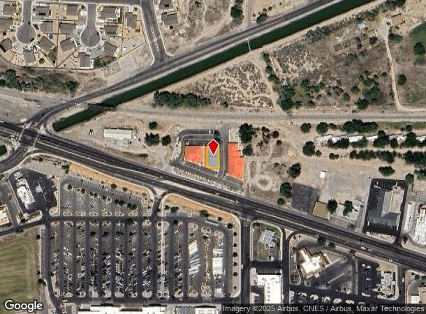
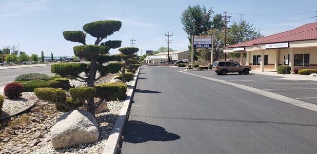
Property Record
2260 Reno Hwy, Fallon, NV 89406
NEARBY LISTINGS FOR SALE OR LEASE
-
-
View all Fallon listings for sale on LoopNet.com
Property Detail
2260 Reno Hwy
008-361-41
Fallon Business Park
Commercialnec
2000/2001,CREATED FROM SPLIT OF PARCEL 008-361-25,PRIMARY NEW PARCEL IS PARCEL 008-361-43,PARCEL IN SE1/4,FINAL MAP FOR: FALLON BUSINESS PARK PUD,PARCEL B,FILE 322861 C/A 323416 REC: 7/15/99,RECORDED: JUNE 16, 1999,PARCEL 008-361-41
X
Churchill
32001C1731F
Nevada
2024
0.11 AC
2025
Outer Churchill County
950302
Reno/Sparks
3,980 SF
Fallon, NV
DEMOGRAPHICS near 2260 Reno Hwy
1 Mile
3 Mile
5 Mile
2024 Total Population
3,224
17,216
21,957
2029 Population
3,330
17,888
22,801
Pop Growth 2024-2029
+ 3.29%
+ 3.90%
+ 3.84%
Average Age
42
41
41
2024 Total Households
1,258
6,941
8,720
HH Growth 2024-2029
+ 3.34%
+ 3.92%
+ 3.88%
Median Household Inc
$69,033
$64,155
$67,377
Avg Household Size
2.50
2.40
2.50
2024 Avg HH Vehicles
2.00
2.00
2.00
Median Home Value
$292,256
$267,474
$275,430
Median Year Built
1981
1985
1986
Nearby Places
Map Layers
Map Styles
 Street
 Aerial
- Restaurants
- Banks
- Shops
- Fitness
- Groceries
SALE & LEASE HISTORY
LISTING DATE
SALE/LEASE

May 12, 2020
For Sale
Nearby Properties
Address
Land Use
TOTAL SIZE
Lot Size
Zoning
Address
Land Use
TOTAL SIZE
Lot Size
Zoning
112,210 SF
17.70 AC
C2;GENERAL
Address
Land Use
TOTAL SIZE
Lot Size
Zoning
307,680 SF
66.31 AC
R1-5K
Address
Land Use
TOTAL SIZE
Lot Size
Zoning
81,350 SF
31.50 AC
LI
Address
Land Use
TOTAL SIZE
Lot Size
Zoning
107,708 SF
77.77 AC
C2;GENERAL
Address
Land Use
TOTAL SIZE
Lot Size
Zoning
44,440 SF
1.69 AC
C2
Address
Land Use
TOTAL SIZE
Lot Size
Zoning
200,656 SF
21.53 AC
C1;TR RES/
Address
Land Use
TOTAL SIZE
Lot Size
Zoning
117,392 SF
9.07 AC
RC
Address
Land Use
TOTAL SIZE
Lot Size
Zoning
40.13 AC
A10
Address
Land Use
TOTAL SIZE
Lot Size
Zoning
149,624 SF
14.60 AC
R1-5K
Address
Land Use
TOTAL SIZE
Lot Size
Zoning
32,181 SF
37.53 AC
C2;GENERAL
Address
Land Use
TOTAL SIZE
Lot Size
Zoning
72,173 SF
17.26 AC
A5
Address
Land Use
TOTAL SIZE
Lot Size
Zoning
29,385 SF
10 AC
R2;MULTI 1
Address
Land Use
TOTAL SIZE
Lot Size
Zoning
63,187 SF
2.51 AC
C2;GENERAL
Address
Land Use
TOTAL SIZE
Lot Size
Zoning
46,041 SF
12.19 AC
I
Address
Land Use
TOTAL SIZE
Lot Size
Zoning
58,616 SF
28.24 AC
R2;MULTI 1
Address
Land Use
TOTAL SIZE
Lot Size
Zoning
49,146 SF
6.62 AC
C2
Address
Land Use
TOTAL SIZE
Lot Size
Zoning
63,020 SF
5.52 AC
C2
Address
Land Use
TOTAL SIZE
Lot Size
Zoning
14,632 SF
1.06 AC
C1
Address
Land Use
TOTAL SIZE
Lot Size
Zoning
3,127 SF
2.03 AC
R1;SFR 1HS
Address
Land Use
TOTAL SIZE
Lot Size
Zoning
12,764 SF
8.70 AC
R15K
Address
Land Use
TOTAL SIZE
Lot Size
Zoning
14,869 SF
1.18 AC
I;INDUSTRI
Address
Land Use
TOTAL SIZE
Lot Size
Zoning
37,909 SF
6.05 AC
C2;GENERAL
Address
Land Use
TOTAL SIZE
Lot Size
Zoning
15,792 SF
2.48 AC
C2
Address
Land Use
TOTAL SIZE
Lot Size
Zoning
22,245 SF
2.39 AC
C1;TR RES/
Address
Land Use
TOTAL SIZE
Lot Size
Zoning
44,189 SF
3.76 AC
C2
Address
Land Use
TOTAL SIZE
Lot Size
Zoning
10.59 AC
LI
Address
Land Use
TOTAL SIZE
Lot Size
Zoning
39,028 SF
2 AC
C2;GENERAL
Address
Land Use
TOTAL SIZE
Lot Size
Zoning
40,903 SF
7.35 AC
R1-5K
Address
Land Use
TOTAL SIZE
Lot Size
Zoning
47,792 SF
5.25 AC
RC
Address
Land Use
TOTAL SIZE
Lot Size
Zoning
14,739 SF
3.18 AC
C2;GENERAL
The World's #1 Commercial Real Estate Marketplace
Connect with us
© 2026 CoStar Group
The information above has been obtained from sources believed reliable. While we do not doubt its accuracy we have not verified it and make no guarantee, warranty or representation about it. It is your responsibility to independently confirm its accuracy and completeness. Any projections, opinions, assumptions, or estimates used are for example only and do not represent the current or future performance of the property. The value of this transaction to you depends on tax and other factors which should be evaluated by your tax, financial, and legal advisors. You and your advisors should conduct a careful, independent investigation of the property to determine to your satisfaction the suitability of the property for your needs.