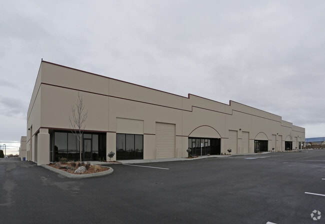
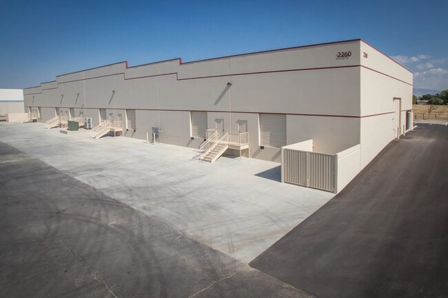
Property Record
2260 S Cole Rd, Boise, ID 83709

Current Lease Availabilities
Property Detail
2260 S Cole Rd
R8207350570
PAR #0570 @ SE COR LOT 1 BLK 3 SUBURBAN LAND TRACTS UNIT NO 1 PARCEL C R/S 9882 #0560S
Foundry
Ada
M-1D
Idaho
B and X Area of moderate flood hazard, usually the area between the limits of the 100-year and 500-year floods.
1
2025
2.40 AC
2025
Airport
002100
Boise City/Nampa
25,165 SF
Boise City, ID
NEARBY LISTINGS FOR SALE OR LEASE
DEMOGRAPHICS near 2260 S Cole Rd
1 mile
3 mile
5 mile
2024 Total Population
4,930
82,936
225,394
2029 Population
5,603
93,817
255,391
Pop Growth 2024-2029
+ 13.65%
+ 13.12%
+ 13.31%
Average Age
40
39
39
2024 Total Households
1,812
33,295
91,857
HH Growth 2024-2029
+ 13.96%
+ 13.42%
+ 13.69%
Median Household Inc
$67,564
$66,273
$67,466
Avg Household Size
2.60
2.40
2.30
2024 Avg HH Vehicles
2.00
2.00
2.00
Median Home Value
$393,989
$422,005
$427,522
Median Year Built
1979
1984
1988
Nearby Places
Map Layers
Map Styles
 Street
 Aerial
Transit
 Traffic
 Biking
Places
Listings with unknown addresses are not visible on the map
- Restaurants
- Banks
- Shops
- Fitness
- Groceries
PUBLIC TRANSPORTATION
AIRPORT
Boise Air Trml/Gowen Field
Drive
Walk
Distance
Boise Air Trml/Gowen Field
13 min
5.1 mi
Nearby Properties
Address
Land Use
TOTAL SIZE
Lot Size
Zoning
Address
Land Use
TOTAL SIZE
Lot Size
Zoning
646,787 SF
27.37 AC
C-2D
Address
Land Use
TOTAL SIZE
Lot Size
Zoning
207,033 SF
10.67 AC
L-OD
Address
Land Use
TOTAL SIZE
Lot Size
Zoning
225,032 SF
12.75 AC
R-3D
Address
Land Use
TOTAL SIZE
Lot Size
Zoning
249,800 SF
12.99 AC
C-2D
Address
Land Use
TOTAL SIZE
Lot Size
Zoning
319,052 SF
24.33 AC
C-2D
Address
Land Use
TOTAL SIZE
Lot Size
Zoning
211,039 SF
12.21 AC
C-3D
Address
Land Use
TOTAL SIZE
Lot Size
Zoning
164,981 SF
7.47 AC
R20
Address
Land Use
TOTAL SIZE
Lot Size
Zoning
162,432 SF
8.31 AC
R-3D
Address
Land Use
TOTAL SIZE
Lot Size
Zoning
72,579 SF
4.48 AC
M-1D
Address
Land Use
TOTAL SIZE
Lot Size
Zoning
290,239 SF
4.73 AC
ZC-243
Address
Land Use
TOTAL SIZE
Lot Size
Zoning
136,244 SF
8.56 AC
R-3D/DA
Address
Land Use
TOTAL SIZE
Lot Size
Zoning
118,345 SF
5.20 AC
R-2D
Address
Land Use
TOTAL SIZE
Lot Size
Zoning
137,752 SF
5.13 AC
ZC-268
Address
Land Use
TOTAL SIZE
Lot Size
Zoning
173,766 SF
9.53 AC
L-OD
Address
Land Use
TOTAL SIZE
Lot Size
Zoning
91,740 SF
3.63 AC
C-4D
Address
Land Use
TOTAL SIZE
Lot Size
Zoning
161,259 SF
13.30 AC
C-2D
Address
Land Use
TOTAL SIZE
Lot Size
Zoning
164,141 SF
24.32 AC
M-1D
Address
Land Use
TOTAL SIZE
Lot Size
Zoning
323,236 SF
14.77 AC
M-1D
Address
Land Use
TOTAL SIZE
Lot Size
Zoning
93,112 SF
2.73 AC
C-2D
Address
Land Use
TOTAL SIZE
Lot Size
Zoning
218,215 SF
17.11 AC
C-4D
Address
Land Use
TOTAL SIZE
Lot Size
Zoning
70,705 SF
0.63 AC
H-SD
Address
Land Use
TOTAL SIZE
Lot Size
Zoning
130,560 SF
7.72 AC
R-2
Address
Land Use
TOTAL SIZE
Lot Size
Zoning
49,821 SF
5.45 AC
C-1D/DA
Address
Land Use
TOTAL SIZE
Lot Size
Zoning
196,326 SF
M-1
Address
Land Use
TOTAL SIZE
Lot Size
Zoning
116,756 SF
11.17 AC
C-2D/DA
Address
Land Use
TOTAL SIZE
Lot Size
Zoning
37.86 AC
R-2
Address
Land Use
TOTAL SIZE
Lot Size
Zoning
135,679 SF
3.11 AC
R-2D
Address
Land Use
TOTAL SIZE
Lot Size
Zoning
83,700 SF
6.48 AC
R-2
Address
Land Use
TOTAL SIZE
Lot Size
Zoning
224,614 SF
9.89 AC
C-2D
Address
Land Use
TOTAL SIZE
Lot Size
Zoning
116,821 SF
6.19 AC
R-3D
The World's #1 Commercial Real Estate Marketplace
Connect with us
© 2026 CoStar Group
The information above has been obtained from sources believed reliable. While we do not doubt its accuracy we have not verified it and make no guarantee, warranty or representation about it. It is your responsibility to independently confirm its accuracy and completeness. Any projections, opinions, assumptions, or estimates used are for example only and do not represent the current or future performance of the property. The value of this transaction to you depends on tax and other factors which should be evaluated by your tax, financial, and legal advisors. You and your advisors should conduct a careful, independent investigation of the property to determine to your satisfaction the suitability of the property for your needs.