Property Record
2260 State Rd, Plymouth, MA 02360


NEARBY LISTINGS FOR SALE OR LEASE
-
-
View all Plymouth listings for sale on LoopNet.com
Property Detail
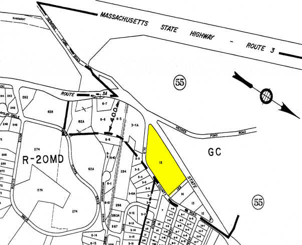
2260 State Rd
PLYM-000054-000000-000015
Plymouth
Supermarket
Massachusetts
X
15
25023C0508L
5.74 AC
2025
Route 3 South
2025
Boston
530902
Boston-Cambridge-Newton, MA-NH
59,320 SF
DEMOGRAPHICS near 2260 State Rd
1 Mile
3 Mile
5 Mile
2024 Total Population
3,073
14,087
30,025
2029 Population
3,133
14,242
30,428
Pop Growth 2024-2029
+ 1.95%
+ 1.10%
+ 1.34%
Average Age
46
43
45
2024 Total Households
1,212
5,242
11,788
HH Growth 2024-2029
+ 1.90%
+ 0.97%
+ 1.18%
Median Household Inc
$106,547
$107,763
$104,943
Avg Household Size
2.50
2.60
2.50
2024 Avg HH Vehicles
2.00
2.00
2.00
Median Home Value
$432,575
$443,397
$461,387
Median Year Built
1987
1987
1986
Nearby Places
Map Layers
Map Styles
 Street
 Aerial
- Restaurants
- Banks
- Shops
- Fitness
- Groceries
PUBLIC TRANSPORTATION
COMMUTER RAIL
Bourne (CapeFLYER - Cape Cod Regional Transit Authority)
DRIVE
WALK
Distance
Bourne (CapeFLYER - Cape Cod Regional Transit Authority)
12 min
7.0 mi
Buzzards Bay (CapeFLYER - Cape Cod Regional Transit Authority)
DRIVE
WALK
Distance
Buzzards Bay (CapeFLYER - Cape Cod Regional Transit Authority)
13 min
7.6 mi
AIRPORT
Martha's Vineyard
DRIVE
WALK
Distance
Martha's Vineyard
100 min
38.4 mi
Freight Ports
Port of New Bedford Harbor
DRIVE
WALK
Distance
Port of New Bedford Harbor
46 min
33.0 mi
Nearby Properties
Address
Land Use
TOTAL SIZE
Lot Size
Zoning
Address
Land Use
TOTAL SIZE
Lot Size
Zoning
5,928 SF
12.90 AC
Address
Land Use
TOTAL SIZE
Lot Size
Zoning
79,376 SF
20.06 AC
RR
Address
Land Use
TOTAL SIZE
Lot Size
Zoning
148.70 AC
R40
Address
Land Use
TOTAL SIZE
Lot Size
Zoning
24,512 SF
35.74 AC
RR
Address
Land Use
TOTAL SIZE
Lot Size
Zoning
Address
Land Use
TOTAL SIZE
Lot Size
Zoning
10,682 SF
2.05 AC
GC
Address
Land Use
TOTAL SIZE
Lot Size
Zoning
14.92 AC
GC
Address
Land Use
TOTAL SIZE
Lot Size
Zoning
10,000 SF
13.15 AC
R40
Address
Land Use
TOTAL SIZE
Lot Size
Zoning
37,257 SF
3.54 AC
R40
Address
Land Use
TOTAL SIZE
Lot Size
Zoning
3.47 AC
GC
Address
Land Use
TOTAL SIZE
Lot Size
Zoning
4,242 SF
25.20 AC
RR
Address
Land Use
TOTAL SIZE
Lot Size
Zoning
13,372 SF
1.51 AC
GC
Address
Land Use
TOTAL SIZE
Lot Size
Zoning
8,884 SF
176.69 AC
RR
Address
Land Use
TOTAL SIZE
Lot Size
Zoning
25,035 SF
2 AC
Address
Land Use
TOTAL SIZE
Lot Size
Zoning
9,584 SF
1.08 AC
GC
Address
Land Use
TOTAL SIZE
Lot Size
Zoning
2.58 AC
R20M
Address
Land Use
TOTAL SIZE
Lot Size
Zoning
26,302 SF
6.39 AC
R25
Address
Land Use
TOTAL SIZE
Lot Size
Zoning
0.92 AC
R40
Address
Land Use
TOTAL SIZE
Lot Size
Zoning
20,633 SF
2.26 AC
GC
Address
Land Use
TOTAL SIZE
Lot Size
Zoning
2.92 AC
GC
Address
Land Use
TOTAL SIZE
Lot Size
Zoning
16,320 SF
1.31 AC
R40
Address
Land Use
TOTAL SIZE
Lot Size
Zoning
5,956 SF
1.23 AC
GC
Address
Land Use
TOTAL SIZE
Lot Size
Zoning
15.46 AC
R20M
Address
Land Use
TOTAL SIZE
Lot Size
Zoning
61.14 AC
RR
Address
Land Use
TOTAL SIZE
Lot Size
Zoning
5,724 SF
2.07 AC
GC
Address
Land Use
TOTAL SIZE
Lot Size
Zoning
1.38 AC
GC
Address
Land Use
TOTAL SIZE
Lot Size
Zoning
233.45 AC
RR
Address
Land Use
TOTAL SIZE
Lot Size
Zoning
9,630 SF
0.92 AC
GC
Address
Land Use
TOTAL SIZE
Lot Size
Zoning
10,200 SF
1.36 AC
GC
The World's #1 Commercial Real Estate Marketplace
Connect with us
© 2026 CoStar Group
The information above has been obtained from sources believed reliable. While we do not doubt its accuracy we have not verified it and make no guarantee, warranty or representation about it. It is your responsibility to independently confirm its accuracy and completeness. Any projections, opinions, assumptions, or estimates used are for example only and do not represent the current or future performance of the property. The value of this transaction to you depends on tax and other factors which should be evaluated by your tax, financial, and legal advisors. You and your advisors should conduct a careful, independent investigation of the property to determine to your satisfaction the suitability of the property for your needs.