Property Record
22627 State Route 527 Hwy, Bothell, WA 98021


NEARBY LISTINGS FOR SALE OR LEASE
Property Detail
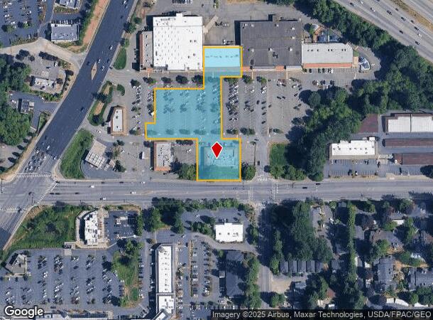
22627 State Route 527 Hwy
Seattle-Tacoma-Bellevue, WA
Belanichs Canyon Park Center
007150-000-004-00
BELANICHS CANYON PARK CENTER BLK 000 D-00 - TH PTNS OF LOTS 2 & 4 DAF - COM NW COR OF LOT 7 SD PLAT TH N19*58 41E 26.52FT ALG WLY LN OF SD PLAT TO A LN LY PLW & 25FT NLY OF THE N LN SD LOT 7 TH S89*29 03E 98.30FT ALG SD PLL LN TH N00*30 57E 205.50FT
Storebuilding
Snohomish
X
Washington
53061C1337F
2,4
2024
2.08 AC
2025
Bothell/Kenmore
051916
Seattle/Puget Sound
17,680 SF
DEMOGRAPHICS near 22627 State Route 527 Hwy
1 Mile
3 Mile
5 Mile
2024 Total Population
10,092
116,442
287,808
2029 Population
10,562
120,485
297,120
Pop Growth 2024-2029
+ 4.66%
+ 3.47%
+ 3.24%
Average Age
39
38
39
2024 Total Households
3,834
43,139
109,151
HH Growth 2024-2029
+ 4.51%
+ 3.41%
+ 3.25%
Median Household Inc
$124,732
$130,259
$121,931
Avg Household Size
2.60
2.60
2.60
2024 Avg HH Vehicles
2.00
2.00
2.00
Median Home Value
$840,655
$769,565
$755,535
Median Year Built
1992
1993
1988
Nearby Places
Map Layers
Map Styles
 Street
 Aerial
- Restaurants
- Banks
- Shops
- Fitness
- Groceries
PUBLIC TRANSPORTATION
COMMUTER RAIL
Edmonds Station (Sounder South Line - Central Puget Sound Regional Transit Authority Rail (Link Light Rail/Sounder))
DRIVE
WALK
Distance
Edmonds Station (Sounder South Line - Central Puget Sound Regional Transit Authority Rail (Link Light Rail/Sounder))
23 min
9.0 mi
AIRPORT
Seattle Paine Field International
DRIVE
WALK
Distance
Seattle Paine Field International
23 min
11.0 mi
Seattle-Tacoma International
DRIVE
WALK
Distance
Seattle-Tacoma International
43 min
30.1 mi
Freight Ports
Port of Everett
DRIVE
WALK
Distance
Port of Everett
28 min
15.1 mi
SALE & LEASE HISTORY
LISTING DATE
SALE/LEASE

Apr 08, 2024
For Lease
Nearby Properties
Address
Land Use
TOTAL SIZE
Lot Size
Zoning
Address
Land Use
TOTAL SIZE
Lot Size
Zoning
50,400 SF
123.66 AC
C
Address
Land Use
TOTAL SIZE
Lot Size
Zoning
11.29 AC
R-AC, OP,
Address
Land Use
TOTAL SIZE
Lot Size
Zoning
581,232 SF
43.22 AC
UC
Address
Land Use
TOTAL SIZE
Lot Size
Zoning
329,964 SF
20.07 AC
MR
Address
Land Use
TOTAL SIZE
Lot Size
Zoning
2.60 AC
DN
Address
Land Use
TOTAL SIZE
Lot Size
Zoning
343,095 SF
39.09 AC
R 5,400A,
Address
Land Use
TOTAL SIZE
Lot Size
Zoning
372,073 SF
9.11 AC
UC
Address
Land Use
TOTAL SIZE
Lot Size
Zoning
293,664 SF
38.51 AC
R 2800, OP
Address
Land Use
TOTAL SIZE
Lot Size
Zoning
194,388 SF
1.65 AC
DC
Address
Land Use
TOTAL SIZE
Lot Size
Zoning
233,025 SF
3.97 AC
R-9,600
Address
Land Use
TOTAL SIZE
Lot Size
Zoning
264,253 SF
29.11 AC
R 4,000
Address
Land Use
TOTAL SIZE
Lot Size
Zoning
170,520 SF
1.92 AC
DN
Address
Land Use
TOTAL SIZE
Lot Size
Zoning
394,152 SF
18 AC
E-M
Address
Land Use
TOTAL SIZE
Lot Size
Zoning
181,008 SF
9.76 AC
E-L
Address
Land Use
TOTAL SIZE
Lot Size
Zoning
250,800 SF
11.69 AC
UC
Address
Land Use
TOTAL SIZE
Lot Size
Zoning
217,877 SF
17.03 AC
R 2,800
Address
Land Use
TOTAL SIZE
Lot Size
Zoning
75,661 SF
30.54 AC
R 8400
Address
Land Use
TOTAL SIZE
Lot Size
Zoning
47,176 SF
38.88 AC
R 9,600
Address
Land Use
TOTAL SIZE
Lot Size
Zoning
122,766 SF
2 AC
GDC
Address
Land Use
TOTAL SIZE
Lot Size
Zoning
119,470 SF
1.56 AC
DN
Address
Land Use
TOTAL SIZE
Lot Size
Zoning
189,700 SF
18.85 AC
OR-L
Address
Land Use
TOTAL SIZE
Lot Size
Zoning
210,072 SF
13.89 AC
E-L
Address
Land Use
TOTAL SIZE
Lot Size
Zoning
173,130 SF
10.27 AC
E-L
Address
Land Use
TOTAL SIZE
Lot Size
Zoning
114,513 SF
2.35 AC
GDC
Address
Land Use
TOTAL SIZE
Lot Size
Zoning
113,880 SF
1.56 AC
GDC
Address
Land Use
TOTAL SIZE
Lot Size
Zoning
229,632 SF
37.61 AC
P/I
Address
Land Use
TOTAL SIZE
Lot Size
Zoning
165,456 SF
8.70 AC
UC
Address
Land Use
TOTAL SIZE
Lot Size
Zoning
120,420 SF
0.94 AC
DN
Address
Land Use
TOTAL SIZE
Lot Size
Zoning
222,333 SF
36.10 AC
E-M
Address
Land Use
TOTAL SIZE
Lot Size
Zoning
177,300 SF
15.50 AC
OR-M
The World's #1 Commercial Real Estate Marketplace
Connect with us
© 2026 CoStar Group
The information above has been obtained from sources believed reliable. While we do not doubt its accuracy we have not verified it and make no guarantee, warranty or representation about it. It is your responsibility to independently confirm its accuracy and completeness. Any projections, opinions, assumptions, or estimates used are for example only and do not represent the current or future performance of the property. The value of this transaction to you depends on tax and other factors which should be evaluated by your tax, financial, and legal advisors. You and your advisors should conduct a careful, independent investigation of the property to determine to your satisfaction the suitability of the property for your needs.