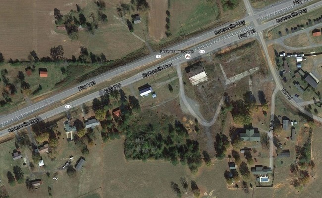
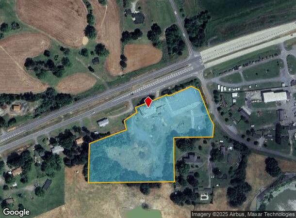
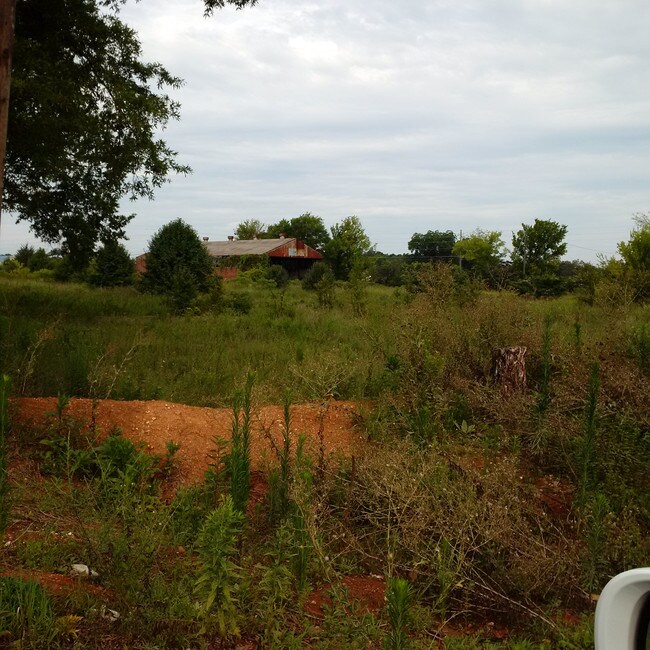
Property Record
2265 Highway 113, Cartersville, GA 30120

NEARBY LISTINGS FOR SALE OR LEASE
-
-
No Photo
-
View all Cartersville listings for sale on LoopNet.com
Property Detail
2265 Highway 113
Atlanta-Sandy Springs-Roswell, GA
Com - West/Highway 113
0032-1112-004
LL 1049 1112 D 17
Commercialnec
Bartow
X
Georgia
13223C0010D
1049
2024
7.42 AC
2024
Bartow County
960902
Atlanta
6,000 SF
DEMOGRAPHICS near 2265 Highway 113
1 Mile
3 Mile
5 Mile
2024 Total Population
652
3,106
13,915
2029 Population
708
3,360
15,090
Pop Growth 2024-2029
+ 8.59%
+ 8.18%
+ 8.44%
Average Age
38
38
38
2024 Total Households
235
1,117
4,842
HH Growth 2024-2029
+ 8.09%
+ 7.88%
+ 8.20%
Median Household Inc
$48,999
$78,587
$85,913
Avg Household Size
2.80
2.80
2.80
2024 Avg HH Vehicles
2.00
2.00
3.00
Median Home Value
$198,170
$183,506
$209,054
Median Year Built
1991
1990
1992
Nearby Places
Map Layers
Map Styles
 Street
 Aerial
- Restaurants
- Banks
- Shops
- Fitness
- Groceries
SALE & LEASE HISTORY
LISTING DATE
SALE/LEASE

Sep 24, 2016
For Sale
Nearby Properties
Address
Land Use
TOTAL SIZE
Lot Size
Zoning
Address
Land Use
TOTAL SIZE
Lot Size
Zoning
2.74 AC
IN
Address
Land Use
TOTAL SIZE
Lot Size
Zoning
58,074 SF
20.28 AC
I1
Address
Land Use
TOTAL SIZE
Lot Size
Zoning
13,500 SF
55.40 AC
I2
Address
Land Use
TOTAL SIZE
Lot Size
Zoning
13,932 SF
7.82 AC
C1
Address
Land Use
TOTAL SIZE
Lot Size
Zoning
51.82 AC
I1
Address
Land Use
TOTAL SIZE
Lot Size
Zoning
228.37 AC
A1
Address
Land Use
TOTAL SIZE
Lot Size
Zoning
744 SF
170.02 AC
A1
Address
Land Use
TOTAL SIZE
Lot Size
Zoning
199 AC
A1
Address
Land Use
TOTAL SIZE
Lot Size
Zoning
242.47 AC
A1
Address
Land Use
TOTAL SIZE
Lot Size
Zoning
1,440 SF
35.45 AC
A1
Address
Land Use
TOTAL SIZE
Lot Size
Zoning
480 SF
28.05 AC
I1
Address
Land Use
TOTAL SIZE
Lot Size
Zoning
870 SF
276.04 AC
A1
Address
Land Use
TOTAL SIZE
Lot Size
Zoning
158.64 AC
A1
Address
Land Use
TOTAL SIZE
Lot Size
Zoning
7,920 SF
5 AC
I1
Address
Land Use
TOTAL SIZE
Lot Size
Zoning
10,440 SF
60.78 AC
A1
Address
Land Use
TOTAL SIZE
Lot Size
Zoning
Address
Land Use
TOTAL SIZE
Lot Size
Zoning
1,147 SF
34.77 AC
A1
Address
Land Use
TOTAL SIZE
Lot Size
Zoning
1,008 SF
10 AC
Address
Land Use
TOTAL SIZE
Lot Size
Zoning
8,920 SF
9.67 AC
I1
Address
Land Use
TOTAL SIZE
Lot Size
Zoning
227.22 AC
A1
Address
Land Use
TOTAL SIZE
Lot Size
Zoning
1,450 SF
71.96 AC
A1
Address
Land Use
TOTAL SIZE
Lot Size
Zoning
101.14 AC
A1
Address
Land Use
TOTAL SIZE
Lot Size
Zoning
63.03 AC
Address
Land Use
TOTAL SIZE
Lot Size
Zoning
110.70 AC
A1
Address
Land Use
TOTAL SIZE
Lot Size
Zoning
7,278 SF
1.28 AC
Address
Land Use
TOTAL SIZE
Lot Size
Zoning
8,592 SF
1.58 AC
C1
Address
Land Use
TOTAL SIZE
Lot Size
Zoning
253.66 AC
Address
Land Use
TOTAL SIZE
Lot Size
Zoning
5,954 SF
2.07 AC
Address
Land Use
TOTAL SIZE
Lot Size
Zoning
84.27 AC
Address
Land Use
TOTAL SIZE
Lot Size
Zoning
2,308 SF
1.48 AC
A1
The World's #1 Commercial Real Estate Marketplace
Connect with us
© 2025 CoStar Group
The information above has been obtained from sources believed reliable. While we do not doubt its accuracy we have not verified it and make no guarantee, warranty or representation about it. It is your responsibility to independently confirm its accuracy and completeness. Any projections, opinions, assumptions, or estimates used are for example only and do not represent the current or future performance of the property. The value of this transaction to you depends on tax and other factors which should be evaluated by your tax, financial, and legal advisors. You and your advisors should conduct a careful, independent investigation of the property to determine to your satisfaction the suitability of the property for your needs.