Property Record
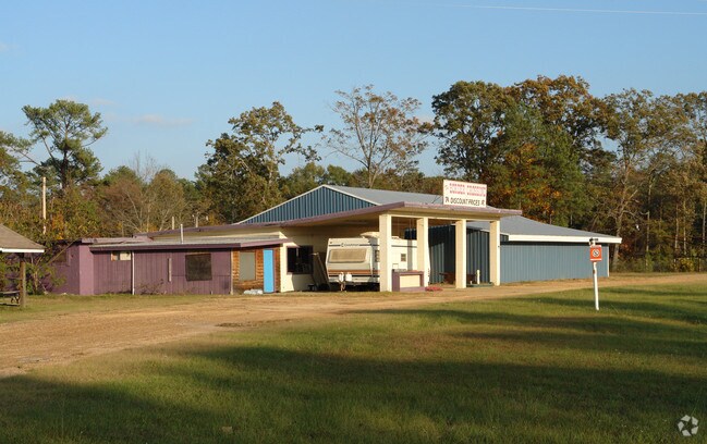
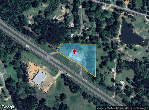
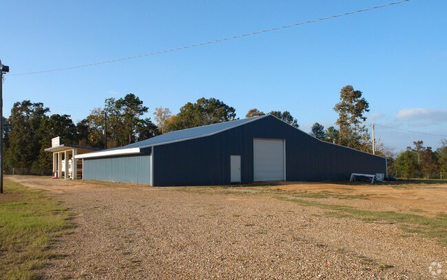
2268 Simpson Highway 49 Rd, Mendenhall, MS 39114
NEARBY LISTINGS FOR SALE OR LEASE
Property Detail
2268 Simpson Highway 49 Rd
1-0581-27-00000-000-02200
3.2 ACS PT NE1/4 NW1/4 N OF HWY SEC 27-1-5 DB 522-342 67
Storebuilding
Simpson
X
Mississippi
28127C0219D
3.20 AC
2025
Simpson County
2024
Jackson
950102
Jackson, MS
1,904 SF
DEMOGRAPHICS near 2268 Simpson Highway 49 Rd
1 Mile
3 Mile
5 Mile
2024 Total Population
397
3,243
8,512
2029 Population
390
3,196
8,376
Pop Growth 2024-2029
(1.76%)
(1.45%)
(1.60%)
Average Age
39
40
39
2024 Total Households
148
1,211
3,212
HH Growth 2024-2029
(1.35%)
(1.24%)
(1.46%)
Median Household Inc
$44,374
$43,338
$42,092
Avg Household Size
2.50
2.50
2.50
2024 Avg HH Vehicles
2.00
2.00
2.00
Median Home Value
$129,807
$122,000
$102,532
Median Year Built
1990
1979
1979
Nearby Places
Map Layers
Map Styles
 Street
 Aerial
- Restaurants
- Banks
- Shops
- Fitness
- Groceries
Nearby Properties
Address
Land Use
TOTAL SIZE
Lot Size
Zoning
Address
Land Use
TOTAL SIZE
Lot Size
Zoning
153,412 SF
24.10 AC
Address
Land Use
TOTAL SIZE
Lot Size
Zoning
7,239 SF
6 AC
Address
Land Use
TOTAL SIZE
Lot Size
Zoning
31,698 SF
1.51 AC
Address
Land Use
TOTAL SIZE
Lot Size
Zoning
52,857 SF
6.90 AC
Address
Land Use
TOTAL SIZE
Lot Size
Zoning
19,249 SF
3.50 AC
Address
Land Use
TOTAL SIZE
Lot Size
Zoning
17,110 SF
2.60 AC
Address
Land Use
TOTAL SIZE
Lot Size
Zoning
9,094 SF
1.40 AC
Address
Land Use
TOTAL SIZE
Lot Size
Zoning
3,733 SF
1.98 AC
Address
Land Use
TOTAL SIZE
Lot Size
Zoning
6,084 SF
1.50 AC
Address
Land Use
TOTAL SIZE
Lot Size
Zoning
1,350 SF
0.90 AC
Address
Land Use
TOTAL SIZE
Lot Size
Zoning
1,544 SF
1.96 AC
Address
Land Use
TOTAL SIZE
Lot Size
Zoning
10,088 SF
1.10 AC
Address
Land Use
TOTAL SIZE
Lot Size
Zoning
7,497 SF
2.80 AC
Address
Land Use
TOTAL SIZE
Lot Size
Zoning
2,163 SF
1.70 AC
Address
Land Use
TOTAL SIZE
Lot Size
Zoning
4,035 SF
0.77 AC
Address
Land Use
TOTAL SIZE
Lot Size
Zoning
3,853 SF
0.22 AC
The World's #1 Commercial Real Estate Marketplace
Connect with us
© 2026 CoStar Group
The information above has been obtained from sources believed reliable. While we do not doubt its accuracy we have not verified it and make no guarantee, warranty or representation about it. It is your responsibility to independently confirm its accuracy and completeness. Any projections, opinions, assumptions, or estimates used are for example only and do not represent the current or future performance of the property. The value of this transaction to you depends on tax and other factors which should be evaluated by your tax, financial, and legal advisors. You and your advisors should conduct a careful, independent investigation of the property to determine to your satisfaction the suitability of the property for your needs.