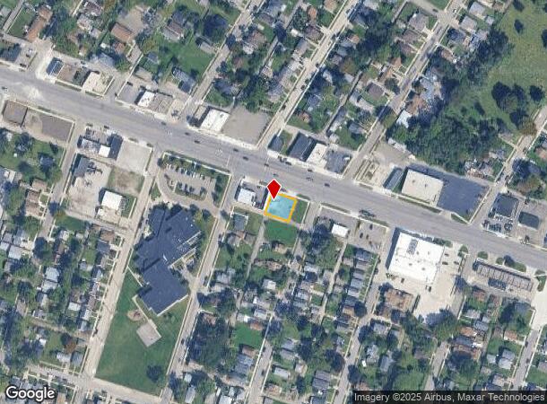
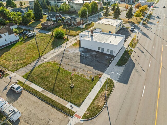
Property Record
227 Southfield Rd, Ecorse, MI 48229
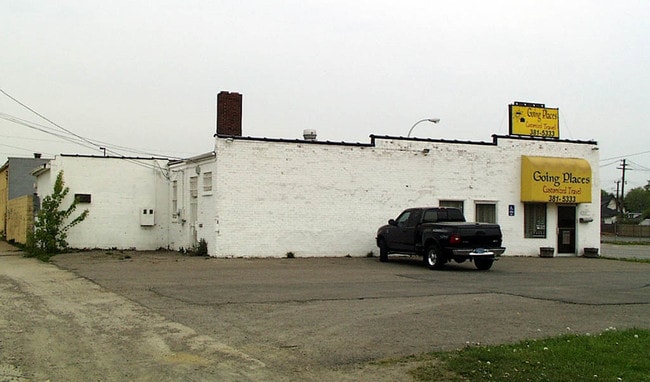
This Property Is For Sale
NEARBY LISTINGS FOR SALE OR LEASE
Property Detail
227 Southfield Rd
Detroit-Warren-Dearborn, MI
The National
34-012-04-0014-301
*085D14A TO 17A* LOTS 14 TO 17 INCL EXC NLY 28FT THEREOF THE NATIONAL SUB PC 85 L39 P21 WCR - K - 69.24
Officebuilding
Wayne
X
Michigan
26163C0407F
14-17
2025
0.13 AC
2025
Downriver North
579700
Detroit
2,488 SF
DEMOGRAPHICS near 227 Southfield Rd
1 Mile
3 Mile
5 Mile
2024 Total Population
15,030
98,027
193,150
2029 Population
14,592
94,705
186,076
Pop Growth 2024-2029
(2.91%)
(3.39%)
(3.66%)
Average Age
39
39
40
2024 Total Households
5,829
39,465
76,987
HH Growth 2024-2029
(2.97%)
(3.47%)
(3.70%)
Median Household Inc
$48,536
$51,875
$55,982
Avg Household Size
2.50
2.40
2.40
2024 Avg HH Vehicles
1.00
2.00
2.00
Median Home Value
$89,285
$122,322
$136,801
Median Year Built
1953
1952
1954
Nearby Places
Map Layers
Map Styles
 Street
 Aerial
- Restaurants
- Banks
- Shops
- Fitness
- Groceries
PUBLIC TRANSPORTATION
COMMUTER RAIL
DRIVE
WALK
Distance
18 min
8.4 mi
AIRPORT
Detroit Metro Wayne County
DRIVE
WALK
Distance
Detroit Metro Wayne County
27 min
14.8 mi
Windsor International
DRIVE
WALK
Distance
Windsor International
37 min
19.3 mi
Freight Ports
DRIVE
WALK
Distance
67 min
52.6 mi
Nearby Properties
Address
Land Use
TOTAL SIZE
Lot Size
Zoning
Address
Land Use
TOTAL SIZE
Lot Size
Zoning
1,025,154 SF
233.15 AC
Address
Land Use
TOTAL SIZE
Lot Size
Zoning
7,320 SF
226.49 AC
Address
Land Use
TOTAL SIZE
Lot Size
Zoning
187,395 SF
Address
Land Use
TOTAL SIZE
Lot Size
Zoning
114,157 SF
Address
Land Use
TOTAL SIZE
Lot Size
Zoning
196,801 SF
38.32 AC
M5
Address
Land Use
TOTAL SIZE
Lot Size
Zoning
111,402 SF
3.17 AC
Address
Land Use
TOTAL SIZE
Lot Size
Zoning
193,650 SF
18.39 AC
Address
Land Use
TOTAL SIZE
Lot Size
Zoning
145,572 SF
58.41 AC
M4
Address
Land Use
TOTAL SIZE
Lot Size
Zoning
76,350 SF
0.69 AC
Address
Land Use
TOTAL SIZE
Lot Size
Zoning
130,968 SF
0.84 AC
Address
Land Use
TOTAL SIZE
Lot Size
Zoning
79.03 AC
M2 HEAV
Address
Land Use
TOTAL SIZE
Lot Size
Zoning
660 SF
41.97 AC
R1 1 FA
Address
Land Use
TOTAL SIZE
Lot Size
Zoning
105,920 SF
12.46 AC
Address
Land Use
TOTAL SIZE
Lot Size
Zoning
45,400 SF
R1 1 FA
Address
Land Use
TOTAL SIZE
Lot Size
Zoning
32,245 SF
23.27 AC
M5
Address
Land Use
TOTAL SIZE
Lot Size
Zoning
105,503 SF
19.83 AC
Address
Land Use
TOTAL SIZE
Lot Size
Zoning
121,912 SF
7.88 AC
Address
Land Use
TOTAL SIZE
Lot Size
Zoning
77,026 SF
9.64 AC
R1 1 FA
Address
Land Use
TOTAL SIZE
Lot Size
Zoning
106.97 AC
M2 HEAV
Address
Land Use
TOTAL SIZE
Lot Size
Zoning
70,100 SF
2.40 AC
C 6C
Address
Land Use
TOTAL SIZE
Lot Size
Zoning
228,000 SF
12.70 AC
Address
Land Use
TOTAL SIZE
Lot Size
Zoning
414,868 SF
26.36 AC
R1 1 FA
Address
Land Use
TOTAL SIZE
Lot Size
Zoning
8,774 SF
29.39 AC
R1 1 FA
Address
Land Use
TOTAL SIZE
Lot Size
Zoning
78,580 SF
0.62 AC
Address
Land Use
TOTAL SIZE
Lot Size
Zoning
2,220 SF
10.66 AC
Address
Land Use
TOTAL SIZE
Lot Size
Zoning
108,000 SF
7.46 AC
Address
Land Use
TOTAL SIZE
Lot Size
Zoning
292,797 SF
9.31 AC
Address
Land Use
TOTAL SIZE
Lot Size
Zoning
182,640 SF
13.98 AC
Address
Land Use
TOTAL SIZE
Lot Size
Zoning
282,489 SF
15.96 AC
Address
Land Use
TOTAL SIZE
Lot Size
Zoning
19,361 SF
2.09 AC
The World's #1 Commercial Real Estate Marketplace
Connect with us
© 2026 CoStar Group
The information above has been obtained from sources believed reliable. While we do not doubt its accuracy we have not verified it and make no guarantee, warranty or representation about it. It is your responsibility to independently confirm its accuracy and completeness. Any projections, opinions, assumptions, or estimates used are for example only and do not represent the current or future performance of the property. The value of this transaction to you depends on tax and other factors which should be evaluated by your tax, financial, and legal advisors. You and your advisors should conduct a careful, independent investigation of the property to determine to your satisfaction the suitability of the property for your needs.