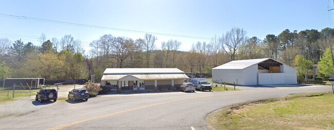
Property Record
2270 Pelham Rd S, Jacksonville, AL 36265
NEARBY LISTINGS FOR SALE OR LEASE
Property Detail
2270 Pelham Rd S
12-07-35-0-002-003.000
SEC 35 T14S R08E BEG 202 S OF INT E R/W HWY 21 & E LINE NW1/4 NE1/4 TH S 116 NW 135 NE 98 SE 97 TO POB
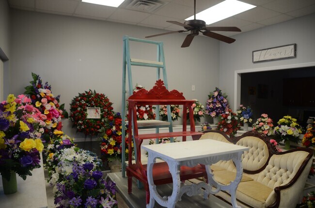
Officebuilding
Calhoun
X
Alabama
01015C0169E
0.28 AC
2025
Gadsden/Anniston Area
2025
Other Market Areas
001801
Anniston-Oxford-Jacksonville, AL
2,400 SF
DEMOGRAPHICS near 2270 Pelham Rd S
1 Mile
3 Mile
5 Mile
2024 Total Population
880
10,560
27,836
2029 Population
878
10,276
27,827
Pop Growth 2024-2029
(0.23%)
(2.69%)
(0.03%)
Average Age
40
39
37
2024 Total Households
363
4,358
10,421
HH Growth 2024-2029
(0.28%)
(2.85%)
+ 0.34%
Median Household Inc
$50,192
$43,637
$42,172
Avg Household Size
2.30
2.30
2.30
2024 Avg HH Vehicles
2.00
2.00
2.00
Median Home Value
$137,156
$147,834
$146,528
Median Year Built
1984
1985
1983
Nearby Places
Map Layers
Map Styles
 Street
 Aerial
- Restaurants
- Banks
- Shops
- Fitness
- Groceries
SALE & LEASE HISTORY
LISTING DATE
SALE/LEASE

Sep 12, 2024
For Sale
Oct 24, 2025
For Sale
Nearby Properties
Address
Land Use
TOTAL SIZE
Lot Size
Zoning
Address
Land Use
TOTAL SIZE
Lot Size
Zoning
2,784 SF
17 AC
Address
Land Use
TOTAL SIZE
Lot Size
Zoning
20,074 SF
12 AC
Address
Land Use
TOTAL SIZE
Lot Size
Zoning
163,080 SF
17 AC
Address
Land Use
TOTAL SIZE
Lot Size
Zoning
50,524 SF
3.73 AC
Address
Land Use
TOTAL SIZE
Lot Size
Zoning
2,400 SF
19 AC
Address
Land Use
TOTAL SIZE
Lot Size
Zoning
34,354 SF
29 AC
Address
Land Use
TOTAL SIZE
Lot Size
Zoning
23,512 SF
4.60 AC
Address
Land Use
TOTAL SIZE
Lot Size
Zoning
3,360 SF
10.80 AC
Address
Land Use
TOTAL SIZE
Lot Size
Zoning
1,800 SF
18.95 AC
Address
Land Use
TOTAL SIZE
Lot Size
Zoning
56,080 SF
5.15 AC
Address
Land Use
TOTAL SIZE
Lot Size
Zoning
11,762 SF
12 AC
Address
Land Use
TOTAL SIZE
Lot Size
Zoning
33,413 SF
4.50 AC
Address
Land Use
TOTAL SIZE
Lot Size
Zoning
25,993 SF
6.05 AC
Address
Land Use
TOTAL SIZE
Lot Size
Zoning
26,654 SF
10 AC
Address
Land Use
TOTAL SIZE
Lot Size
Zoning
3,504 SF
6.74 AC
Address
Land Use
TOTAL SIZE
Lot Size
Zoning
3,207 SF
9.50 AC
Address
Land Use
TOTAL SIZE
Lot Size
Zoning
Address
Land Use
TOTAL SIZE
Lot Size
Zoning
1,717 SF
1.12 AC
Address
Land Use
TOTAL SIZE
Lot Size
Zoning
19.22 AC
Address
Land Use
TOTAL SIZE
Lot Size
Zoning
39,828 SF
3.60 AC
Address
Land Use
TOTAL SIZE
Lot Size
Zoning
1,800 SF
6.40 AC
Address
Land Use
TOTAL SIZE
Lot Size
Zoning
3,811 SF
1.82 AC
Address
Land Use
TOTAL SIZE
Lot Size
Zoning
6,808 SF
9 AC
Address
Land Use
TOTAL SIZE
Lot Size
Zoning
13,572 SF
1.38 AC
Address
Land Use
TOTAL SIZE
Lot Size
Zoning
72,962 SF
2.72 AC
Address
Land Use
TOTAL SIZE
Lot Size
Zoning
13.69 AC
Address
Land Use
TOTAL SIZE
Lot Size
Zoning
4,698 SF
1.95 AC
Address
Land Use
TOTAL SIZE
Lot Size
Zoning
7,190 SF
0.75 AC
Address
Land Use
TOTAL SIZE
Lot Size
Zoning
1,588 SF
0.81 AC
Address
Land Use
TOTAL SIZE
Lot Size
Zoning
3,852 SF
1.81 AC
The World's #1 Commercial Real Estate Marketplace
Connect with us
© 2026 CoStar Group
The information above has been obtained from sources believed reliable. While we do not doubt its accuracy we have not verified it and make no guarantee, warranty or representation about it. It is your responsibility to independently confirm its accuracy and completeness. Any projections, opinions, assumptions, or estimates used are for example only and do not represent the current or future performance of the property. The value of this transaction to you depends on tax and other factors which should be evaluated by your tax, financial, and legal advisors. You and your advisors should conduct a careful, independent investigation of the property to determine to your satisfaction the suitability of the property for your needs.