Property Record
22700 71St St, Broken Arrow, OK 74014

Property Detail
22700 71St St
Tulsa, OK
07-18-15 DESC AS BEG AT POINT ON N LINE OF NE4 NW4 OF SEC 7 DIS 50' E OF E LINE OF BLK 1 AMENDED PLAT OF ANGUS AC 2ND ADD - S
730007310
Wagoner
Commercialacreage
Oklahoma
B and X Area of moderate flood hazard, usually the area between the limits of the 100-year and 500-year floods.
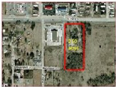
1.85 AC
2025
Wagoner County
2025
Tulsa
030508
NEARBY LISTINGS FOR SALE OR LEASE
DEMOGRAPHICS near 22700 71St St
1 mile
3 mile
5 mile
2025 Total Population
3,952
45,109
120,219
2030 Population
4,287
47,709
126,300
Pop Growth 2025-2030
+ 8.48%
+ 5.76%
+ 5.06%
Average Age
37
38
38
2025 Total Households
1,420
17,483
44,877
HH Growth 2025-2030
+ 8.24%
+ 5.63%
+ 4.93%
Median Household Inc
$74,285
$79,762
$85,633
Avg Household Size
2.70
2.50
2.60
2025 Avg HH Vehicles
2.00
2.00
2.00
Median Home Value
$210,950
$245,983
$252,706
Median Year Built
1988
1999
1995
Nearby Places
Map Layers
Map Styles
 Street
 Aerial
Layers
 Traffic
 Biking
Places
Listings with unknown addresses are not visible on the map
- Restaurants
- Banks
- Shops
- Fitness
- Groceries
PUBLIC TRANSPORTATION
AIRPORT
Tulsa International
Drive
Walk
Distance
Tulsa International
28 min
19.3 mi
Freight Ports
Tulsa Port of Inola
Drive
Walk
Distance
Tulsa Port of Inola
29 min
23.2 mi
SALE & LEASE HISTORY
LISTING DATE
SALE/LEASE

Jul 10, 2018
For Sale
Nearby Properties
Address
Land Use
TOTAL SIZE
Lot Size
Zoning
Address
Land Use
TOTAL SIZE
Lot Size
Zoning
13,691 SF
2.04 AC
CH
Address
Land Use
TOTAL SIZE
Lot Size
Zoning
28,071 SF
19 AC
Address
Land Use
TOTAL SIZE
Lot Size
Zoning
10,140 SF
18.57 AC
R1
Address
Land Use
TOTAL SIZE
Lot Size
Zoning
27,477 SF
5.79 AC
R1
Address
Land Use
TOTAL SIZE
Lot Size
Zoning
255,328 SF
27.50 AC
IL
Address
Land Use
TOTAL SIZE
Lot Size
Zoning
Address
Land Use
TOTAL SIZE
Lot Size
Zoning
74,293 SF
9.34 AC
CH
Address
Land Use
TOTAL SIZE
Lot Size
Zoning
72,754 SF
9.18 AC
CH
Address
Land Use
TOTAL SIZE
Lot Size
Zoning
16,623 SF
4.28 AC
R2
Address
Land Use
TOTAL SIZE
Lot Size
Zoning
145,261 SF
14.09 AC
CH
Address
Land Use
TOTAL SIZE
Lot Size
Zoning
125,153 SF
11.65 AC
CH
Address
Land Use
TOTAL SIZE
Lot Size
Zoning
5,920 SF
10.77 AC
Address
Land Use
TOTAL SIZE
Lot Size
Zoning
18,820 SF
13.42 AC
Address
Land Use
TOTAL SIZE
Lot Size
Zoning
7,200 SF
24.37 AC
Address
Land Use
TOTAL SIZE
Lot Size
Zoning
8,020 SF
29.93 AC
Address
Land Use
TOTAL SIZE
Lot Size
Zoning
14,625 SF
42.36 AC
Address
Land Use
TOTAL SIZE
Lot Size
Zoning
38,658 SF
7.62 AC
CH
Address
Land Use
TOTAL SIZE
Lot Size
Zoning
5,738 SF
1.72 AC
CH
Address
Land Use
TOTAL SIZE
Lot Size
Zoning
50,325 SF
4.46 AC
CH
Address
Land Use
TOTAL SIZE
Lot Size
Zoning
8,206 SF
4.53 AC
Address
Land Use
TOTAL SIZE
Lot Size
Zoning
Address
Land Use
TOTAL SIZE
Lot Size
Zoning
152,100 SF
10.06 AC
IL
Address
Land Use
TOTAL SIZE
Lot Size
Zoning
21,500 SF
2.51 AC
CH
Address
Land Use
TOTAL SIZE
Lot Size
Zoning
11,220 SF
8.58 AC
Address
Land Use
TOTAL SIZE
Lot Size
Zoning
6,804 SF
3.29 AC
CH
Address
Land Use
TOTAL SIZE
Lot Size
Zoning
319 SF
8.23 AC
Address
Land Use
TOTAL SIZE
Lot Size
Zoning
810 SF
56.20 AC
Address
Land Use
TOTAL SIZE
Lot Size
Zoning
3,080 SF
1.05 AC
CH
The World's #1 Commercial Real Estate Marketplace
Connect with us
© 2026 CoStar Group
The information above has been obtained from sources believed reliable. While we do not doubt its accuracy we have not verified it and make no guarantee, warranty or representation about it. It is your responsibility to independently confirm its accuracy and completeness. Any projections, opinions, assumptions, or estimates used are for example only and do not represent the current or future performance of the property. The value of this transaction to you depends on tax and other factors which should be evaluated by your tax, financial, and legal advisors. You and your advisors should conduct a careful, independent investigation of the property to determine to your satisfaction the suitability of the property for your needs.