Property Record
2275 Health Dr Sw, Wyoming, MI 49519
NEARBY LISTINGS FOR SALE OR LEASE
Property Detail
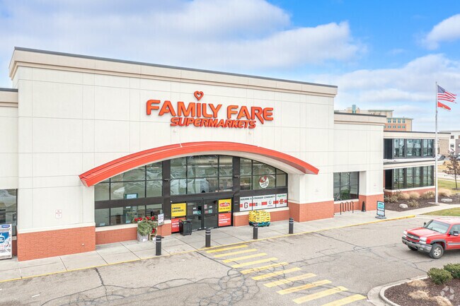
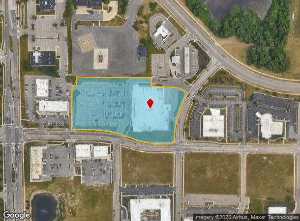
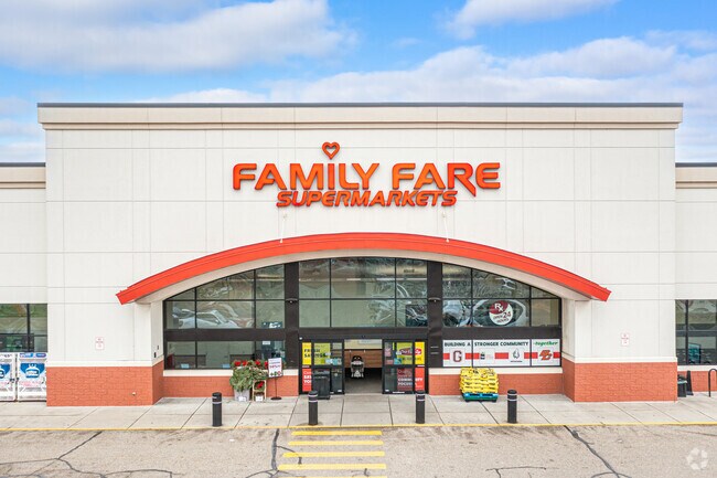
2275 Health Dr Sw
41-17-34-376-075
Metro Health Village Kent County Condomi
Commercialcondominium
411734376075 UNIT 49 * METRO HEALTH VILLAGE KENT COUNTY CONDOMINIUM SUBDIVISION PLAN NO.754 INSTRUMENT NO.20050629-0076202 AS
X
Kent
26005C0125G
Michigan
2024
4.74 AC
2025
Southwestern Grand Rapids
014505
West Michigan
49,779 SF
Grand Rapids-Wyoming, MI
DEMOGRAPHICS near 2275 Health Dr Sw
1 Mile
3 Mile
5 Mile
2024 Total Population
5,852
60,194
165,059
2029 Population
5,895
61,021
166,990
Pop Growth 2024-2029
+ 0.73%
+ 1.37%
+ 1.17%
Average Age
39
39
38
2024 Total Households
2,156
23,257
62,387
HH Growth 2024-2029
+ 0.79%
+ 1.38%
+ 1.20%
Median Household Inc
$81,543
$73,189
$67,038
Avg Household Size
2.60
2.50
2.60
2024 Avg HH Vehicles
2.00
2.00
2.00
Median Home Value
$261,870
$240,863
$214,750
Median Year Built
1995
1987
1977
Nearby Places
- Restaurants
- Banks
- Shops
- Fitness
- Groceries
PUBLIC TRANSPORTATION
COMMUTER RAIL
Grand Rapids Vernon J. Ehlers Station (Pere Marquette - Amtrak)
DRIVE
WALK
Distance
Grand Rapids Vernon J. Ehlers Station (Pere Marquette - Amtrak)
13 min
9.4 mi
AIRPORT
Gerald R Ford International
DRIVE
WALK
Distance
Gerald R Ford International
21 min
13.5 mi
Freight Ports
Port Milwaukee
DRIVE
WALK
Distance
Port Milwaukee
299 min
256.7 mi
SALE & LEASE HISTORY
LISTING DATE
SALE/LEASE

Aug 16, 2023
For Sale
Nearby Properties
Address
Land Use
TOTAL SIZE
Lot Size
Zoning
Address
Land Use
TOTAL SIZE
Lot Size
Zoning
290,627 SF
Address
Land Use
TOTAL SIZE
Lot Size
Zoning
79.40 AC
C-4
Address
Land Use
TOTAL SIZE
Lot Size
Zoning
899,034 SF
78.93 AC
B1
Address
Land Use
TOTAL SIZE
Lot Size
Zoning
28.51 AC
Address
Land Use
TOTAL SIZE
Lot Size
Zoning
17,165 SF
33.12 AC
PUD3
Address
Land Use
TOTAL SIZE
Lot Size
Zoning
560,062 SF
55.39 AC
R4
Address
Land Use
TOTAL SIZE
Lot Size
Zoning
295,027 SF
51.42 AC
I3
Address
Land Use
TOTAL SIZE
Lot Size
Zoning
307,361 SF
16.60 AC
R1-A
Address
Land Use
TOTAL SIZE
Lot Size
Zoning
487,739 SF
73.87 AC
RR
Address
Land Use
TOTAL SIZE
Lot Size
Zoning
26.94 AC
Address
Land Use
TOTAL SIZE
Lot Size
Zoning
225,992 SF
14.40 AC
Address
Land Use
TOTAL SIZE
Lot Size
Zoning
Address
Land Use
TOTAL SIZE
Lot Size
Zoning
112,040 SF
9.69 AC
PUD3
Address
Land Use
TOTAL SIZE
Lot Size
Zoning
230,864 SF
59.58 AC
PUD2
Address
Land Use
TOTAL SIZE
Lot Size
Zoning
Address
Land Use
TOTAL SIZE
Lot Size
Zoning
13.53 AC
R1-A
Address
Land Use
TOTAL SIZE
Lot Size
Zoning
386,450 SF
29.10 AC
Address
Land Use
TOTAL SIZE
Lot Size
Zoning
264,739 SF
26.56 AC
I2
Address
Land Use
TOTAL SIZE
Lot Size
Zoning
465,772 SF
61.95 AC
I1
Address
Land Use
TOTAL SIZE
Lot Size
Zoning
206,562 SF
15.12 AC
R1
Address
Land Use
TOTAL SIZE
Lot Size
Zoning
22.35 AC
Address
Land Use
TOTAL SIZE
Lot Size
Zoning
191,331 SF
9.20 AC
PUD1
Address
Land Use
TOTAL SIZE
Lot Size
Zoning
179,436 SF
24.94 AC
I2
Address
Land Use
TOTAL SIZE
Lot Size
Zoning
212,353 SF
16.52 AC
R4
Address
Land Use
TOTAL SIZE
Lot Size
Zoning
20.30 AC
Address
Land Use
TOTAL SIZE
Lot Size
Zoning
128,872 SF
7.32 AC
PUD3
Address
Land Use
TOTAL SIZE
Lot Size
Zoning
20.50 AC
RR
Address
Land Use
TOTAL SIZE
Lot Size
Zoning
Address
Land Use
TOTAL SIZE
Lot Size
Zoning
Address
Land Use
TOTAL SIZE
Lot Size
Zoning
179,056 SF
17.75 AC
PUD1
The World's #1 Commercial Real Estate Marketplace
Connect with us
© 2025 CoStar Group
The information above has been obtained from sources believed reliable. While we do not doubt its accuracy we have not verified it and make no guarantee, warranty or representation about it. It is your responsibility to independently confirm its accuracy and completeness. Any projections, opinions, assumptions, or estimates used are for example only and do not represent the current or future performance of the property. The value of this transaction to you depends on tax and other factors which should be evaluated by your tax, financial, and legal advisors. You and your advisors should conduct a careful, independent investigation of the property to determine to your satisfaction the suitability of the property for your needs.