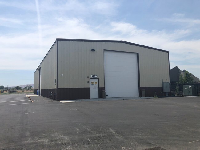
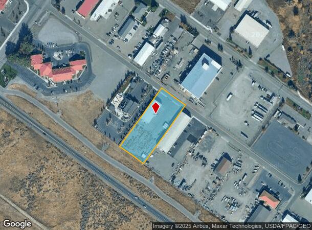
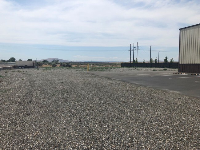
Property Record
2277 Henderson Loop, Richland, WA 99354
NEARBY LISTINGS FOR SALE OR LEASE
Property Detail
2277 Henderson Loop
Kennewick-Richland, WA
A PORTION OF PARCEL 13 AND PARCEL 14 OF BLOCK 1 OF RECORD SURVEY #2056 (BINDING SITE PLAN #95-100) AS RECORDED IN VOL. 1 OF SURVEYS PAGE 2056 RECORDS OF BENTON COUNTY WASHINGTON DESCRIBED MORE PARTICULARLY AS FOLLOWS COMMENCING AT THE CENTERLINE IN
127083000018001
Benton
Industrialgeneral
Washington
2024
1.35 AC
2024
Yakima/Kennewick
010201
Other Market Areas
6,000 SF
DEMOGRAPHICS near 2277 Henderson Loop
1 Mile
3 Mile
5 Mile
2024 Total Population
1,636
31,618
65,158
2029 Population
1,751
33,977
70,076
Pop Growth 2024-2029
+ 7.03%
+ 7.46%
+ 7.55%
Average Age
39
39
38
2024 Total Households
606
12,674
24,941
HH Growth 2024-2029
+ 7.10%
+ 7.44%
+ 7.51%
Median Household Inc
$72,650
$81,629
$93,109
Avg Household Size
2.60
2.40
2.60
2024 Avg HH Vehicles
2.00
2.00
2.00
Median Home Value
$293,136
$332,503
$358,354
Median Year Built
1976
1971
1984
Nearby Places
Map Layers
Map Styles
 Street
 Aerial
- Restaurants
- Banks
- Shops
- Fitness
- Groceries
PUBLIC TRANSPORTATION
AIRPORT
Tri-Cities
DRIVE
WALK
Distance
Tri-Cities
23 min
15.1 mi
Freight Ports
Port of Tacoma
DRIVE
WALK
Distance
Port of Tacoma
259 min
213.1 mi
SALE & LEASE HISTORY
LISTING DATE
SALE/LEASE

Jun 25, 2018
For Sale
Nearby Properties
Address
Land Use
TOTAL SIZE
Lot Size
Zoning
Address
Land Use
TOTAL SIZE
Lot Size
Zoning
650,794 SF
55.19 AC
Address
Land Use
TOTAL SIZE
Lot Size
Zoning
351,518 SF
16.01 AC
Address
Land Use
TOTAL SIZE
Lot Size
Zoning
14,514 SF
160 AC
Address
Land Use
TOTAL SIZE
Lot Size
Zoning
562,186 SF
7.61 AC
Address
Land Use
TOTAL SIZE
Lot Size
Zoning
5,948 SF
25 AC
Address
Land Use
TOTAL SIZE
Lot Size
Zoning
305,328 SF
83.37 AC
Address
Land Use
TOTAL SIZE
Lot Size
Zoning
12,866 SF
44.02 AC
Address
Land Use
TOTAL SIZE
Lot Size
Zoning
245,782 SF
10 AC
RICHLAND -
Address
Land Use
TOTAL SIZE
Lot Size
Zoning
148,367 SF
1 AC
Address
Land Use
TOTAL SIZE
Lot Size
Zoning
306,563 SF
14.60 AC
Address
Land Use
TOTAL SIZE
Lot Size
Zoning
277,559 SF
30 AC
Address
Land Use
TOTAL SIZE
Lot Size
Zoning
201,040 SF
4.24 AC
Address
Land Use
TOTAL SIZE
Lot Size
Zoning
719,130 SF
75 AC
RICHLAND -
Address
Land Use
TOTAL SIZE
Lot Size
Zoning
428,225 SF
12.60 AC
Address
Land Use
TOTAL SIZE
Lot Size
Zoning
351,217 SF
60.86 AC
Address
Land Use
TOTAL SIZE
Lot Size
Zoning
47,160 SF
14.28 AC
Address
Land Use
TOTAL SIZE
Lot Size
Zoning
280,136 SF
Address
Land Use
TOTAL SIZE
Lot Size
Zoning
220,970 SF
1.28 AC
Address
Land Use
TOTAL SIZE
Lot Size
Zoning
106,500 SF
3.83 AC
Address
Land Use
TOTAL SIZE
Lot Size
Zoning
90,520 SF
4.32 AC
RICHLAND -
Address
Land Use
TOTAL SIZE
Lot Size
Zoning
94,714 SF
5.22 AC
Address
Land Use
TOTAL SIZE
Lot Size
Zoning
100,872 SF
1 AC
Address
Land Use
TOTAL SIZE
Lot Size
Zoning
69,488 SF
1.69 AC
Address
Land Use
TOTAL SIZE
Lot Size
Zoning
100,872 SF
1 AC
Address
Land Use
TOTAL SIZE
Lot Size
Zoning
233,709 SF
39.16 AC
Address
Land Use
TOTAL SIZE
Lot Size
Zoning
69,697 SF
16.83 AC
Address
Land Use
TOTAL SIZE
Lot Size
Zoning
280.55 AC
Address
Land Use
TOTAL SIZE
Lot Size
Zoning
150,522 SF
Address
Land Use
TOTAL SIZE
Lot Size
Zoning
93,484 SF
61.65 AC
Address
Land Use
TOTAL SIZE
Lot Size
Zoning
96,486 SF
13.24 AC
The World's #1 Commercial Real Estate Marketplace
Connect with us
© 2025 CoStar Group
The information above has been obtained from sources believed reliable. While we do not doubt its accuracy we have not verified it and make no guarantee, warranty or representation about it. It is your responsibility to independently confirm its accuracy and completeness. Any projections, opinions, assumptions, or estimates used are for example only and do not represent the current or future performance of the property. The value of this transaction to you depends on tax and other factors which should be evaluated by your tax, financial, and legal advisors. You and your advisors should conduct a careful, independent investigation of the property to determine to your satisfaction the suitability of the property for your needs.