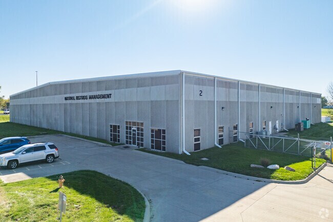
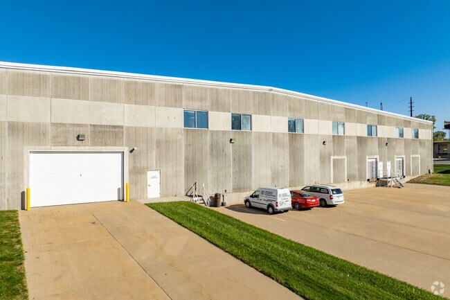
Property Record
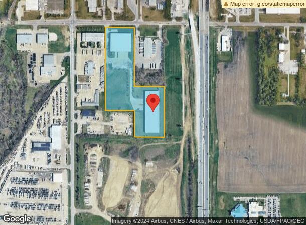
2277 Ne 46Th Ave, Des Moines, IA 50317
NEARBY LISTINGS FOR SALE OR LEASE
Property Detail
2277 Ne 46Th Ave
Des Moines-West Des Moines, IA
Leland S Forrest Estate Plat 1
190-01646501001
LT 1 & S 589.91F LT 2 LELAND S FORREST ESTATE PLAT NO. 1
Warehouse
Polk
X
Iowa
19153C0215F
1,2
2024
12.31 AC
2025
Northeast
010601
Des Moines
127,200 SF
DEMOGRAPHICS near 2277 Ne 46Th Ave
1 Mile
3 Mile
5 Mile
2024 Total Population
1,863
49,594
138,881
2029 Population
1,920
51,302
145,026
Pop Growth 2024-2029
+ 3.06%
+ 3.44%
+ 4.42%
Average Age
42
39
37
2024 Total Households
773
19,027
55,202
HH Growth 2024-2029
+ 3.23%
+ 3.62%
+ 4.68%
Median Household Inc
$71,249
$57,988
$57,743
Avg Household Size
2.40
2.40
2.40
2024 Avg HH Vehicles
2.00
2.00
2.00
Median Home Value
$162,311
$142,805
$162,207
Median Year Built
1959
1955
1967
Nearby Places
Map Layers
Map Styles
 Street
 Aerial
- Restaurants
- Banks
- Shops
- Fitness
- Groceries
PUBLIC TRANSPORTATION
AIRPORT
Des Moines International
DRIVE
WALK
Distance
Des Moines International
20 min
10.8 mi
Freight Ports
Port Milwaukee
DRIVE
WALK
Distance
Port Milwaukee
411 min
370.7 mi
Nearby Properties
Address
Land Use
TOTAL SIZE
Lot Size
Zoning
Address
Land Use
TOTAL SIZE
Lot Size
Zoning
481,030 SF
31.92 AC
PUD
Address
Land Use
TOTAL SIZE
Lot Size
Zoning
857,109 SF
73.97 AC
LI
Address
Land Use
TOTAL SIZE
Lot Size
Zoning
675,000 SF
65.27 AC
Address
Land Use
TOTAL SIZE
Lot Size
Zoning
600,000 SF
40.15 AC
Address
Land Use
TOTAL SIZE
Lot Size
Zoning
274,300 SF
24.85 AC
Address
Land Use
TOTAL SIZE
Lot Size
Zoning
312,500 SF
38.14 AC
Address
Land Use
TOTAL SIZE
Lot Size
Zoning
320,429 SF
22.34 AC
R3
Address
Land Use
TOTAL SIZE
Lot Size
Zoning
300,000 SF
18.98 AC
Address
Land Use
TOTAL SIZE
Lot Size
Zoning
529,161 SF
33.60 AC
HI
Address
Land Use
TOTAL SIZE
Lot Size
Zoning
200,860 SF
11.25 AC
Address
Land Use
TOTAL SIZE
Lot Size
Zoning
126,935 SF
28.61 AC
Address
Land Use
TOTAL SIZE
Lot Size
Zoning
130,496 SF
39.96 AC
HI
Address
Land Use
TOTAL SIZE
Lot Size
Zoning
200,220 SF
15.61 AC
Address
Land Use
TOTAL SIZE
Lot Size
Zoning
275,000 SF
16.17 AC
HI
Address
Land Use
TOTAL SIZE
Lot Size
Zoning
603,502 SF
33.03 AC
M-1
Address
Land Use
TOTAL SIZE
Lot Size
Zoning
220,740 SF
23.21 AC
Address
Land Use
TOTAL SIZE
Lot Size
Zoning
206,000 SF
19.12 AC
Address
Land Use
TOTAL SIZE
Lot Size
Zoning
1,838,971 SF
76.24 AC
HI
Address
Land Use
TOTAL SIZE
Lot Size
Zoning
90,325 SF
5.49 AC
PUD
Address
Land Use
TOTAL SIZE
Lot Size
Zoning
82,202 SF
9.48 AC
PUD
Address
Land Use
TOTAL SIZE
Lot Size
Zoning
170,872 SF
25 AC
Address
Land Use
TOTAL SIZE
Lot Size
Zoning
184,320 SF
9.68 AC
Address
Land Use
TOTAL SIZE
Lot Size
Zoning
136,900 SF
28.82 AC
Address
Land Use
TOTAL SIZE
Lot Size
Zoning
180,000 SF
11.72 AC
Address
Land Use
TOTAL SIZE
Lot Size
Zoning
142,118 SF
10.59 AC
PUD
Address
Land Use
TOTAL SIZE
Lot Size
Zoning
162,240 SF
9.19 AC
Address
Land Use
TOTAL SIZE
Lot Size
Zoning
157,500 SF
13.71 AC
Address
Land Use
TOTAL SIZE
Lot Size
Zoning
79,991 SF
4.55 AC
M-1
Address
Land Use
TOTAL SIZE
Lot Size
Zoning
141,616 SF
20.41 AC
Address
Land Use
TOTAL SIZE
Lot Size
Zoning
101,723 SF
18.16 AC
The World's #1 Commercial Real Estate Marketplace
Connect with us
© 2026 CoStar Group
The information above has been obtained from sources believed reliable. While we do not doubt its accuracy we have not verified it and make no guarantee, warranty or representation about it. It is your responsibility to independently confirm its accuracy and completeness. Any projections, opinions, assumptions, or estimates used are for example only and do not represent the current or future performance of the property. The value of this transaction to you depends on tax and other factors which should be evaluated by your tax, financial, and legal advisors. You and your advisors should conduct a careful, independent investigation of the property to determine to your satisfaction the suitability of the property for your needs.