Property Record
22770 S Tamiami Trl, Estero, FL 33928
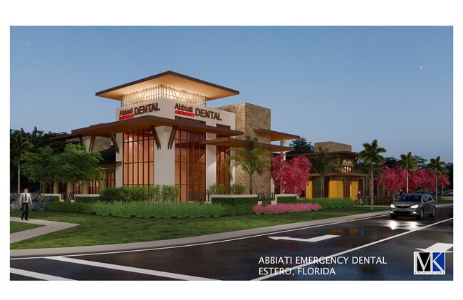

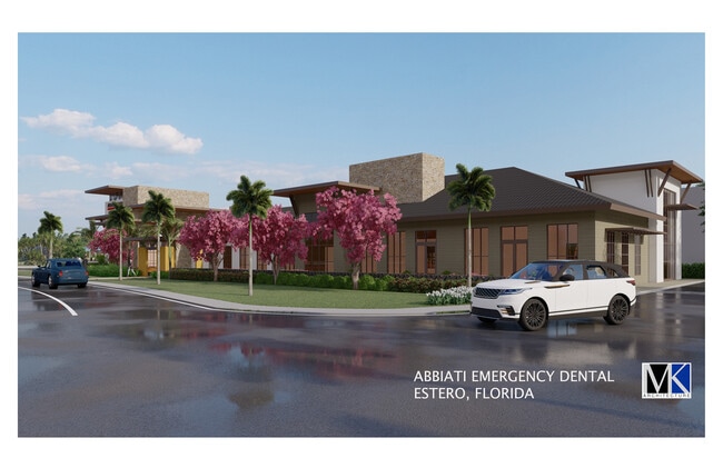

This Property Is For Sale
NEARBY LISTINGS FOR SALE OR LEASE
Property Detail
22770 S Tamiami Trl
Cape Coral-Fort Myers, FL
S. 41 To Bonita
04-47-25-E4-U1893.2141
PARL LYING IN S 1/2 W OF 41 AS DESC IN INST#2006000024869
Commercialacreage
Lee
AE
Florida
12071C0587G
1
2024
1.45 AC
2025
Estero
050320
Southwest Florida
DEMOGRAPHICS near 22770 S Tamiami Trl
1 Mile
3 Mile
5 Mile
2024 Total Population
5,675
40,772
94,577
2029 Population
6,811
49,394
113,565
Pop Growth 2024-2029
+ 20.02%
+ 21.15%
+ 20.08%
Average Age
58
59
53
2024 Total Households
2,831
20,725
43,637
HH Growth 2024-2029
+ 19.64%
+ 20.83%
+ 20.08%
Median Household Inc
$91,912
$88,125
$84,886
Avg Household Size
1.90
1.90
2.10
2024 Avg HH Vehicles
2.00
2.00
2.00
Median Home Value
$382,052
$372,791
$372,589
Median Year Built
2001
2002
1999
Nearby Places
Map Layers
Map Styles
 Street
 Aerial
- Restaurants
- Banks
- Shops
- Fitness
- Groceries
PUBLIC TRANSPORTATION
AIRPORT
Southwest Florida International
DRIVE
WALK
Distance
Southwest Florida International
23 min
14.9 mi
Punta Gorda
DRIVE
WALK
Distance
Punta Gorda
52 min
43.0 mi
Nearby Properties
Address
Land Use
TOTAL SIZE
Lot Size
Zoning
Address
Land Use
TOTAL SIZE
Lot Size
Zoning
785,522 SF
70.04 AC
MPD
Address
Land Use
TOTAL SIZE
Lot Size
Zoning
177,930 SF
20.74 AC
MPD
Address
Land Use
TOTAL SIZE
Lot Size
Zoning
687,668 SF
27.19 AC
CPD
Address
Land Use
TOTAL SIZE
Lot Size
Zoning
20.19 AC
MPD
Address
Land Use
TOTAL SIZE
Lot Size
Zoning
482,782 SF
27.98 AC
CPD
Address
Land Use
TOTAL SIZE
Lot Size
Zoning
540,648 SF
19.75 AC
MPD
Address
Land Use
TOTAL SIZE
Lot Size
Zoning
293,332 SF
7.03 AC
CPD
Address
Land Use
TOTAL SIZE
Lot Size
Zoning
245,356 SF
12.54 AC
MPD
Address
Land Use
TOTAL SIZE
Lot Size
Zoning
274,691 SF
6.62 AC
MPD
Address
Land Use
TOTAL SIZE
Lot Size
Zoning
348,757 SF
69.01 AC
CF-2
Address
Land Use
TOTAL SIZE
Lot Size
Zoning
69.37 AC
RPD
Address
Land Use
TOTAL SIZE
Lot Size
Zoning
5.39 AC
RPD
Address
Land Use
TOTAL SIZE
Lot Size
Zoning
236,456 SF
27.05 AC
MPD
Address
Land Use
TOTAL SIZE
Lot Size
Zoning
239.40 AC
Address
Land Use
TOTAL SIZE
Lot Size
Zoning
166,672 SF
8.58 AC
CPD
Address
Land Use
TOTAL SIZE
Lot Size
Zoning
139,174 SF
4.73 AC
CPD
Address
Land Use
TOTAL SIZE
Lot Size
Zoning
151,366 SF
15.47 AC
CPD
Address
Land Use
TOTAL SIZE
Lot Size
Zoning
48,538 SF
4.46 AC
CC
Address
Land Use
TOTAL SIZE
Lot Size
Zoning
97,916 SF
19.72 AC
CF-2
Address
Land Use
TOTAL SIZE
Lot Size
Zoning
181,680 SF
9.89 AC
MPD
Address
Land Use
TOTAL SIZE
Lot Size
Zoning
8.87 AC
CT
Address
Land Use
TOTAL SIZE
Lot Size
Zoning
35,085 SF
1.70 AC
TFC2
Address
Land Use
TOTAL SIZE
Lot Size
Zoning
103,495 SF
13.29 AC
CPD
Address
Land Use
TOTAL SIZE
Lot Size
Zoning
101,930 SF
6.60 AC
CPD
Address
Land Use
TOTAL SIZE
Lot Size
Zoning
206,959 SF
29.59 AC
MPD
Address
Land Use
TOTAL SIZE
Lot Size
Zoning
97,737 SF
10.67 AC
CPD
Address
Land Use
TOTAL SIZE
Lot Size
Zoning
269,023 SF
13.60 AC
CPD
Address
Land Use
TOTAL SIZE
Lot Size
Zoning
67,650 SF
2.27 AC
MPD
Address
Land Use
TOTAL SIZE
Lot Size
Zoning
73,370 SF
2.42 AC
MPD
Address
Land Use
TOTAL SIZE
Lot Size
Zoning
68,187 SF
2.47 AC
CPD
The World's #1 Commercial Real Estate Marketplace
Connect with us
© 2026 CoStar Group
The information above has been obtained from sources believed reliable. While we do not doubt its accuracy we have not verified it and make no guarantee, warranty or representation about it. It is your responsibility to independently confirm its accuracy and completeness. Any projections, opinions, assumptions, or estimates used are for example only and do not represent the current or future performance of the property. The value of this transaction to you depends on tax and other factors which should be evaluated by your tax, financial, and legal advisors. You and your advisors should conduct a careful, independent investigation of the property to determine to your satisfaction the suitability of the property for your needs.