Property Record
2290 Highway 87, Port Bolivar, TX 77650
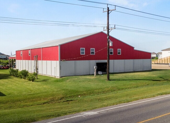
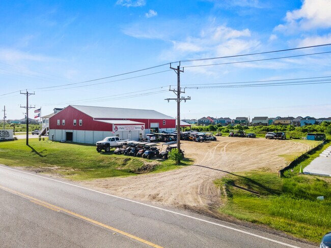
This Property Is For Sale
NEARBY LISTINGS FOR SALE OR LEASE
Property Detail
2290 Highway 87
Houston-The Woodlands-Sugar Land, TX
Franks, B Survey
0065-0020-0002-000
ABST 65 PAGE 4 B FRANKS SUR TR 20-2 0.603 ACRS
Commercialnec
Galveston
VE
Texas
48167C0328G
20-2
2024
0.60 AC
2025
Outlying Chambers County
723900
Houston
2,952 SF
DEMOGRAPHICS near 2290 Highway 87
1 Mile
3 Mile
5 Mile
2024 Total Population
314
1,115
1,471
2029 Population
325
1,152
1,525
Pop Growth 2024-2029
+ 3.50%
+ 3.32%
+ 3.67%
Average Age
57
57
55
2024 Total Households
165
585
748
HH Growth 2024-2029
+ 3.64%
+ 3.59%
+ 3.74%
Median Household Inc
$77,678
$77,000
$75,347
Avg Household Size
1.90
1.90
1.90
2024 Avg HH Vehicles
2.00
2.00
2.00
Median Home Value
$410,909
$410,914
$397,418
Median Year Built
1997
1997
1996
Nearby Places
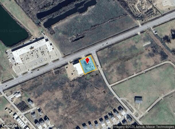
Map Layers
Map Styles
 Street
 Aerial
- Restaurants
- Banks
- Shops
- Fitness
- Groceries
Nearby Properties
Address
Land Use
TOTAL SIZE
Lot Size
Zoning
Address
Land Use
TOTAL SIZE
Lot Size
Zoning
36,085 SF
5.73 AC
Address
Land Use
TOTAL SIZE
Lot Size
Zoning
Address
Land Use
TOTAL SIZE
Lot Size
Zoning
8,208 SF
0.12 AC
Address
Land Use
TOTAL SIZE
Lot Size
Zoning
52,600 SF
1.94 AC
Address
Land Use
TOTAL SIZE
Lot Size
Zoning
31,360 SF
5 AC
Address
Land Use
TOTAL SIZE
Lot Size
Zoning
11,250 SF
2.89 AC
Address
Land Use
TOTAL SIZE
Lot Size
Zoning
2,532 SF
40 AC
Address
Land Use
TOTAL SIZE
Lot Size
Zoning
11,400 SF
2.46 AC
Address
Land Use
TOTAL SIZE
Lot Size
Zoning
6,648 SF
0.79 AC
Address
Land Use
TOTAL SIZE
Lot Size
Zoning
6,600 SF
3.62 AC
Address
Land Use
TOTAL SIZE
Lot Size
Zoning
80.72 AC
Address
Land Use
TOTAL SIZE
Lot Size
Zoning
11,312 SF
4.58 AC
Address
Land Use
TOTAL SIZE
Lot Size
Zoning
55 SF
7.88 AC
Address
Land Use
TOTAL SIZE
Lot Size
Zoning
10,388 SF
2.50 AC
Address
Land Use
TOTAL SIZE
Lot Size
Zoning
7,484 SF
9.90 AC
Address
Land Use
TOTAL SIZE
Lot Size
Zoning
2,905 SF
2.19 AC
Address
Land Use
TOTAL SIZE
Lot Size
Zoning
7,715 SF
0.72 AC
Address
Land Use
TOTAL SIZE
Lot Size
Zoning
4,800 SF
15 AC
Address
Land Use
TOTAL SIZE
Lot Size
Zoning
2,840 SF
0.31 AC
Address
Land Use
TOTAL SIZE
Lot Size
Zoning
41 SF
2.63 AC
Address
Land Use
TOTAL SIZE
Lot Size
Zoning
41 SF
1.45 AC
Address
Land Use
TOTAL SIZE
Lot Size
Zoning
9,570 SF
0.91 AC
Address
Land Use
TOTAL SIZE
Lot Size
Zoning
2,744 SF
1.95 AC
Address
Land Use
TOTAL SIZE
Lot Size
Zoning
4,140 SF
0.36 AC
Address
Land Use
TOTAL SIZE
Lot Size
Zoning
2,098 SF
0.86 AC
Address
Land Use
TOTAL SIZE
Lot Size
Zoning
Address
Land Use
TOTAL SIZE
Lot Size
Zoning
1,920 SF
0.80 AC
Address
Land Use
TOTAL SIZE
Lot Size
Zoning
129.09 AC
Address
Land Use
TOTAL SIZE
Lot Size
Zoning
2,100 SF
0.82 AC
Address
Land Use
TOTAL SIZE
Lot Size
Zoning
8,173 SF
0.71 AC
The World's #1 Commercial Real Estate Marketplace
Connect with us
© 2025 CoStar Group
The information above has been obtained from sources believed reliable. While we do not doubt its accuracy we have not verified it and make no guarantee, warranty or representation about it. It is your responsibility to independently confirm its accuracy and completeness. Any projections, opinions, assumptions, or estimates used are for example only and do not represent the current or future performance of the property. The value of this transaction to you depends on tax and other factors which should be evaluated by your tax, financial, and legal advisors. You and your advisors should conduct a careful, independent investigation of the property to determine to your satisfaction the suitability of the property for your needs.