Property Record
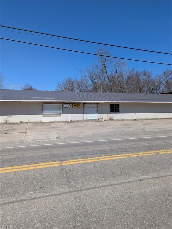
22798 Alliance Sebring Rd, Alliance, OH 44601
NEARBY LISTINGS FOR SALE OR LEASE
Property Detail
22798 Alliance Sebring Rd
Youngstown/Warren/Boardman
Derthicks City View
Youngstown-Warren-Boardman, OH-PA
SEC 30
19-029-0-053.00-0
Mahoning
Storebuilding
Ohio
2024
0.61 AC
2024
Mahoning County
710300
DEMOGRAPHICS near 22798 Alliance Sebring Rd
1 Mile
3 Mile
5 Mile
2024 Total Population
3,614
26,254
37,531
2029 Population
3,675
26,219
37,327
Pop Growth 2024-2029
+ 1.69%
(0.13%)
(0.54%)
Average Age
38
41
42
2024 Total Households
1,475
10,481
15,398
HH Growth 2024-2029
+ 1.76%
(0.10%)
(0.47%)
Median Household Inc
$33,047
$49,813
$51,034
Avg Household Size
2.30
2.30
2.30
2024 Avg HH Vehicles
1.00
2.00
2.00
Median Home Value
$64,750
$107,136
$123,556
Median Year Built
1946
1950
1954
Nearby Places
Map Layers
Map Styles
 Street
 Aerial
- Restaurants
- Banks
- Shops
- Fitness
- Groceries
PUBLIC TRANSPORTATION
COMMUTER RAIL
Alliance Amtrak (Capitol Limited - Amtrak)
DRIVE
WALK
Distance
Alliance Amtrak (Capitol Limited - Amtrak)
1 min
9 min
0.5 mi
AIRPORT
Akron-Canton Regional
DRIVE
WALK
Distance
Akron-Canton Regional
35 min
21.1 mi
Freight Ports
Port of Toledo
DRIVE
WALK
Distance
Port of Toledo
194 min
159.4 mi
SALE & LEASE HISTORY
LISTING DATE
SALE/LEASE

Apr 04, 2025
For Sale
Nearby Properties
Address
Land Use
TOTAL SIZE
Lot Size
Zoning
Address
Land Use
TOTAL SIZE
Lot Size
Zoning
1,015,253 SF
83.25 AC
Address
Land Use
TOTAL SIZE
Lot Size
Zoning
294,532 SF
7.73 AC
Address
Land Use
TOTAL SIZE
Lot Size
Zoning
121,669 SF
27.80 AC
Address
Land Use
TOTAL SIZE
Lot Size
Zoning
275,422 SF
10 AC
Address
Land Use
TOTAL SIZE
Lot Size
Zoning
402,113 SF
25.10 AC
Address
Land Use
TOTAL SIZE
Lot Size
Zoning
93,477 SF
8.21 AC
Address
Land Use
TOTAL SIZE
Lot Size
Zoning
79,700 SF
1.80 AC
Address
Land Use
TOTAL SIZE
Lot Size
Zoning
120,552 SF
10.37 AC
Address
Land Use
TOTAL SIZE
Lot Size
Zoning
69,467 SF
18.25 AC
Address
Land Use
TOTAL SIZE
Lot Size
Zoning
60,037 SF
6.38 AC
Address
Land Use
TOTAL SIZE
Lot Size
Zoning
65,108 SF
164.87 AC
Address
Land Use
TOTAL SIZE
Lot Size
Zoning
73,853 SF
3.83 AC
Address
Land Use
TOTAL SIZE
Lot Size
Zoning
75,318 SF
4.59 AC
Address
Land Use
TOTAL SIZE
Lot Size
Zoning
56,112 SF
6.37 AC
Address
Land Use
TOTAL SIZE
Lot Size
Zoning
134,368 SF
10.30 AC
Address
Land Use
TOTAL SIZE
Lot Size
Zoning
73,764 SF
1.52 AC
Address
Land Use
TOTAL SIZE
Lot Size
Zoning
62,767 SF
2.85 AC
Address
Land Use
TOTAL SIZE
Lot Size
Zoning
130,339 SF
10.28 AC
Address
Land Use
TOTAL SIZE
Lot Size
Zoning
53,959 SF
3.58 AC
Address
Land Use
TOTAL SIZE
Lot Size
Zoning
49,226 SF
10.57 AC
Address
Land Use
TOTAL SIZE
Lot Size
Zoning
52,644 SF
1.03 AC
Address
Land Use
TOTAL SIZE
Lot Size
Zoning
34,078 SF
28.41 AC
Address
Land Use
TOTAL SIZE
Lot Size
Zoning
10,800 SF
6.60 AC
Address
Land Use
TOTAL SIZE
Lot Size
Zoning
56,474 SF
9.80 AC
Address
Land Use
TOTAL SIZE
Lot Size
Zoning
80,552 SF
68.27 AC
Address
Land Use
TOTAL SIZE
Lot Size
Zoning
29,283 SF
1.53 AC
Address
Land Use
TOTAL SIZE
Lot Size
Zoning
154,537 SF
14.37 AC
Address
Land Use
TOTAL SIZE
Lot Size
Zoning
93,477 SF
9.34 AC
Address
Land Use
TOTAL SIZE
Lot Size
Zoning
90,156 SF
8.20 AC
Address
Land Use
TOTAL SIZE
Lot Size
Zoning
626,234 SF
25.15 AC
The World's #1 Commercial Real Estate Marketplace
Connect with us
© 2025 CoStar Group
The information above has been obtained from sources believed reliable. While we do not doubt its accuracy we have not verified it and make no guarantee, warranty or representation about it. It is your responsibility to independently confirm its accuracy and completeness. Any projections, opinions, assumptions, or estimates used are for example only and do not represent the current or future performance of the property. The value of this transaction to you depends on tax and other factors which should be evaluated by your tax, financial, and legal advisors. You and your advisors should conduct a careful, independent investigation of the property to determine to your satisfaction the suitability of the property for your needs.