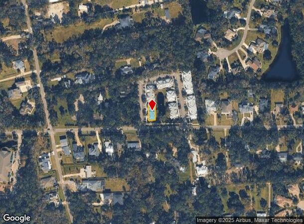
Property Record
228 Canal Blvd, Ponte Vedra Beach, FL 32082
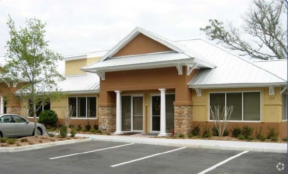
This Property Is For Sale
NEARBY LISTINGS FOR SALE OR LEASE
Property Detail
228 Canal Blvd
Jacksonville, FL
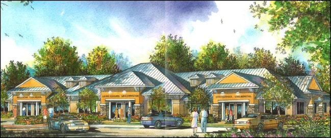
Palmetto Landing Condo
066021-0001
(OR2834/832) PALMETTO LANDING CONDO 066021-0101 THRU 066021-0104 BLDG 1 UNITS 1-1 THRU 1-4 (4 UNITS)
Resorthotel
St. Johns
X
Florida
12109C0095J
1
0
0.11 AC
2025
Beaches
020705
Jacksonville (Florida)
DEMOGRAPHICS near 228 Canal Blvd
1 Mile
3 Mile
5 Mile
2024 Total Population
3,039
22,233
38,788
2029 Population
3,976
29,292
51,019
Pop Growth 2024-2029
+ 30.83%
+ 31.75%
+ 31.53%
Average Age
46
48
45
2024 Total Households
1,183
9,263
15,581
HH Growth 2024-2029
+ 30.52%
+ 31.52%
+ 31.24%
Median Household Inc
$150,197
$135,321
$131,485
Avg Household Size
2.50
2.30
2.40
2024 Avg HH Vehicles
2.00
2.00
2.00
Median Home Value
$625,711
$680,797
$660,447
Median Year Built
1995
1992
1993
Nearby Places
- Restaurants
- Banks
- Shops
- Fitness
- Groceries
PUBLIC TRANSPORTATION
AIRPORT
Jacksonville International
DRIVE
WALK
Distance
Jacksonville International
53 min
36.6 mi
Freight Ports
Jacksonville Port
DRIVE
WALK
Distance
Jacksonville Port
44 min
27.3 mi
Nearby Properties
Address
Land Use
TOTAL SIZE
Lot Size
Zoning
Address
Land Use
TOTAL SIZE
Lot Size
Zoning
199,463 SF
131.13 AC
PUD
Address
Land Use
TOTAL SIZE
Lot Size
Zoning
159,780 SF
35.73 AC
PUD
Address
Land Use
TOTAL SIZE
Lot Size
Zoning
398,312 SF
39.43 AC
Address
Land Use
TOTAL SIZE
Lot Size
Zoning
433,943 SF
24.90 AC
PUD
Address
Land Use
TOTAL SIZE
Lot Size
Zoning
384,314 SF
24.30 AC
PUD
Address
Land Use
TOTAL SIZE
Lot Size
Zoning
129,840 SF
496.26 AC
PUD
Address
Land Use
TOTAL SIZE
Lot Size
Zoning
127,691 SF
36.98 AC
PUD
Address
Land Use
TOTAL SIZE
Lot Size
Zoning
69,171 SF
263.69 AC
PUD
Address
Land Use
TOTAL SIZE
Lot Size
Zoning
80,034 SF
7 AC
PUD
Address
Land Use
TOTAL SIZE
Lot Size
Zoning
62,405 SF
7.77 AC
Address
Land Use
TOTAL SIZE
Lot Size
Zoning
89,365 SF
1.54 AC
PUD
Address
Land Use
TOTAL SIZE
Lot Size
Zoning
100,213 SF
32.44 AC
OR
Address
Land Use
TOTAL SIZE
Lot Size
Zoning
82,038 SF
19 AC
PUD
Address
Land Use
TOTAL SIZE
Lot Size
Zoning
22,248 SF
3.82 AC
R3
Address
Land Use
TOTAL SIZE
Lot Size
Zoning
152,288 SF
2.61 AC
PUD
Address
Land Use
TOTAL SIZE
Lot Size
Zoning
76,729 SF
5 AC
OR
Address
Land Use
TOTAL SIZE
Lot Size
Zoning
76,556 SF
0.87 AC
PUD
Address
Land Use
TOTAL SIZE
Lot Size
Zoning
53,383 SF
6.71 AC
PUD
Address
Land Use
TOTAL SIZE
Lot Size
Zoning
45,562 SF
11.69 AC
OR
Address
Land Use
TOTAL SIZE
Lot Size
Zoning
9,868 SF
1.93 AC
R1B
Address
Land Use
TOTAL SIZE
Lot Size
Zoning
156,788 SF
33.79 AC
R1C
Address
Land Use
TOTAL SIZE
Lot Size
Zoning
43,182 SF
11.51 AC
PUD
Address
Land Use
TOTAL SIZE
Lot Size
Zoning
63,128 SF
0.78 AC
PUD
Address
Land Use
TOTAL SIZE
Lot Size
Zoning
58,707 SF
0.82 AC
PUD
Address
Land Use
TOTAL SIZE
Lot Size
Zoning
71,672 SF
11.07 AC
PUD
Address
Land Use
TOTAL SIZE
Lot Size
Zoning
61,042 SF
0.62 AC
PUD
Address
Land Use
TOTAL SIZE
Lot Size
Zoning
43,501 SF
4.53 AC
CG
Address
Land Use
TOTAL SIZE
Lot Size
Zoning
23,696 SF
19.50 AC
OR
Address
Land Use
TOTAL SIZE
Lot Size
Zoning
6,657 SF
1.85 AC
R1B
Address
Land Use
TOTAL SIZE
Lot Size
Zoning
37,730 SF
4.14 AC
OR
The World's #1 Commercial Real Estate Marketplace
Connect with us
© 2025 CoStar Group
The information above has been obtained from sources believed reliable. While we do not doubt its accuracy we have not verified it and make no guarantee, warranty or representation about it. It is your responsibility to independently confirm its accuracy and completeness. Any projections, opinions, assumptions, or estimates used are for example only and do not represent the current or future performance of the property. The value of this transaction to you depends on tax and other factors which should be evaluated by your tax, financial, and legal advisors. You and your advisors should conduct a careful, independent investigation of the property to determine to your satisfaction the suitability of the property for your needs.