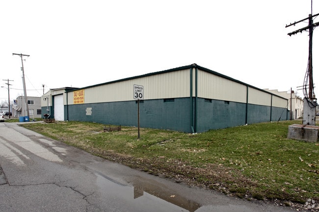
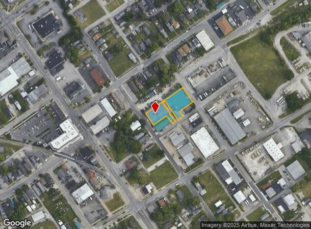
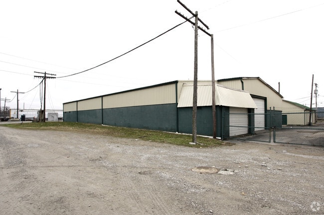
Property Record
228 Galt St, New Albany, IN 47150
NEARBY LISTINGS FOR SALE OR LEASE
Property Detail
228 Galt St
Louisville-Jefferson County, KY-IN
Galt Street
22-05-02-800-900.000-008
P 31 S 22.5' OF L 15 & S 25' OF L 22, ALL LTS14 & 23, 31.3' X 40' & 20' X 28' L 13 AND PART L 24
Storageyardopenstoragelightequipmentmaterial
Floyd
X
Indiana
21111C0012F
15,22
2024
0.26 AC
2024
New Albany
070200
Louisville
22,863 SF
DEMOGRAPHICS near 228 Galt St
1 Mile
3 Mile
5 Mile
2024 Total Population
9,892
81,452
182,153
2029 Population
10,093
83,456
186,758
Pop Growth 2024-2029
+ 2.03%
+ 2.46%
+ 2.53%
Average Age
39
39
40
2024 Total Households
4,377
34,303
78,412
HH Growth 2024-2029
+ 2.06%
+ 2.44%
+ 2.65%
Median Household Inc
$47,243
$42,080
$40,594
Avg Household Size
2.10
2.30
2.20
2024 Avg HH Vehicles
2.00
2.00
1.00
Median Home Value
$138,437
$128,703
$139,710
Median Year Built
1946
1954
1959
Nearby Places
Map Layers
Map Styles
 Street
 Aerial
- Restaurants
- Banks
- Shops
- Fitness
- Groceries
PUBLIC TRANSPORTATION
AIRPORT
Louisville Muhammad Ali International
DRIVE
WALK
Distance
Louisville Muhammad Ali International
24 min
13.5 mi
Nearby Properties
Address
Land Use
TOTAL SIZE
Lot Size
Zoning
Address
Land Use
TOTAL SIZE
Lot Size
Zoning
3,452 SF
13.22 AC
Address
Land Use
TOTAL SIZE
Lot Size
Zoning
95,508 SF
3.67 AC
EZ1-ENTERP
Address
Land Use
TOTAL SIZE
Lot Size
Zoning
120,337 SF
18.20 AC
Address
Land Use
TOTAL SIZE
Lot Size
Zoning
175,626 SF
60.10 AC
Address
Land Use
TOTAL SIZE
Lot Size
Zoning
2,208 SF
26.20 AC
Address
Land Use
TOTAL SIZE
Lot Size
Zoning
2,000 SF
13.11 AC
Address
Land Use
TOTAL SIZE
Lot Size
Zoning
12,270 SF
13.50 AC
Address
Land Use
TOTAL SIZE
Lot Size
Zoning
25,728 SF
10.37 AC
Address
Land Use
TOTAL SIZE
Lot Size
Zoning
12,752 SF
13.56 AC
Address
Land Use
TOTAL SIZE
Lot Size
Zoning
1,276 SF
3.78 AC
Address
Land Use
TOTAL SIZE
Lot Size
Zoning
9,900 SF
11.23 AC
Address
Land Use
TOTAL SIZE
Lot Size
Zoning
3,692 SF
15.99 AC
Address
Land Use
TOTAL SIZE
Lot Size
Zoning
204,428 SF
9.82 AC
Address
Land Use
TOTAL SIZE
Lot Size
Zoning
143,700 SF
0.29 AC
Address
Land Use
TOTAL SIZE
Lot Size
Zoning
202,859 SF
22.95 AC
Address
Land Use
TOTAL SIZE
Lot Size
Zoning
43,204 SF
6.95 AC
Address
Land Use
TOTAL SIZE
Lot Size
Zoning
1,920 SF
19.15 AC
Address
Land Use
TOTAL SIZE
Lot Size
Zoning
10,290 SF
3.96 AC
Address
Land Use
TOTAL SIZE
Lot Size
Zoning
169 SF
35.25 AC
Address
Land Use
TOTAL SIZE
Lot Size
Zoning
14,355 SF
1.50 AC
C2-COMMERC
Address
Land Use
TOTAL SIZE
Lot Size
Zoning
34,308 SF
4.59 AC
Address
Land Use
TOTAL SIZE
Lot Size
Zoning
72,332 SF
2.48 AC
Address
Land Use
TOTAL SIZE
Lot Size
Zoning
85,328 SF
9.74 AC
Address
Land Use
TOTAL SIZE
Lot Size
Zoning
83,084 SF
14.65 AC
Address
Land Use
TOTAL SIZE
Lot Size
Zoning
35,200 SF
5 AC
Address
Land Use
TOTAL SIZE
Lot Size
Zoning
49,088 SF
0.34 AC
EZ1-ENTERP
Address
Land Use
TOTAL SIZE
Lot Size
Zoning
67,600 SF
6.76 AC
EZ1-ENTERP
Address
Land Use
TOTAL SIZE
Lot Size
Zoning
60,371 SF
1.54 AC
EZ1-ENTERP
Address
Land Use
TOTAL SIZE
Lot Size
Zoning
272 SF
210.55 AC
Address
Land Use
TOTAL SIZE
Lot Size
Zoning
28,416 SF
2.05 AC
CM-COMMERC
The World's #1 Commercial Real Estate Marketplace
Connect with us
© 2025 CoStar Group
The information above has been obtained from sources believed reliable. While we do not doubt its accuracy we have not verified it and make no guarantee, warranty or representation about it. It is your responsibility to independently confirm its accuracy and completeness. Any projections, opinions, assumptions, or estimates used are for example only and do not represent the current or future performance of the property. The value of this transaction to you depends on tax and other factors which should be evaluated by your tax, financial, and legal advisors. You and your advisors should conduct a careful, independent investigation of the property to determine to your satisfaction the suitability of the property for your needs.