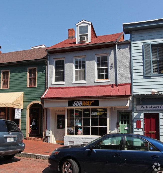
Property Record
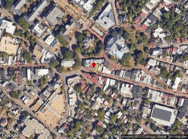
228 Main St, Annapolis, MD 21401
Current Lease Availabilities
NEARBY LISTINGS FOR SALE OR LEASE
Property Detail
228 Main St
06-000-00137710
Annapolis
Restaurantbuilding
LT OR 1471 SQ FT ANNAPOLIS
X
Anne Arundel
24003C0251F
Maryland
2024
0.03 AC
2025
Annapolis
706103
Baltimore
2,520 SF
Baltimore-Columbia-Towson, MD
DEMOGRAPHICS near 228 Main St
1 Mile
3 Mile
5 Mile
2024 Total Population
13,397
61,566
111,162
2029 Population
13,890
63,478
114,286
Pop Growth 2024-2029
+ 3.68%
+ 3.11%
+ 2.81%
Average Age
43
41
42
2024 Total Households
6,151
25,719
45,077
HH Growth 2024-2029
+ 3.82%
+ 3.22%
+ 2.90%
Median Household Inc
$107,936
$106,925
$116,713
Avg Household Size
2.10
2.30
2.40
2024 Avg HH Vehicles
2.00
2.00
2.00
Median Home Value
$759,566
$539,014
$532,633
Median Year Built
1963
1977
1980
Nearby Places
- Restaurants
- Banks
- Shops
- Fitness
- Groceries
PUBLIC TRANSPORTATION
AIRPORT
Baltimore/Washington International Thurgood Marshall
DRIVE
WALK
Distance
Baltimore/Washington International Thurgood Marshall
35 min
24.8 mi
Ronald Reagan Washington Ntl
DRIVE
WALK
Distance
Ronald Reagan Washington Ntl
52 min
36.5 mi
Freight Ports
Port of Baltimore
DRIVE
WALK
Distance
Port of Baltimore
41 min
30.1 mi
Nearby Properties
Address
Land Use
TOTAL SIZE
Lot Size
Zoning
Address
Land Use
TOTAL SIZE
Lot Size
Zoning
2,568,175 SF
55.32 AC
TC
Address
Land Use
TOTAL SIZE
Lot Size
Zoning
717,491 SF
26.28 AC
C2
Address
Land Use
TOTAL SIZE
Lot Size
Zoning
6,400 SF
31.17 AC
C1
Address
Land Use
TOTAL SIZE
Lot Size
Zoning
31.16 AC
R4
Address
Land Use
TOTAL SIZE
Lot Size
Zoning
434,112 SF
822.11 AC
R1
Address
Land Use
TOTAL SIZE
Lot Size
Zoning
406,976 SF
18.98 AC
R2
Address
Land Use
TOTAL SIZE
Lot Size
Zoning
58.99 AC
R2
Address
Land Use
TOTAL SIZE
Lot Size
Zoning
296,790 SF
27.74 AC
TC
Address
Land Use
TOTAL SIZE
Lot Size
Zoning
313,440 SF
23.43 AC
TC
Address
Land Use
TOTAL SIZE
Lot Size
Zoning
250,163 SF
2.19 AC
P
Address
Land Use
TOTAL SIZE
Lot Size
Zoning
577,560 SF
3.71 AC
C2
Address
Land Use
TOTAL SIZE
Lot Size
Zoning
346,335 SF
16.42 AC
R22
Address
Land Use
TOTAL SIZE
Lot Size
Zoning
389,081 SF
4.79 AC
TC
Address
Land Use
TOTAL SIZE
Lot Size
Zoning
591,962 SF
6.43 AC
BCE
Address
Land Use
TOTAL SIZE
Lot Size
Zoning
271,003 SF
1 AC
TC
Address
Land Use
TOTAL SIZE
Lot Size
Zoning
365,268 SF
4.85 AC
W1
Address
Land Use
TOTAL SIZE
Lot Size
Zoning
198,795 SF
36 AC
R2
Address
Land Use
TOTAL SIZE
Lot Size
Zoning
341,468 SF
1.82 AC
TC
Address
Land Use
TOTAL SIZE
Lot Size
Zoning
435,081 SF
2.62 AC
TC
Address
Land Use
TOTAL SIZE
Lot Size
Zoning
248,820 SF
24.92 AC
R2
Address
Land Use
TOTAL SIZE
Lot Size
Zoning
309,756 SF
0.01 AC
R-22
Address
Land Use
TOTAL SIZE
Lot Size
Zoning
146,329 SF
1.26 AC
WMC
Address
Land Use
TOTAL SIZE
Lot Size
Zoning
272,275 SF
3.11 AC
P
Address
Land Use
TOTAL SIZE
Lot Size
Zoning
8.78 AC
R3
Address
Land Use
TOTAL SIZE
Lot Size
Zoning
189,134 SF
1.02 AC
MX
Address
Land Use
TOTAL SIZE
Lot Size
Zoning
389,242 SF
11.56 AC
C2
Address
Land Use
TOTAL SIZE
Lot Size
Zoning
14.42 AC
R3
Address
Land Use
TOTAL SIZE
Lot Size
Zoning
117,577 SF
6.92 AC
R2
Address
Land Use
TOTAL SIZE
Lot Size
Zoning
37.74 AC
R3
Address
Land Use
TOTAL SIZE
Lot Size
Zoning
118,260 SF
34.01 AC
The World's #1 Commercial Real Estate Marketplace
Connect with us
© 2025 CoStar Group
The information above has been obtained from sources believed reliable. While we do not doubt its accuracy we have not verified it and make no guarantee, warranty or representation about it. It is your responsibility to independently confirm its accuracy and completeness. Any projections, opinions, assumptions, or estimates used are for example only and do not represent the current or future performance of the property. The value of this transaction to you depends on tax and other factors which should be evaluated by your tax, financial, and legal advisors. You and your advisors should conduct a careful, independent investigation of the property to determine to your satisfaction the suitability of the property for your needs.