Property Record
228 Pierson Ave, Edison, NJ 08837
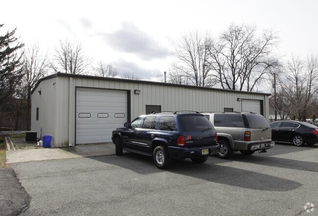

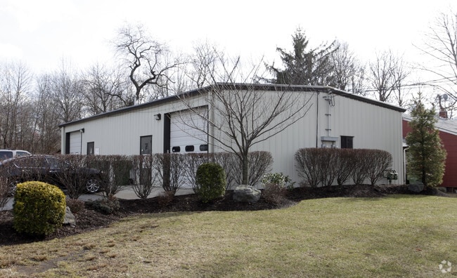
Property Detail
228 Pierson Ave
Lakewood-New Brunswick, NJ
81X116 IRR
05-00795-0000-00022
MIDDLESEX
Commercialnec
New Jersey
LI
22
B and X Area of moderate flood hazard, usually the area between the limits of the 100-year and 500-year floods.
0.22 AC
2024
Exit 10
2025
Northern New Jersey
001805
NEARBY LISTINGS FOR SALE OR LEASE
DEMOGRAPHICS near 228 Pierson Ave
1 mile
3 mile
5 mile
2025 Total Population
13,257
103,102
330,291
2030 Population
13,745
107,425
342,155
Pop Growth 2025-2030
+ 3.68%
+ 4.19%
+ 3.59%
Average Age
42
40
40
2025 Total Households
5,134
37,148
113,477
HH Growth 2025-2030
+ 3.78%
+ 4.31%
+ 3.84%
Median Household Inc
$125,989
$117,583
$107,672
Avg Household Size
2.50
2.70
2.80
2025 Avg HH Vehicles
2.00
2.00
2.00
Median Home Value
$568,907
$483,218
$469,988
Median Year Built
1961
1967
1966
Nearby Places
Map Layers
Map Styles
 Street
 Aerial
Layers
 Traffic
 Biking
Places
Listings with unknown addresses are not visible on the map
- Restaurants
- Banks
- Shops
- Fitness
- Groceries
PUBLIC TRANSPORTATION
COMMUTER RAIL
Metuchen (Northeast Corridor Line - NJ Transit Commuter Rail (NJ Transit))
Drive
Walk
Distance
Metuchen (Northeast Corridor Line - NJ Transit Commuter Rail (NJ Transit))
5 min
1.9 mi
Metropark (Northeast Corridor Line - NJ Transit Commuter Rail (NJ Transit))
Drive
Walk
Distance
Metropark (Northeast Corridor Line - NJ Transit Commuter Rail (NJ Transit))
8 min
3.8 mi
AIRPORT
Newark Liberty International
Drive
Walk
Distance
Newark Liberty International
30 min
18.5 mi
Trenton Mercer
Drive
Walk
Distance
Trenton Mercer
53 min
35.0 mi
LaGuardia
Drive
Walk
Distance
LaGuardia
64 min
38.9 mi
Freight Ports
New York Container Terminal
Drive
Walk
Distance
New York Container Terminal
25 min
14.3 mi
Nearby Properties
Address
Land Use
TOTAL SIZE
Lot Size
Zoning
Address
Land Use
TOTAL SIZE
Lot Size
Zoning
37.46 AC
EI
Address
Land Use
TOTAL SIZE
Lot Size
Zoning
65.84 AC
PB
Address
Land Use
TOTAL SIZE
Lot Size
Zoning
165.43 AC
EI
Address
Land Use
TOTAL SIZE
Lot Size
Zoning
80,000 SF
23.37 AC
R50
Address
Land Use
TOTAL SIZE
Lot Size
Zoning
147.45 AC
RRRD
Address
Land Use
TOTAL SIZE
Lot Size
Zoning
137.89 AC
RAA
Address
Land Use
TOTAL SIZE
Lot Size
Zoning
49.83 AC
LI
Address
Land Use
TOTAL SIZE
Lot Size
Zoning
55.57 AC
LI
Address
Land Use
TOTAL SIZE
Lot Size
Zoning
40.78 AC
RRRD
Address
Land Use
TOTAL SIZE
Lot Size
Zoning
35.98 AC
LI
Address
Land Use
TOTAL SIZE
Lot Size
Zoning
27.36 AC
Address
Land Use
TOTAL SIZE
Lot Size
Zoning
34.14 AC
LR
Address
Land Use
TOTAL SIZE
Lot Size
Zoning
191.81 AC
R75
Address
Land Use
TOTAL SIZE
Lot Size
Zoning
3.18 AC
Address
Land Use
TOTAL SIZE
Lot Size
Zoning
162.66 AC
LI
Address
Land Use
TOTAL SIZE
Lot Size
Zoning
58.78 AC
LI
Address
Land Use
TOTAL SIZE
Lot Size
Zoning
53.95 AC
RRRD
Address
Land Use
TOTAL SIZE
Lot Size
Zoning
90.33 AC
Address
Land Use
TOTAL SIZE
Lot Size
Zoning
164.79 AC
LI
Address
Land Use
TOTAL SIZE
Lot Size
Zoning
52.04 AC
RRRD
Address
Land Use
TOTAL SIZE
Lot Size
Zoning
10,173 SF
14.04 AC
OR
Address
Land Use
TOTAL SIZE
Lot Size
Zoning
34.63 AC
LR
Address
Land Use
TOTAL SIZE
Lot Size
Zoning
52.80 AC
LI
Address
Land Use
TOTAL SIZE
Lot Size
Zoning
43.63 AC
MF
Address
Land Use
TOTAL SIZE
Lot Size
Zoning
5.83 AC
RO
Address
Land Use
TOTAL SIZE
Lot Size
Zoning
41.20 AC
RRRD
Address
Land Use
TOTAL SIZE
Lot Size
Zoning
25 AC
LR
Address
Land Use
TOTAL SIZE
Lot Size
Zoning
19.50 AC
LR
Address
Land Use
TOTAL SIZE
Lot Size
Zoning
50 AC
LI
Address
Land Use
TOTAL SIZE
Lot Size
Zoning
6.10 AC
RO
The World's #1 Commercial Real Estate Marketplace
Connect with us
© 2026 CoStar Group
The information above has been obtained from sources believed reliable. While we do not doubt its accuracy we have not verified it and make no guarantee, warranty or representation about it. It is your responsibility to independently confirm its accuracy and completeness. Any projections, opinions, assumptions, or estimates used are for example only and do not represent the current or future performance of the property. The value of this transaction to you depends on tax and other factors which should be evaluated by your tax, financial, and legal advisors. You and your advisors should conduct a careful, independent investigation of the property to determine to your satisfaction the suitability of the property for your needs.