Property Record
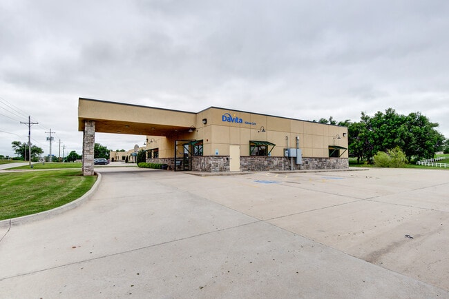
228 S 29Th St, Chickasha, OK 73018


Property Detail
228 S 29Th St
C565-00-000-00A-0-000-00
30-07N-07W ROSS MEDICAL PARK LOT A BEG. AT A POINT 624.81' S 00 13'14" E OF THE NE/C SE/4 TH S 00 13'14" E ALONG THE E BOUNDA
Medicalbuilding
Grady
C1
Oklahoma
B and X Area of moderate flood hazard, usually the area between the limits of the 100-year and 500-year floods.
a
2024
1.28 AC
2025
Grady County
000600
Oklahoma City
3,900 SF
Oklahoma City, OK
NEARBY LISTINGS FOR SALE OR LEASE
DEMOGRAPHICS near 228 S 29Th St
1 mile
3 mile
5 mile
2025 Total Population
1,142
16,774
20,498
2030 Population
1,212
17,987
21,952
Pop Growth 2025-2030
+ 6.13%
+ 7.23%
+ 7.09%
Average Age
41
39
39
2025 Total Households
439
6,315
7,842
HH Growth 2025-2030
+ 6.38%
+ 7.54%
+ 7.33%
Median Household Inc
$76,550
$51,818
$53,658
Avg Household Size
2.30
2.30
2.40
2025 Avg HH Vehicles
2.00
2.00
2.00
Median Home Value
$121,367
$108,999
$126,453
Median Year Built
1949
1964
1970
Nearby Places
Map Layers
Map Styles
 Street
 Aerial
Transit
 Traffic
 Biking
Places
Listings with unknown addresses are not visible on the map
- Restaurants
- Banks
- Shops
- Fitness
- Groceries
PUBLIC TRANSPORTATION
AIRPORT
Will Rogers World
Drive
Walk
Distance
Will Rogers World
47 min
40.4 mi
SALE & LEASE HISTORY
LISTING DATE
SALE/LEASE

Apr 30, 2020
For Sale
Nearby Properties
Address
Land Use
TOTAL SIZE
Lot Size
Zoning
Address
Land Use
TOTAL SIZE
Lot Size
Zoning
190,235 SF
44 SF
Address
Land Use
TOTAL SIZE
Lot Size
Zoning
305,250 SF
33.02 AC
Address
Land Use
TOTAL SIZE
Lot Size
Zoning
8,634 SF
70.48 AC
Address
Land Use
TOTAL SIZE
Lot Size
Zoning
27,418 SF
3.22 AC
Address
Land Use
TOTAL SIZE
Lot Size
Zoning
19,005 SF
0.66 AC
Address
Land Use
TOTAL SIZE
Lot Size
Zoning
136,570 SF
10.73 AC
Address
Land Use
TOTAL SIZE
Lot Size
Zoning
1,584 SF
8.58 AC
Address
Land Use
TOTAL SIZE
Lot Size
Zoning
14,784 SF
11.44 AC
Address
Land Use
TOTAL SIZE
Lot Size
Zoning
25,713 SF
10 AC
Address
Land Use
TOTAL SIZE
Lot Size
Zoning
2,643 SF
2.22 AC
Address
Land Use
TOTAL SIZE
Lot Size
Zoning
3,212 SF
2.94 AC
Address
Land Use
TOTAL SIZE
Lot Size
Zoning
888 SF
4.20 AC
Address
Land Use
TOTAL SIZE
Lot Size
Zoning
18,535 SF
27.79 AC
CR
Address
Land Use
TOTAL SIZE
Lot Size
Zoning
6,596 SF
1.67 AC
Address
Land Use
TOTAL SIZE
Lot Size
Zoning
78,198 SF
23.38 AC
Address
Land Use
TOTAL SIZE
Lot Size
Zoning
324,120 SF
54.68 AC
Address
Land Use
TOTAL SIZE
Lot Size
Zoning
2,644 SF
4.80 AC
Address
Land Use
TOTAL SIZE
Lot Size
Zoning
5,245 SF
1.79 AC
Address
Land Use
TOTAL SIZE
Lot Size
Zoning
5,846 SF
1.57 AC
Address
Land Use
TOTAL SIZE
Lot Size
Zoning
14,707 SF
2.06 AC
C2
Address
Land Use
TOTAL SIZE
Lot Size
Zoning
12,881 SF
1.10 AC
Address
Land Use
TOTAL SIZE
Lot Size
Zoning
21,390 SF
9.11 AC
Address
Land Use
TOTAL SIZE
Lot Size
Zoning
6,710 SF
4.64 AC
Address
Land Use
TOTAL SIZE
Lot Size
Zoning
19,290 SF
3.30 AC
Address
Land Use
TOTAL SIZE
Lot Size
Zoning
34,396 SF
2.28 AC
Address
Land Use
TOTAL SIZE
Lot Size
Zoning
24,332 SF
4.50 AC
Address
Land Use
TOTAL SIZE
Lot Size
Zoning
7,721 SF
2.65 AC
The World's #1 Commercial Real Estate Marketplace
Connect with us
© 2026 CoStar Group
The information above has been obtained from sources believed reliable. While we do not doubt its accuracy we have not verified it and make no guarantee, warranty or representation about it. It is your responsibility to independently confirm its accuracy and completeness. Any projections, opinions, assumptions, or estimates used are for example only and do not represent the current or future performance of the property. The value of this transaction to you depends on tax and other factors which should be evaluated by your tax, financial, and legal advisors. You and your advisors should conduct a careful, independent investigation of the property to determine to your satisfaction the suitability of the property for your needs.