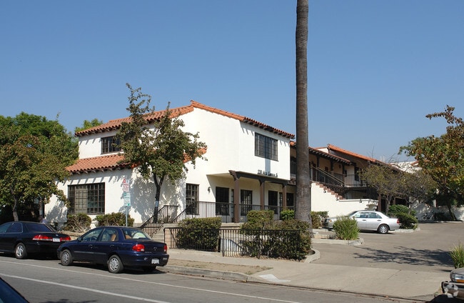
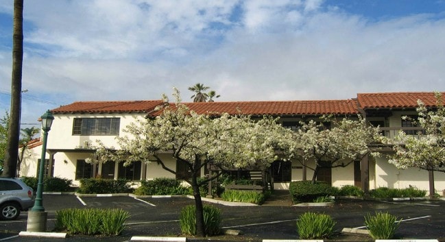
Property Record
228 W Carrillo St, Santa Barbara, CA 93101
Current Lease Availabilities
NEARBY LISTINGS FOR SALE OR LEASE
Property Detail
228 W Carrillo St
Santa Maria-Santa Barbara, CA
Santa Barbara
039-271-019
LOT 11 BLK 144
Officebuilding
Santa Barbara
X
California
06083C1387J
11
2024
0.15 AC
2025
Downtown
001002
Santa Barbara/Sta Maria/Goleta
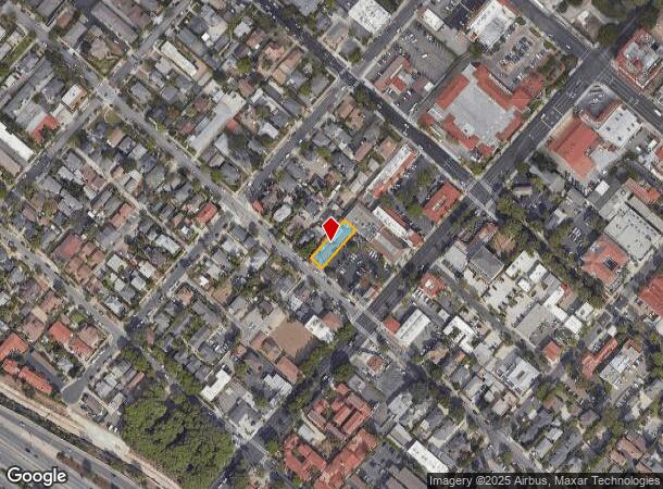
DEMOGRAPHICS near 228 W Carrillo St
1 Mile
3 Mile
5 Mile
2024 Total Population
29,802
90,791
114,417
2029 Population
29,497
90,562
114,319
Pop Growth 2024-2029
(1.02%)
(0.25%)
(0.09%)
Average Age
37
42
42
2024 Total Households
12,435
35,894
45,231
HH Growth 2024-2029
(1.21%)
(0.31%)
(0.13%)
Median Household Inc
$74,062
$97,203
$101,196
Avg Household Size
2.30
2.40
2.40
2024 Avg HH Vehicles
2.00
2.00
2.00
Median Home Value
$1,008,274
$1,092,702
$1,088,932
Median Year Built
1961
1963
1965
Nearby Places
Map Layers
Map Styles
 Street
 Aerial
- Restaurants
- Banks
- Shops
- Fitness
- Groceries
PUBLIC TRANSPORTATION
COMMUTER RAIL
DRIVE
WALK
Distance
4 min
1.2 mi
DRIVE
WALK
Distance
14 min
9.3 mi
AIRPORT
Santa Barbara Municipal
DRIVE
WALK
Distance
Santa Barbara Municipal
13 min
9.5 mi
Nearby Properties
Address
Land Use
TOTAL SIZE
Lot Size
Zoning
Address
Land Use
TOTAL SIZE
Lot Size
Zoning
710 SF
9.92 AC
SP8
Address
Land Use
TOTAL SIZE
Lot Size
Zoning
21.85 AC
HRC1SP
Address
Land Use
TOTAL SIZE
Lot Size
Zoning
16.87 AC
E3SD2
Address
Land Use
TOTAL SIZE
Lot Size
Zoning
0.39 AC
C2
Address
Land Use
TOTAL SIZE
Lot Size
Zoning
7.06 AC
R240R
Address
Land Use
TOTAL SIZE
Lot Size
Zoning
Address
Land Use
TOTAL SIZE
Lot Size
Zoning
1.16 AC
Address
Land Use
TOTAL SIZE
Lot Size
Zoning
77.82 AC
A2SD3
Address
Land Use
TOTAL SIZE
Lot Size
Zoning
1.43 AC
Address
Land Use
TOTAL SIZE
Lot Size
Zoning
1.12 AC
HRC1SD
Address
Land Use
TOTAL SIZE
Lot Size
Zoning
0.75 AC
HRC2SD
Address
Land Use
TOTAL SIZE
Lot Size
Zoning
0.37 AC
C2
Address
Land Use
TOTAL SIZE
Lot Size
Zoning
1.35 AC
CM
Address
Land Use
TOTAL SIZE
Lot Size
Zoning
6.59 AC
R2SD3
Address
Land Use
TOTAL SIZE
Lot Size
Zoning
0.57 AC
CM
Address
Land Use
TOTAL SIZE
Lot Size
Zoning
8.79 AC
C2SD2
Address
Land Use
TOTAL SIZE
Lot Size
Zoning
4.32 AC
CP
Address
Land Use
TOTAL SIZE
Lot Size
Zoning
0.99 AC
Address
Land Use
TOTAL SIZE
Lot Size
Zoning
9.21 AC
R2
Address
Land Use
TOTAL SIZE
Lot Size
Zoning
1.32 AC
Address
Land Use
TOTAL SIZE
Lot Size
Zoning
4.94 AC
CPSD2
Address
Land Use
TOTAL SIZE
Lot Size
Zoning
7.44 AC
OM1SD3
Address
Land Use
TOTAL SIZE
Lot Size
Zoning
1 AC
HRC1SD
Address
Land Use
TOTAL SIZE
Lot Size
Zoning
1.65 AC
HRC2SD
Address
Land Use
TOTAL SIZE
Lot Size
Zoning
0.48 AC
HRC2SD
Address
Land Use
TOTAL SIZE
Lot Size
Zoning
2.62 AC
C2
Address
Land Use
TOTAL SIZE
Lot Size
Zoning
1.29 AC
HRC1SD
Address
Land Use
TOTAL SIZE
Lot Size
Zoning
11.37 AC
E1
Address
Land Use
TOTAL SIZE
Lot Size
Zoning
27,346 SF
8.72 AC
SP7
Address
Land Use
TOTAL SIZE
Lot Size
Zoning
1.35 AC
C2SD2
The World's #1 Commercial Real Estate Marketplace
Connect with us
© 2025 CoStar Group
The information above has been obtained from sources believed reliable. While we do not doubt its accuracy we have not verified it and make no guarantee, warranty or representation about it. It is your responsibility to independently confirm its accuracy and completeness. Any projections, opinions, assumptions, or estimates used are for example only and do not represent the current or future performance of the property. The value of this transaction to you depends on tax and other factors which should be evaluated by your tax, financial, and legal advisors. You and your advisors should conduct a careful, independent investigation of the property to determine to your satisfaction the suitability of the property for your needs.