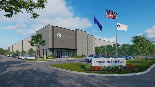
Property Record
2280 E Mcclain Dr E, Franklin, IN 46131

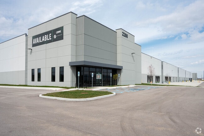
Current Lease Availabilities
Property Detail
2280 E Mcclain Dr E
41-07-18-011-002.000-018
PT E 1/2 NE 1/4 S18 T12 R5 MP FRANKLIN COMMUNI
Warehouse
JOHNSON
B and X Area of moderate flood hazard, usually the area between the limits of the 100-year and 500-year floods.
Indiana
2024
35.86 AC
2025
Johnson County
611200
Indianapolis
553,152 SF
Indianapolis-Carmel-Greenwood, IN
NEARBY LISTINGS FOR SALE OR LEASE
DEMOGRAPHICS near 2280 E Mcclain Dr E
1 mile
3 mile
5 mile
2025 Total Population
1,358
15,605
31,936
2030 Population
1,428
16,409
33,551
Pop Growth 2025-2030
+ 5.15%
+ 5.15%
+ 5.06%
Average Age
42
40
40
2025 Total Households
534
5,877
11,862
HH Growth 2025-2030
+ 5.24%
+ 5.50%
+ 5.29%
Median Household Inc
$97,272
$81,109
$85,513
Avg Household Size
2.50
2.50
2.50
2025 Avg HH Vehicles
2.00
2.00
2.00
Median Home Value
$301,562
$252,051
$254,351
Median Year Built
1993
1982
1992
Nearby Places
Map Layers
Map Styles
 Street
 Aerial
Transit
 Traffic
 Biking
Places
Listings with unknown addresses are not visible on the map
- Restaurants
- Banks
- Shops
- Fitness
- Groceries
PUBLIC TRANSPORTATION
AIRPORT
Indianapolis International
Drive
Walk
Distance
Indianapolis International
49 min
33.8 mi
Freight Ports
Port of Toledo
Drive
Walk
Distance
Port of Toledo
294 min
245.7 mi
Nearby Properties
Address
Land Use
TOTAL SIZE
Lot Size
Zoning
Address
Land Use
TOTAL SIZE
Lot Size
Zoning
2,908 SF
1.31 AC
Address
Land Use
TOTAL SIZE
Lot Size
Zoning
954,880 SF
42.36 AC
Address
Land Use
TOTAL SIZE
Lot Size
Zoning
153,589 SF
160.27 AC
Address
Land Use
TOTAL SIZE
Lot Size
Zoning
933,504 SF
42.07 AC
Address
Land Use
TOTAL SIZE
Lot Size
Zoning
806,916 SF
42.56 AC
Address
Land Use
TOTAL SIZE
Lot Size
Zoning
519,376 SF
53.98 AC
Address
Land Use
TOTAL SIZE
Lot Size
Zoning
160.96 AC
PUD
Address
Land Use
TOTAL SIZE
Lot Size
Zoning
3,668 SF
18.95 AC
Address
Land Use
TOTAL SIZE
Lot Size
Zoning
1,792 SF
66.50 AC
Address
Land Use
TOTAL SIZE
Lot Size
Zoning
146,505 SF
30.71 AC
Address
Land Use
TOTAL SIZE
Lot Size
Zoning
8,504 SF
31.42 AC
Address
Land Use
TOTAL SIZE
Lot Size
Zoning
7,304 SF
15.32 AC
Address
Land Use
TOTAL SIZE
Lot Size
Zoning
193,690 SF
47 AC
Address
Land Use
TOTAL SIZE
Lot Size
Zoning
66,906 SF
2.92 AC
Address
Land Use
TOTAL SIZE
Lot Size
Zoning
539,190 SF
33.27 AC
Address
Land Use
TOTAL SIZE
Lot Size
Zoning
140,328 SF
20 AC
Address
Land Use
TOTAL SIZE
Lot Size
Zoning
133,820 SF
32.60 AC
Address
Land Use
TOTAL SIZE
Lot Size
Zoning
49,807 SF
3.05 AC
Address
Land Use
TOTAL SIZE
Lot Size
Zoning
172.16 AC
Address
Land Use
TOTAL SIZE
Lot Size
Zoning
11.61 AC
Address
Land Use
TOTAL SIZE
Lot Size
Zoning
29,517 SF
10.45 AC
Address
Land Use
TOTAL SIZE
Lot Size
Zoning
30,070 SF
0.24 AC
Address
Land Use
TOTAL SIZE
Lot Size
Zoning
10,728 SF
9.45 AC
Address
Land Use
TOTAL SIZE
Lot Size
Zoning
63,776 SF
24.53 AC
Address
Land Use
TOTAL SIZE
Lot Size
Zoning
50,400 SF
13.11 AC
Address
Land Use
TOTAL SIZE
Lot Size
Zoning
40,000 SF
20.21 AC
Address
Land Use
TOTAL SIZE
Lot Size
Zoning
64,970 SF
9.94 AC
Address
Land Use
TOTAL SIZE
Lot Size
Zoning
52,284 SF
11.20 AC
Address
Land Use
TOTAL SIZE
Lot Size
Zoning
33,870 SF
3 AC
The World's #1 Commercial Real Estate Marketplace
Connect with us
© 2026 CoStar Group
The information above has been obtained from sources believed reliable. While we do not doubt its accuracy we have not verified it and make no guarantee, warranty or representation about it. It is your responsibility to independently confirm its accuracy and completeness. Any projections, opinions, assumptions, or estimates used are for example only and do not represent the current or future performance of the property. The value of this transaction to you depends on tax and other factors which should be evaluated by your tax, financial, and legal advisors. You and your advisors should conduct a careful, independent investigation of the property to determine to your satisfaction the suitability of the property for your needs.