Property Record
2280 Monier Ave, Douglasville, GA 30134

NEARBY LISTINGS FOR SALE OR LEASE
Property Detail
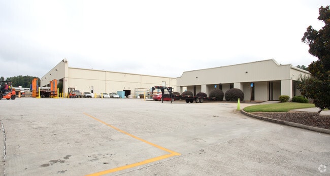
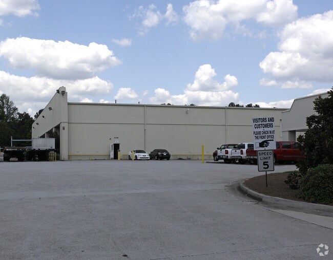
2280 Monier Ave
8182-07-1-0-002
2 BLDGS/10.708 ACRES +, MONIER AVENUE
Officebuilding
Douglas
X
Georgia
13097C0069D
668
2024
10.71 AC
2024
I-20 W/Douglasville
080307
Atlanta
117,120 SF
Atlanta-Sandy Springs-Roswell, GA
DEMOGRAPHICS near 2280 Monier Ave
1 Mile
3 Mile
5 Mile
2024 Total Population
4,989
34,380
94,641
2029 Population
5,249
36,041
98,434
Pop Growth 2024-2029
+ 5.21%
+ 4.83%
+ 4.01%
Average Age
37
37
37
2024 Total Households
2,011
13,340
34,537
HH Growth 2024-2029
+ 5.02%
+ 4.75%
+ 4.05%
Median Household Inc
$52,419
$52,528
$61,118
Avg Household Size
2.50
2.50
2.70
2024 Avg HH Vehicles
2.00
2.00
2.00
Median Home Value
$153,815
$172,003
$200,588
Median Year Built
1994
1991
1989
Nearby Places
Map Layers
Map Styles
 Street
 Aerial
- Restaurants
- Banks
- Shops
- Fitness
- Groceries
PUBLIC TRANSPORTATION
AIRPORT
Hartsfield - Jackson Atlanta International
DRIVE
WALK
Distance
Hartsfield - Jackson Atlanta International
33 min
24.1 mi
Nearby Properties
Address
Land Use
TOTAL SIZE
Lot Size
Zoning
Address
Land Use
TOTAL SIZE
Lot Size
Zoning
840,110 SF
53.36 AC
PUD
Address
Land Use
TOTAL SIZE
Lot Size
Zoning
320,073 SF
38.78 AC
R-MF
Address
Land Use
TOTAL SIZE
Lot Size
Zoning
417,860 SF
40.32 AC
LI
Address
Land Use
TOTAL SIZE
Lot Size
Zoning
75,628 SF
290.39 AC
DCD
Address
Land Use
TOTAL SIZE
Lot Size
Zoning
330,754 SF
27.25 AC
R-6
Address
Land Use
TOTAL SIZE
Lot Size
Zoning
318,456 SF
30.91 AC
R-MF
Address
Land Use
TOTAL SIZE
Lot Size
Zoning
222,846 SF
50.74 AC
R-6
Address
Land Use
TOTAL SIZE
Lot Size
Zoning
285,933 SF
46.22 AC
R-MF
Address
Land Use
TOTAL SIZE
Lot Size
Zoning
494,858 SF
43.29 AC
IL
Address
Land Use
TOTAL SIZE
Lot Size
Zoning
281,844 SF
38.66 AC
R-MF
Address
Land Use
TOTAL SIZE
Lot Size
Zoning
603,952 SF
37.71 AC
IL
Address
Land Use
TOTAL SIZE
Lot Size
Zoning
245,812 SF
30.90 AC
DCD
Address
Land Use
TOTAL SIZE
Lot Size
Zoning
490,726 SF
50.62 AC
LI-R
Address
Land Use
TOTAL SIZE
Lot Size
Zoning
527,000 SF
30.38 AC
LI
Address
Land Use
TOTAL SIZE
Lot Size
Zoning
240,612 SF
23.22 AC
R-6
Address
Land Use
TOTAL SIZE
Lot Size
Zoning
635,664 SF
35.94 AC
5
Address
Land Use
TOTAL SIZE
Lot Size
Zoning
351,845 SF
29.99 AC
LI-R
Address
Land Use
TOTAL SIZE
Lot Size
Zoning
400,000 SF
66.21 AC
IL
Address
Land Use
TOTAL SIZE
Lot Size
Zoning
380,000 SF
33.97 AC
IL
Address
Land Use
TOTAL SIZE
Lot Size
Zoning
280,670 SF
23 AC
PVC
Address
Land Use
TOTAL SIZE
Lot Size
Zoning
283,998 SF
41.22 AC
LI-R
Address
Land Use
TOTAL SIZE
Lot Size
Zoning
312,093 SF
19.79 AC
PUD
Address
Land Use
TOTAL SIZE
Lot Size
Zoning
261,930 SF
21.83 AC
R-A
Address
Land Use
TOTAL SIZE
Lot Size
Zoning
312,240 SF
24.58 AC
PUD
Address
Land Use
TOTAL SIZE
Lot Size
Zoning
261,794 SF
2.32 AC
DCD
Address
Land Use
TOTAL SIZE
Lot Size
Zoning
225,600 SF
50.68 AC
LI-R
Address
Land Use
TOTAL SIZE
Lot Size
Zoning
252,890 SF
18.98 AC
LI-R
Address
Land Use
TOTAL SIZE
Lot Size
Zoning
122,697 SF
13.02 AC
PUD
Address
Land Use
TOTAL SIZE
Lot Size
Zoning
284,307 SF
15.75 AC
LI-R
Address
Land Use
TOTAL SIZE
Lot Size
Zoning
296,942 SF
72.27 AC
IL
The World's #1 Commercial Real Estate Marketplace
Connect with us
© 2025 CoStar Group
The information above has been obtained from sources believed reliable. While we do not doubt its accuracy we have not verified it and make no guarantee, warranty or representation about it. It is your responsibility to independently confirm its accuracy and completeness. Any projections, opinions, assumptions, or estimates used are for example only and do not represent the current or future performance of the property. The value of this transaction to you depends on tax and other factors which should be evaluated by your tax, financial, and legal advisors. You and your advisors should conduct a careful, independent investigation of the property to determine to your satisfaction the suitability of the property for your needs.