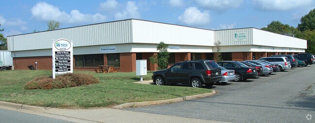
Property Record
2281 Dabney Rd, Richmond, VA 23230


NEARBY LISTINGS FOR SALE OR LEASE
Property Detail
2281 Dabney Rd
777-738-4299
01040A0000 0032B; EL DABNEY RD AC 1.38 PAR A 96 B2 7
Multipleuses
Henrico
X
Virginia
5101290028E
1.38 AC
2025
Scott's Add/West End
2025
Richmond VA
200502
Richmond, VA
20,293 SF
DEMOGRAPHICS near 2281 Dabney Rd
1 Mile
3 Mile
5 Mile
2024 Total Population
5,349
103,079
252,778
2029 Population
5,680
105,145
257,556
Pop Growth 2024-2029
+ 6.19%
+ 2.00%
+ 1.89%
Average Age
48
40
39
2024 Total Households
3,177
48,950
112,966
HH Growth 2024-2029
+ 6.58%
+ 2.08%
+ 2.03%
Median Household Inc
$58,539
$69,895
$63,968
Avg Household Size
1.60
2.00
2.10
2024 Avg HH Vehicles
1.00
2.00
2.00
Median Home Value
$314,500
$355,378
$305,732
Median Year Built
1966
1954
1961
Nearby Places
Map Layers
Map Styles
 Street
 Aerial
- Restaurants
- Banks
- Shops
- Fitness
- Groceries
PUBLIC TRANSPORTATION
COMMUTER RAIL
DRIVE
WALK
Distance
6 min
2.6 mi
DRIVE
WALK
Distance
11 min
7.3 mi
AIRPORT
Richmond International
DRIVE
WALK
Distance
Richmond International
24 min
15.2 mi
Freight Ports
Virginia Port Authority - Richmond
DRIVE
WALK
Distance
Virginia Port Authority - Richmond
21 min
12.5 mi
Nearby Properties
Address
Land Use
TOTAL SIZE
Lot Size
Zoning
Address
Land Use
TOTAL SIZE
Lot Size
Zoning
494,791 SF
38.85 AC
R-6
Address
Land Use
TOTAL SIZE
Lot Size
Zoning
272,131 SF
11.22 AC
R-6 SINGLE
Address
Land Use
TOTAL SIZE
Lot Size
Zoning
597,042 SF
41.03 AC
R-6C
Address
Land Use
TOTAL SIZE
Lot Size
Zoning
482,958 SF
2.38 AC
M-1 LIGHT
Address
Land Use
TOTAL SIZE
Lot Size
Zoning
1,185 SF
2.54 AC
M-1 LIGHT
Address
Land Use
TOTAL SIZE
Lot Size
Zoning
382,570 SF
2.98 AC
UMUC
Address
Land Use
TOTAL SIZE
Lot Size
Zoning
14.89 AC
R-53 MULTI
Address
Land Use
TOTAL SIZE
Lot Size
Zoning
185,604 SF
2.30 AC
MULTIPLE Z
Address
Land Use
TOTAL SIZE
Lot Size
Zoning
16.14 AC
MULTIPLE Z
Address
Land Use
TOTAL SIZE
Lot Size
Zoning
111,876 SF
5.90 AC
M-1 LIGHT
Address
Land Use
TOTAL SIZE
Lot Size
Zoning
321,552 SF
UMUC
Address
Land Use
TOTAL SIZE
Lot Size
Zoning
2.11 AC
M-1
Address
Land Use
TOTAL SIZE
Lot Size
Zoning
299,820 SF
3.16 AC
M-2 HEAVY
Address
Land Use
TOTAL SIZE
Lot Size
Zoning
80,519 SF
27.21 AC
I INSTITUT
Address
Land Use
TOTAL SIZE
Lot Size
Zoning
319,512 SF
20.33 AC
UMU
Address
Land Use
TOTAL SIZE
Lot Size
Zoning
250,000 SF
4.04 AC
Address
Land Use
TOTAL SIZE
Lot Size
Zoning
97,713 SF
21.60 AC
B-4 CENTRA
Address
Land Use
TOTAL SIZE
Lot Size
Zoning
2,909 SF
2.47 AC
M-1 LIGHT
Address
Land Use
TOTAL SIZE
Lot Size
Zoning
21,954 SF
4.79 AC
B-3 GENERA
Address
Land Use
TOTAL SIZE
Lot Size
Zoning
1,404 SF
30.52 AC
R-5
Address
Land Use
TOTAL SIZE
Lot Size
Zoning
3.25 AC
M-1 LIGHT
Address
Land Use
TOTAL SIZE
Lot Size
Zoning
395,435 SF
13.26 AC
O-3C
Address
Land Use
TOTAL SIZE
Lot Size
Zoning
224,768 SF
18.08 AC
R-6
Address
Land Use
TOTAL SIZE
Lot Size
Zoning
126,303 SF
4.50 AC
M-1 LIGHT
Address
Land Use
TOTAL SIZE
Lot Size
Zoning
182,188 SF
21.84 AC
R-5
Address
Land Use
TOTAL SIZE
Lot Size
Zoning
224,108 SF
2.10 AC
M-2 HEAVY
Address
Land Use
TOTAL SIZE
Lot Size
Zoning
257,130 SF
33.65 AC
B-3
Address
Land Use
TOTAL SIZE
Lot Size
Zoning
227,000 SF
6.32 AC
R-6 SINGLE
Address
Land Use
TOTAL SIZE
Lot Size
Zoning
147,352 SF
8.33 AC
R-5 SINGLE
Address
Land Use
TOTAL SIZE
Lot Size
Zoning
228,297 SF
15.79 AC
M-1 LIGHT
The World's #1 Commercial Real Estate Marketplace
Connect with us
© 2025 CoStar Group
The information above has been obtained from sources believed reliable. While we do not doubt its accuracy we have not verified it and make no guarantee, warranty or representation about it. It is your responsibility to independently confirm its accuracy and completeness. Any projections, opinions, assumptions, or estimates used are for example only and do not represent the current or future performance of the property. The value of this transaction to you depends on tax and other factors which should be evaluated by your tax, financial, and legal advisors. You and your advisors should conduct a careful, independent investigation of the property to determine to your satisfaction the suitability of the property for your needs.