Property Record
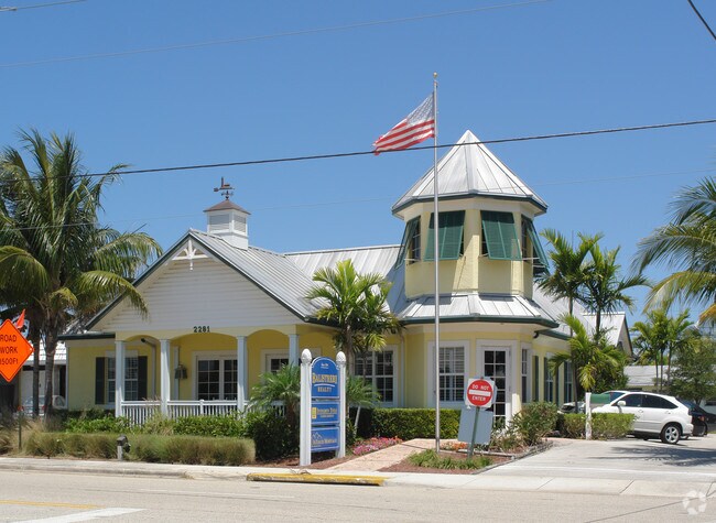
2281 Ne 36Th St, Lighthouse Point, FL 33064


Property Detail
2281 Ne 36Th St
48-43-18-07-0090
LIGHTHOUSE MANOR 43-42 B LOT 9,10 LESS PT FORMED BY EXT AREA OF 25 RAD ARC LOCATED IN SE COR OF SAID LOT 10 BLK 1
Medicalbuilding
Broward
B-1
Florida
AE The base floodplain where base flood elevations are provided. AE Zones are now used on new format FIRMs instead of A1-A30 Zones.
9,10
2025
0.27 AC
2026
Pompano Beach
010901
South Florida
3,754 SF
Fort Lauderdale-Pompano Beach-Sunrise, FL
NEARBY LISTINGS FOR SALE OR LEASE
DEMOGRAPHICS near 2281 Ne 36Th St
1 mile
3 mile
5 mile
2024 Total Population
17,470
113,831
248,656
2029 Population
18,634
121,476
268,045
Pop Growth 2024-2029
+ 6.66%
+ 6.72%
+ 7.80%
Average Age
46
44
46
2024 Total Households
7,754
48,621
111,096
HH Growth 2024-2029
+ 6.80%
+ 6.94%
+ 8.18%
Median Household Inc
$89,020
$68,612
$69,468
Avg Household Size
2.20
2.20
2.10
2024 Avg HH Vehicles
2.00
2.00
1.00
Median Home Value
$617,271
$475,975
$484,697
Median Year Built
1966
1972
1975
Nearby Places
Map Layers
Map Styles
 Street
 Aerial
Transit
 Traffic
 Biking
Places
Listings with unknown addresses are not visible on the map
- Restaurants
- Banks
- Shops
- Fitness
- Groceries
PUBLIC TRANSPORTATION
COMMUTER RAIL
Pompano Beach (Tri-County Commuter - South Florida Regional Transportation Authority (Tri-Rail))
Drive
Walk
Distance
Pompano Beach (Tri-County Commuter - South Florida Regional Transportation Authority (Tri-Rail))
7 min
3.3 mi
Deerfield Beach (Tri-County Commuter - South Florida Regional Transportation Authority (Tri-Rail))
Drive
Walk
Distance
Deerfield Beach (Tri-County Commuter - South Florida Regional Transportation Authority (Tri-Rail))
11 min
6.3 mi
AIRPORT
Fort Lauderdale/Hollywood International
Drive
Walk
Distance
Fort Lauderdale/Hollywood International
28 min
19.5 mi
Palm Beach International
Drive
Walk
Distance
Palm Beach International
44 min
33.7 mi
Freight Ports
Port Everglades
Drive
Walk
Distance
Port Everglades
27 min
18.2 mi
SALE & LEASE HISTORY
LISTING DATE
SALE/LEASE

Apr 26, 2021
For Sale
Nearby Properties
Address
Land Use
TOTAL SIZE
Lot Size
Zoning
Address
Land Use
TOTAL SIZE
Lot Size
Zoning
696,020 SF
31.74 AC
OPC
Address
Land Use
TOTAL SIZE
Lot Size
Zoning
1,166,083 SF
74.07 AC
I
Address
Land Use
TOTAL SIZE
Lot Size
Zoning
513,748 SF
2.99 AC
TO-EOD
Address
Land Use
TOTAL SIZE
Lot Size
Zoning
561,250 SF
137.82 AC
T
Address
Land Use
TOTAL SIZE
Lot Size
Zoning
161,512 SF
16.39 AC
RPC
Address
Land Use
TOTAL SIZE
Lot Size
Zoning
457,033 SF
1.96 AC
TO-EOD
Address
Land Use
TOTAL SIZE
Lot Size
Zoning
392,222 SF
5.33 AC
RPUD
Address
Land Use
TOTAL SIZE
Lot Size
Zoning
285,335 SF
8.56 AC
RM-45
Address
Land Use
TOTAL SIZE
Lot Size
Zoning
386,427 SF
2.24 AC
RM-25
Address
Land Use
TOTAL SIZE
Lot Size
Zoning
374,776 SF
23.52 AC
I-1
Address
Land Use
TOTAL SIZE
Lot Size
Zoning
184,184 SF
2.98 AC
RM-45/HR
Address
Land Use
TOTAL SIZE
Lot Size
Zoning
192,214 SF
10.84 AC
B-3/PCD
Address
Land Use
TOTAL SIZE
Lot Size
Zoning
435,201 SF
23.78 AC
I-1
Address
Land Use
TOTAL SIZE
Lot Size
Zoning
313,030 SF
37.22 AC
CF
Address
Land Use
TOTAL SIZE
Lot Size
Zoning
248,274 SF
13.10 AC
RM-20
Address
Land Use
TOTAL SIZE
Lot Size
Zoning
171,306 SF
0.81 AC
TO-EOD
Address
Land Use
TOTAL SIZE
Lot Size
Zoning
260,464 SF
14.82 AC
PUD
Address
Land Use
TOTAL SIZE
Lot Size
Zoning
210,299 SF
15.19 AC
B-3/PCD
Address
Land Use
TOTAL SIZE
Lot Size
Zoning
252,763 SF
17.03 AC
PUD
Address
Land Use
TOTAL SIZE
Lot Size
Zoning
148,780 SF
13.37 AC
B-1
Address
Land Use
TOTAL SIZE
Lot Size
Zoning
101,978 SF
0.99 AC
RM-25
Address
Land Use
TOTAL SIZE
Lot Size
Zoning
222,660 SF
18.22 AC
CF
Address
Land Use
TOTAL SIZE
Lot Size
Zoning
197,145 SF
13.71 AC
PUD
Address
Land Use
TOTAL SIZE
Lot Size
Zoning
202,384 SF
12.63 AC
I-1
Address
Land Use
TOTAL SIZE
Lot Size
Zoning
139,746 SF
17.86 AC
B-3
Address
Land Use
TOTAL SIZE
Lot Size
Zoning
194,821 SF
19.18 AC
PUD
Address
Land Use
TOTAL SIZE
Lot Size
Zoning
202,893 SF
12.10 AC
PUD
Address
Land Use
TOTAL SIZE
Lot Size
Zoning
248,682 SF
15.10 AC
I-1/PCD
Address
Land Use
TOTAL SIZE
Lot Size
Zoning
16,199 SF
51.78 AC
T-1C
Address
Land Use
TOTAL SIZE
Lot Size
Zoning
97,625 SF
0.89 AC
AOD
The World's #1 Commercial Real Estate Marketplace
Connect with us
© 2026 CoStar Group
The information above has been obtained from sources believed reliable. While we do not doubt its accuracy we have not verified it and make no guarantee, warranty or representation about it. It is your responsibility to independently confirm its accuracy and completeness. Any projections, opinions, assumptions, or estimates used are for example only and do not represent the current or future performance of the property. The value of this transaction to you depends on tax and other factors which should be evaluated by your tax, financial, and legal advisors. You and your advisors should conduct a careful, independent investigation of the property to determine to your satisfaction the suitability of the property for your needs.