Property Record
22811 International Dr, Sterling, VA 20166


NEARBY LISTINGS FOR SALE OR LEASE
Property Detail
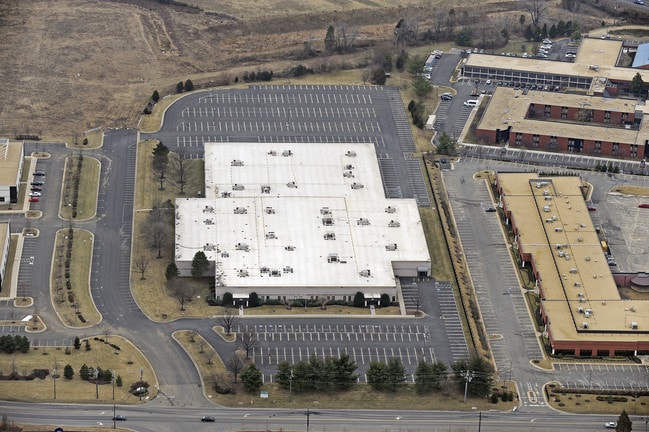
22811 International Dr
Washington-Arlington-Alexandria, DC-VA-MD-WV
Dulles Int Park
034-46-2865
Loudoun
Notresolvable
Virginia
X
9.95 AC
51107C0385E
Rt 28/Dulles North
128,500 SF
Washington, DC
DEMOGRAPHICS near 22811 International Dr
1 Mile
3 Mile
5 Mile
2024 Total Population
4,455
86,304
258,219
2029 Population
4,753
88,076
267,619
Pop Growth 2024-2029
+ 6.69%
+ 2.05%
+ 3.64%
Average Age
36
36
38
2024 Total Households
1,387
29,321
93,617
HH Growth 2024-2029
+ 6.78%
+ 2.08%
+ 3.61%
Median Household Inc
$114,115
$120,888
$133,372
Avg Household Size
3.10
2.80
2.70
2024 Avg HH Vehicles
2.00
2.00
2.00
Median Home Value
$426,383
$493,250
$626,441
Median Year Built
1984
1990
1993
Nearby Places
Map Layers
Map Styles
 Street
 Aerial
- Restaurants
- Banks
- Shops
- Fitness
- Groceries
PUBLIC TRANSPORTATION
AIRPORT
Washington Dulles International
DRIVE
WALK
Distance
Washington Dulles International
12 min
4.5 mi
Ronald Reagan Washington Ntl
DRIVE
WALK
Distance
Ronald Reagan Washington Ntl
45 min
29.7 mi
Freight Ports
Port of Baltimore
DRIVE
WALK
Distance
Port of Baltimore
85 min
61.8 mi
Nearby Properties
Address
Land Use
TOTAL SIZE
Lot Size
Zoning
Address
Land Use
TOTAL SIZE
Lot Size
Zoning
2,700,000 SF
7.51 AC
PDGI
Address
Land Use
TOTAL SIZE
Lot Size
Zoning
125.80 AC
TRC
Address
Land Use
TOTAL SIZE
Lot Size
Zoning
425,073 SF
19.02 AC
330
Address
Land Use
TOTAL SIZE
Lot Size
Zoning
357,437 SF
3.76 AC
350
Address
Land Use
TOTAL SIZE
Lot Size
Zoning
429,038 SF
11.41 AC
400
Address
Land Use
TOTAL SIZE
Lot Size
Zoning
396,112 SF
15.92 AC
330
Address
Land Use
TOTAL SIZE
Lot Size
Zoning
490,340 SF
18.30 AC
320
Address
Land Use
TOTAL SIZE
Lot Size
Zoning
491,841 SF
19.21 AC
320
Address
Land Use
TOTAL SIZE
Lot Size
Zoning
519,708 SF
18.73 AC
316
Address
Land Use
TOTAL SIZE
Lot Size
Zoning
408,315 SF
5.06 AC
400
Address
Land Use
TOTAL SIZE
Lot Size
Zoning
492,219 SF
16.89 AC
330
Address
Land Use
TOTAL SIZE
Lot Size
Zoning
322,205 SF
6.91 AC
330
Address
Land Use
TOTAL SIZE
Lot Size
Zoning
452,626 SF
3.87 AC
400
Address
Land Use
TOTAL SIZE
Lot Size
Zoning
423,347 SF
15.49 AC
312
Address
Land Use
TOTAL SIZE
Lot Size
Zoning
282,193 SF
7.48 AC
400
Address
Land Use
TOTAL SIZE
Lot Size
Zoning
365,468 SF
5.11 AC
400
Address
Land Use
TOTAL SIZE
Lot Size
Zoning
328,008 SF
14.77 AC
897
Address
Land Use
TOTAL SIZE
Lot Size
Zoning
29,800 SF
43.29 AC
IP
Address
Land Use
TOTAL SIZE
Lot Size
Zoning
316,806 SF
28.46 AC
460
Address
Land Use
TOTAL SIZE
Lot Size
Zoning
454,700 SF
54.92 AC
PDGI
Address
Land Use
TOTAL SIZE
Lot Size
Zoning
164,455 SF
14.15 AC
PDIP
Address
Land Use
TOTAL SIZE
Lot Size
Zoning
269,524 SF
13.47 AC
863
Address
Land Use
TOTAL SIZE
Lot Size
Zoning
345,207 SF
9.88 AC
330
Address
Land Use
TOTAL SIZE
Lot Size
Zoning
205,376 SF
15.23 AC
396
Address
Land Use
TOTAL SIZE
Lot Size
Zoning
318,293 SF
4.59 AC
400
Address
Land Use
TOTAL SIZE
Lot Size
Zoning
152,394 SF
10.73 AC
PDIP
Address
Land Use
TOTAL SIZE
Lot Size
Zoning
308,805 SF
34.45 AC
PDCCRC
Address
Land Use
TOTAL SIZE
Lot Size
Zoning
328,057 SF
8.27 AC
312
The World's #1 Commercial Real Estate Marketplace
Connect with us
© 2026 CoStar Group
The information above has been obtained from sources believed reliable. While we do not doubt its accuracy we have not verified it and make no guarantee, warranty or representation about it. It is your responsibility to independently confirm its accuracy and completeness. Any projections, opinions, assumptions, or estimates used are for example only and do not represent the current or future performance of the property. The value of this transaction to you depends on tax and other factors which should be evaluated by your tax, financial, and legal advisors. You and your advisors should conduct a careful, independent investigation of the property to determine to your satisfaction the suitability of the property for your needs.