Property Record
1530 E Reno Rd, Azle, TX 76020
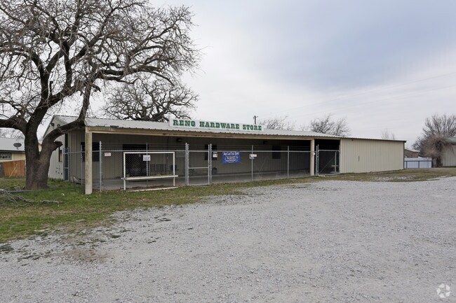


Property Detail
1530 E Reno Rd
Dallas-Fort Worth-Arlington, TX
ACRES: 3.476 LOT: 1R3 BLK: 1 SUBD: ROWDY WINGATE YATES 2ND ADDITION PC D-731; PC E-741
R000093614
Parker
Commercialnec
Texas
B and X Area of moderate flood hazard, usually the area between the limits of the 100-year and 500-year floods.
1r3
2024
3.48 AC
2025
Parker County
140412
Dallas/Ft Worth
3,900 SF
NEARBY LISTINGS FOR SALE OR LEASE
DEMOGRAPHICS near 1530 E Reno Rd
1 mile
3 mile
5 mile
2025 Total Population
1,278
18,013
43,187
2030 Population
1,478
19,979
48,312
Pop Growth 2025-2030
+ 15.65%
+ 10.91%
+ 11.87%
Average Age
40
40
41
2025 Total Households
471
6,660
15,938
HH Growth 2025-2030
+ 15.07%
+ 10.62%
+ 11.44%
Median Household Inc
$84,722
$81,939
$85,174
Avg Household Size
2.60
2.70
2.60
2025 Avg HH Vehicles
2.00
2.00
2.00
Median Home Value
$315,278
$312,481
$339,251
Median Year Built
1985
1988
1993
Nearby Places
Map Layers
Map Styles
 Street
 Aerial
Layers
 Traffic
 Biking
Places
Listings with unknown addresses are not visible on the map
- Restaurants
- Banks
- Shops
- Fitness
- Groceries
PUBLIC TRANSPORTATION
AIRPORT
Dallas-Fort Worth International
Drive
Walk
Distance
Dallas-Fort Worth International
52 min
41.8 mi
SALE & LEASE HISTORY
LISTING DATE
SALE/LEASE

May 14, 2019
For Sale
Nearby Properties
Address
Land Use
TOTAL SIZE
Lot Size
Zoning
Address
Land Use
TOTAL SIZE
Lot Size
Zoning
208,984 SF
14.42 AC
Address
Land Use
TOTAL SIZE
Lot Size
Zoning
262,793 SF
67.85 AC
Address
Land Use
TOTAL SIZE
Lot Size
Zoning
185,807 SF
14.03 AC
Address
Land Use
TOTAL SIZE
Lot Size
Zoning
28,901 SF
14.03 AC
Address
Land Use
TOTAL SIZE
Lot Size
Zoning
62,068 SF
18.93 AC
Address
Land Use
TOTAL SIZE
Lot Size
Zoning
Address
Land Use
TOTAL SIZE
Lot Size
Zoning
119.88 AC
Address
Land Use
TOTAL SIZE
Lot Size
Zoning
36,452 SF
10 AC
Address
Land Use
TOTAL SIZE
Lot Size
Zoning
50,103 SF
11.48 AC
Address
Land Use
TOTAL SIZE
Lot Size
Zoning
62,536 SF
30.53 AC
Address
Land Use
TOTAL SIZE
Lot Size
Zoning
87.74 AC
Address
Land Use
TOTAL SIZE
Lot Size
Zoning
32,334 SF
3.52 AC
Address
Land Use
TOTAL SIZE
Lot Size
Zoning
69,227 SF
19.02 AC
Address
Land Use
TOTAL SIZE
Lot Size
Zoning
62,538 SF
9.19 AC
Address
Land Use
TOTAL SIZE
Lot Size
Zoning
82.25 AC
Address
Land Use
TOTAL SIZE
Lot Size
Zoning
21,141 SF
4.14 AC
Address
Land Use
TOTAL SIZE
Lot Size
Zoning
90,949 SF
5.32 AC
Address
Land Use
TOTAL SIZE
Lot Size
Zoning
71,740 SF
1.75 AC
Address
Land Use
TOTAL SIZE
Lot Size
Zoning
42,008 SF
4.13 AC
Address
Land Use
TOTAL SIZE
Lot Size
Zoning
Address
Land Use
TOTAL SIZE
Lot Size
Zoning
59.11 AC
Address
Land Use
TOTAL SIZE
Lot Size
Zoning
42,206 SF
2.67 AC
Address
Land Use
TOTAL SIZE
Lot Size
Zoning
18,200 SF
4.39 AC
Address
Land Use
TOTAL SIZE
Lot Size
Zoning
36,760 SF
2.79 AC
Address
Land Use
TOTAL SIZE
Lot Size
Zoning
56,317 SF
4.10 AC
Address
Land Use
TOTAL SIZE
Lot Size
Zoning
Address
Land Use
TOTAL SIZE
Lot Size
Zoning
56.08 AC
Address
Land Use
TOTAL SIZE
Lot Size
Zoning
30,824 SF
2.70 AC
Address
Land Use
TOTAL SIZE
Lot Size
Zoning
54,292 SF
6.26 AC
Address
Land Use
TOTAL SIZE
Lot Size
Zoning
The World's #1 Commercial Real Estate Marketplace
Connect with us
© 2026 CoStar Group
The information above has been obtained from sources believed reliable. While we do not doubt its accuracy we have not verified it and make no guarantee, warranty or representation about it. It is your responsibility to independently confirm its accuracy and completeness. Any projections, opinions, assumptions, or estimates used are for example only and do not represent the current or future performance of the property. The value of this transaction to you depends on tax and other factors which should be evaluated by your tax, financial, and legal advisors. You and your advisors should conduct a careful, independent investigation of the property to determine to your satisfaction the suitability of the property for your needs.