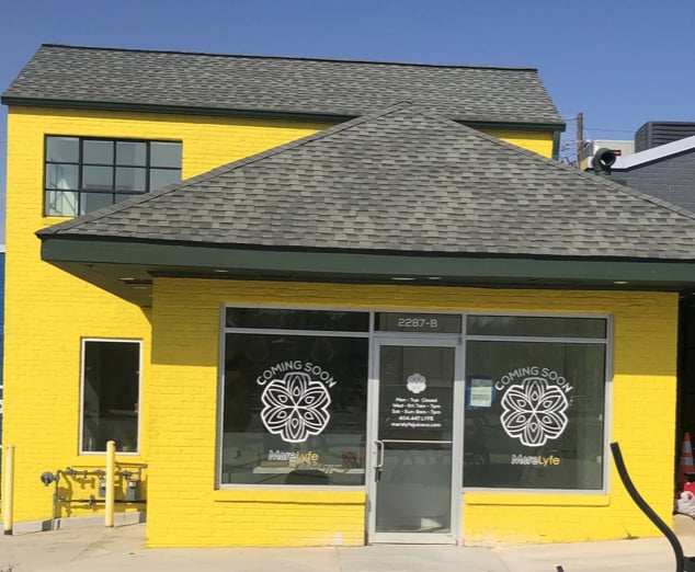
Property Record
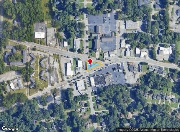
2287 Cascade Rd Sw, Atlanta, GA 30311


NEARBY LISTINGS FOR SALE OR LEASE
Property Detail
2287 Cascade Rd Sw
14-0184-0001-008-1
KA MORE LYFE + MULTI-TENANT PARCEL REVIEW ** UPDATE
Storebuilding
Fulton
X
Georgia
13121C0352F
0.17 AC
2024
College Park/SW Atl
2025
Atlanta
008000
Atlanta-Sandy Springs-Roswell, GA
4,995 SF
DEMOGRAPHICS near 2287 Cascade Rd Sw
1 Mile
3 Mile
5 Mile
2024 Total Population
4,483
83,019
234,112
2029 Population
4,632
86,853
244,755
Pop Growth 2024-2029
+ 3.32%
+ 4.62%
+ 4.55%
Average Age
45
40
38
2024 Total Households
1,895
35,017
96,085
HH Growth 2024-2029
+ 3.48%
+ 4.65%
+ 4.72%
Median Household Inc
$63,965
$45,587
$44,105
Avg Household Size
2.30
2.30
2.30
2024 Avg HH Vehicles
2.00
1.00
1.00
Median Home Value
$333,387
$257,957
$251,197
Median Year Built
1958
1963
1971
Nearby Places
Map Layers
Map Styles
 Street
 Aerial
- Restaurants
- Banks
- Shops
- Fitness
- Groceries
SALE & LEASE HISTORY
LISTING DATE
SALE/LEASE

Nov 15, 2024
For Sale
Nov 14, 2024
For Sale
Nov 07, 2024
For Sale
Feb 21, 2017
For Lease
Dec 21, 2020
For Lease
Nearby Properties
Address
Land Use
TOTAL SIZE
Lot Size
Zoning
Address
Land Use
TOTAL SIZE
Lot Size
Zoning
11.74 AC
I1
Address
Land Use
TOTAL SIZE
Lot Size
Zoning
541,508 SF
110.88 AC
I1
Address
Land Use
TOTAL SIZE
Lot Size
Zoning
857,294 SF
101.10 AC
I1
Address
Land Use
TOTAL SIZE
Lot Size
Zoning
293,935 SF
8.47 AC
I2
Address
Land Use
TOTAL SIZE
Lot Size
Zoning
3,411,710 SF
25.97 AC
RG3
Address
Land Use
TOTAL SIZE
Lot Size
Zoning
425,270 SF
201.84 AC
I1
Address
Land Use
TOTAL SIZE
Lot Size
Zoning
814,536 SF
37 AC
R3
Address
Land Use
TOTAL SIZE
Lot Size
Zoning
274,442 SF
20.33 AC
RG2
Address
Land Use
TOTAL SIZE
Lot Size
Zoning
3,268,352 SF
23.31 AC
RG2
Address
Land Use
TOTAL SIZE
Lot Size
Zoning
1,825,146 SF
16.16 AC
RG3
Address
Land Use
TOTAL SIZE
Lot Size
Zoning
563,256 SF
22.69 AC
I1
Address
Land Use
TOTAL SIZE
Lot Size
Zoning
395,218 SF
21.61 AC
A1
Address
Land Use
TOTAL SIZE
Lot Size
Zoning
34.86 AC
R4
Address
Land Use
TOTAL SIZE
Lot Size
Zoning
4.25 AC
R3
Address
Land Use
TOTAL SIZE
Lot Size
Zoning
70.35 AC
R3
Address
Land Use
TOTAL SIZE
Lot Size
Zoning
6,834,480 SF
9.85 AC
RG3
Address
Land Use
TOTAL SIZE
Lot Size
Zoning
154,200 SF
3.09 AC
I2
Address
Land Use
TOTAL SIZE
Lot Size
Zoning
764,659 SF
51.57 AC
C1
Address
Land Use
TOTAL SIZE
Lot Size
Zoning
79,988 SF
4.05 AC
I1
Address
Land Use
TOTAL SIZE
Lot Size
Zoning
1,477,770 SF
13.60 AC
C1
Address
Land Use
TOTAL SIZE
Lot Size
Zoning
756 SF
52.20 AC
R4
Address
Land Use
TOTAL SIZE
Lot Size
Zoning
38.04 AC
I1
Address
Land Use
TOTAL SIZE
Lot Size
Zoning
910 SF
28.75 AC
R1
Address
Land Use
TOTAL SIZE
Lot Size
Zoning
7,668 SF
17.29 AC
C1
Address
Land Use
TOTAL SIZE
Lot Size
Zoning
2,183,740 SF
12.75 AC
RG3
Address
Land Use
TOTAL SIZE
Lot Size
Zoning
874,924 SF
10 AC
C1
Address
Land Use
TOTAL SIZE
Lot Size
Zoning
281,874 SF
14.72 AC
I1
Address
Land Use
TOTAL SIZE
Lot Size
Zoning
191,540 SF
7.74 AC
RG3
Address
Land Use
TOTAL SIZE
Lot Size
Zoning
60.64 AC
R5
Address
Land Use
TOTAL SIZE
Lot Size
Zoning
191.75 AC
R4
The World's #1 Commercial Real Estate Marketplace
Connect with us
© 2025 CoStar Group
The information above has been obtained from sources believed reliable. While we do not doubt its accuracy we have not verified it and make no guarantee, warranty or representation about it. It is your responsibility to independently confirm its accuracy and completeness. Any projections, opinions, assumptions, or estimates used are for example only and do not represent the current or future performance of the property. The value of this transaction to you depends on tax and other factors which should be evaluated by your tax, financial, and legal advisors. You and your advisors should conduct a careful, independent investigation of the property to determine to your satisfaction the suitability of the property for your needs.