Property Record
22885 Handle Rd, Calhan, CO 80808

Property Detail
22885 Handle Rd
34000-00-265
W2NW4 SEC 24-14-63
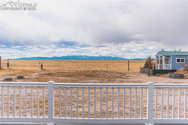
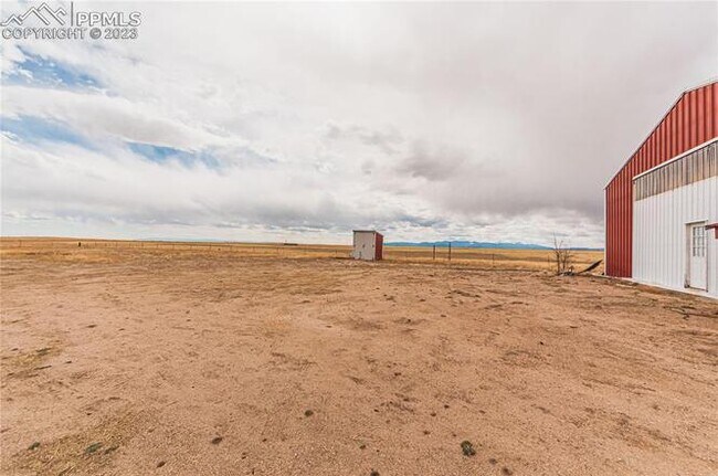
Wellsiteagricultural
EL PASO
A-35
Colorado
B and X Area of moderate flood hazard, usually the area between the limits of the 100-year and 500-year floods.
80 AC
2024
Southeast
2025
Colorado Springs
004603
Colorado Springs, CO
5,248 SF
NEARBY LISTINGS FOR SALE OR LEASE
-
-
View all Calhan listings for lease on LoopNet.com
DEMOGRAPHICS near 22885 Handle Rd
1 mile
3 mile
5 mile
2025 Total Population
69
1,608
2,855
2030 Population
73
1,673
2,978
Pop Growth 2025-2030
+ 5.80%
+ 4.04%
+ 4.31%
Average Age
33
38
38
2025 Total Households
22
556
980
HH Growth 2025-2030
+ 4.55%
+ 4.32%
+ 4.49%
Median Household Inc
$80,000
$84,931
$81,622
Avg Household Size
3.00
2.80
2.80
2025 Avg HH Vehicles
2.00
3.00
3.00
Median Home Value
$416,667
$431,060
$427,317
Median Year Built
2007
1998
1999
Nearby Places
Map Layers
Map Styles
 Street
 Aerial
Layers
 Traffic
 Biking
Places
Listings with unknown addresses are not visible on the map
- Restaurants
- Banks
- Shops
- Fitness
- Groceries
PUBLIC TRANSPORTATION
AIRPORT
City of Colorado Springs Municipal
Drive
Walk
Distance
City of Colorado Springs Municipal
33 min
19.8 mi
Freight Ports
Tulsa Port Of Catoosa
Drive
Walk
Distance
Tulsa Port Of Catoosa
731 min
680.0 mi
SALE & LEASE HISTORY
LISTING DATE
SALE/LEASE

May 08, 2024
For Lease
Nearby Properties
Address
Land Use
TOTAL SIZE
Lot Size
Zoning
Address
Land Use
TOTAL SIZE
Lot Size
Zoning
92,473 SF
10.70 AC
A-35
Address
Land Use
TOTAL SIZE
Lot Size
Zoning
57,884 SF
5.35 AC
A-35
Address
Land Use
TOTAL SIZE
Lot Size
Zoning
3 AC
A-35 RR-5
Address
Land Use
TOTAL SIZE
Lot Size
Zoning
800 AC
RR-5
Address
Land Use
TOTAL SIZE
Lot Size
Zoning
20,330 SF
1.50 AC
CS
Address
Land Use
TOTAL SIZE
Lot Size
Zoning
9,344 SF
2 AC
A-35
Address
Land Use
TOTAL SIZE
Lot Size
Zoning
1,840 SF
29.30 AC
A-35
Address
Land Use
TOTAL SIZE
Lot Size
Zoning
28,302 SF
4.60 AC
PUD
Address
Land Use
TOTAL SIZE
Lot Size
Zoning
3,468 SF
4.77 AC
A-35
Address
Land Use
TOTAL SIZE
Lot Size
Zoning
3,742 SF
80 AC
A35
Address
Land Use
TOTAL SIZE
Lot Size
Zoning
3,641 SF
2.76 AC
A-5
Address
Land Use
TOTAL SIZE
Lot Size
Zoning
3,888 SF
5.40 AC
A-35
Address
Land Use
TOTAL SIZE
Lot Size
Zoning
17,536 SF
77.41 AC
A-35
Address
Land Use
TOTAL SIZE
Lot Size
Zoning
4,197 SF
2.78 AC
PUD
Address
Land Use
TOTAL SIZE
Lot Size
Zoning
165 AC
RR-5
Address
Land Use
TOTAL SIZE
Lot Size
Zoning
1,920 SF
105.62 AC
A35
Address
Land Use
TOTAL SIZE
Lot Size
Zoning
400 SF
10.43 AC
A-35
Address
Land Use
TOTAL SIZE
Lot Size
Zoning
20,677 SF
640 AC
A-35
Address
Land Use
TOTAL SIZE
Lot Size
Zoning
576 SF
0.27 AC
PUD
Address
Land Use
TOTAL SIZE
Lot Size
Zoning
3,500 SF
4.50 AC
CS
Address
Land Use
TOTAL SIZE
Lot Size
Zoning
17,722 SF
35 AC
A-35
Address
Land Use
TOTAL SIZE
Lot Size
Zoning
28.51 AC
A-35
Address
Land Use
TOTAL SIZE
Lot Size
Zoning
3,001 SF
3.50 AC
CS
Address
Land Use
TOTAL SIZE
Lot Size
Zoning
8.20 AC
A-35
Address
Land Use
TOTAL SIZE
Lot Size
Zoning
748 SF
3 AC
A-35
Address
Land Use
TOTAL SIZE
Lot Size
Zoning
6,046 SF
44.09 AC
A-35
Address
Land Use
TOTAL SIZE
Lot Size
Zoning
2,320 SF
0.09 AC
A35
Address
Land Use
TOTAL SIZE
Lot Size
Zoning
1,695 SF
2.54 AC
RR-2.5
Address
Land Use
TOTAL SIZE
Lot Size
Zoning
1,133 SF
4.75 AC
PUD
Address
Land Use
TOTAL SIZE
Lot Size
Zoning
1,484 SF
0.98 AC
A-35
The World's #1 Commercial Real Estate Marketplace
Connect with us
© 2026 CoStar Group
The information above has been obtained from sources believed reliable. While we do not doubt its accuracy we have not verified it and make no guarantee, warranty or representation about it. It is your responsibility to independently confirm its accuracy and completeness. Any projections, opinions, assumptions, or estimates used are for example only and do not represent the current or future performance of the property. The value of this transaction to you depends on tax and other factors which should be evaluated by your tax, financial, and legal advisors. You and your advisors should conduct a careful, independent investigation of the property to determine to your satisfaction the suitability of the property for your needs.