Property Record
Spring Mill Rd, Sheridan, IN 46069

NEARBY LISTINGS FOR SALE OR LEASE
Property Detail
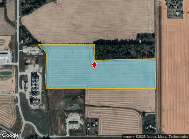
Spring Mill Rd
Indianapolis-Carmel-Anderson, IN
Adams
29-05-03-000-012.000-001
ACREAGE 34.86, SECTION 3, TOWNSHIP 19, RANGE 3
Agriculturalland
Hamilton
A
Indiana
18057C0110G
34.86 AC
2023
Far North Hamilton Cnty
2024
Indianapolis
110303
DEMOGRAPHICS near Spring Mill Rd
1 Mile
3 Mile
5 Mile
2024 Total Population
125
4,333
18,423
2029 Population
137
5,118
21,798
Pop Growth 2024-2029
+ 9.60%
+ 18.12%
+ 18.32%
Average Age
45
40
38
2024 Total Households
50
1,582
6,673
HH Growth 2024-2029
+ 10.00%
+ 17.57%
+ 17.95%
Median Household Inc
$77,500
$65,025
$71,182
Avg Household Size
2.50
2.70
2.70
2024 Avg HH Vehicles
3.00
2.00
2.00
Median Home Value
$248,214
$278,816
$315,059
Median Year Built
1949
1989
2007
Nearby Places
Map Layers
Map Styles
 Street
 Aerial
- Restaurants
- Banks
- Shops
- Fitness
- Groceries
PUBLIC TRANSPORTATION
AIRPORT
Indianapolis International
DRIVE
WALK
Distance
Indianapolis International
66 min
41.9 mi
Freight Ports
Port of Toledo
DRIVE
WALK
Distance
Port of Toledo
265 min
210.3 mi
SALE & LEASE HISTORY
LISTING DATE
SALE/LEASE

Nov 13, 2024
For Sale
Nearby Properties
Address
Land Use
TOTAL SIZE
Lot Size
Zoning
Address
Land Use
TOTAL SIZE
Lot Size
Zoning
172,610 SF
15.51 AC
Address
Land Use
TOTAL SIZE
Lot Size
Zoning
69,205 SF
53.18 AC
Address
Land Use
TOTAL SIZE
Lot Size
Zoning
9,308 SF
9.57 AC
Address
Land Use
TOTAL SIZE
Lot Size
Zoning
13,800 SF
16.92 AC
Address
Land Use
TOTAL SIZE
Lot Size
Zoning
1,200 SF
21.87 AC
Address
Land Use
TOTAL SIZE
Lot Size
Zoning
2.33 AC
Address
Land Use
TOTAL SIZE
Lot Size
Zoning
8,112 SF
16.33 AC
Address
Land Use
TOTAL SIZE
Lot Size
Zoning
4,382 SF
1 AC
Address
Land Use
TOTAL SIZE
Lot Size
Zoning
62,798 SF
3.68 AC
Address
Land Use
TOTAL SIZE
Lot Size
Zoning
107,861 SF
2.65 AC
Address
Land Use
TOTAL SIZE
Lot Size
Zoning
2,400 SF
23.16 AC
Address
Land Use
TOTAL SIZE
Lot Size
Zoning
18,784 SF
11.29 AC
Address
Land Use
TOTAL SIZE
Lot Size
Zoning
8,508 SF
68.22 AC
Address
Land Use
TOTAL SIZE
Lot Size
Zoning
7,506 SF
10 AC
Address
Land Use
TOTAL SIZE
Lot Size
Zoning
4,801 SF
3.34 AC
Address
Land Use
TOTAL SIZE
Lot Size
Zoning
5,678 SF
10.70 AC
Address
Land Use
TOTAL SIZE
Lot Size
Zoning
9,828 SF
79.49 AC
Address
Land Use
TOTAL SIZE
Lot Size
Zoning
6,596 SF
12.43 AC
Address
Land Use
TOTAL SIZE
Lot Size
Zoning
11,220 SF
14.37 AC
Address
Land Use
TOTAL SIZE
Lot Size
Zoning
9,234 SF
18.46 AC
Address
Land Use
TOTAL SIZE
Lot Size
Zoning
29,690 SF
10 AC
Address
Land Use
TOTAL SIZE
Lot Size
Zoning
6,072 SF
5 AC
Address
Land Use
TOTAL SIZE
Lot Size
Zoning
4,538 SF
14.50 AC
Address
Land Use
TOTAL SIZE
Lot Size
Zoning
924 SF
18.79 AC
Address
Land Use
TOTAL SIZE
Lot Size
Zoning
62,145 SF
6 AC
Address
Land Use
TOTAL SIZE
Lot Size
Zoning
8,107 SF
10.04 AC
Address
Land Use
TOTAL SIZE
Lot Size
Zoning
15,205 SF
54.98 AC
Address
Land Use
TOTAL SIZE
Lot Size
Zoning
3,360 SF
34.69 AC
Address
Land Use
TOTAL SIZE
Lot Size
Zoning
8,361 SF
3.50 AC
Address
Land Use
TOTAL SIZE
Lot Size
Zoning
14.15 AC
The World's #1 Commercial Real Estate Marketplace
Connect with us
© 2025 CoStar Group
The information above has been obtained from sources believed reliable. While we do not doubt its accuracy we have not verified it and make no guarantee, warranty or representation about it. It is your responsibility to independently confirm its accuracy and completeness. Any projections, opinions, assumptions, or estimates used are for example only and do not represent the current or future performance of the property. The value of this transaction to you depends on tax and other factors which should be evaluated by your tax, financial, and legal advisors. You and your advisors should conduct a careful, independent investigation of the property to determine to your satisfaction the suitability of the property for your needs.