Property Record
229 E Monroe St, Carlton, OR 97111


Property Detail
229 E Monroe St
96372
TOWNSHIP 3S RANGE 4W SECTION 22 QTR B QQTR C TAXLOT 04800 SUBDIVISIONNAME KUTCHS W.F. ADDITION
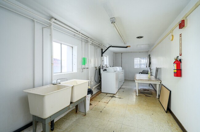
Multifamilydwelling
YAMHILL
MR
Oregon
B and X Area of moderate flood hazard, usually the area between the limits of the 100-year and 500-year floods.
0.72 AC
2025
Yamhill County
2025
Portland
030400
Portland-Vancouver-Hillsboro, OR-WA
NEARBY LISTINGS FOR SALE OR LEASE
-
-
View all Carlton listings for sale on LoopNet.com
DEMOGRAPHICS near 229 E Monroe St
1 mile
3 mile
5 mile
2025 Total Population
2,549
3,472
17,110
2030 Population
2,604
3,533
17,525
Pop Growth 2025-2030
+ 2.16%
+ 1.76%
+ 2.43%
Average Age
42
43
41
2025 Total Households
934
1,272
6,119
HH Growth 2025-2030
+ 2.46%
+ 2.04%
+ 2.61%
Median Household Inc
$105,616
$107,345
$93,083
Avg Household Size
2.70
2.70
2.80
2025 Avg HH Vehicles
3.00
3.00
2.00
Median Home Value
$506,966
$531,798
$465,375
Median Year Built
1988
1987
1993
Nearby Places
Map Layers
Map Styles
 Street
 Aerial
Transit
 Traffic
 Biking
Places
Listings with unknown addresses are not visible on the map
- Restaurants
- Banks
- Shops
- Fitness
- Groceries
PUBLIC TRANSPORTATION
AIRPORT
Portland International
Drive
Walk
Distance
Portland International
78 min
47.0 mi
Freight Ports
Port of Portland
Drive
Walk
Distance
Port of Portland
62 min
45.4 mi
SALE & LEASE HISTORY
LISTING DATE
SALE/LEASE

Sep 15, 2025
For Sale
Nearby Properties
Address
Land Use
TOTAL SIZE
Lot Size
Zoning
Address
Land Use
TOTAL SIZE
Lot Size
Zoning
5.80 AC
HI
Address
Land Use
TOTAL SIZE
Lot Size
Zoning
7.31 AC
PF
Address
Land Use
TOTAL SIZE
Lot Size
Zoning
0.36 AC
DD-MS
Address
Land Use
TOTAL SIZE
Lot Size
Zoning
16.20 AC
AH
Address
Land Use
TOTAL SIZE
Lot Size
Zoning
Address
Land Use
TOTAL SIZE
Lot Size
Zoning
0.54 AC
DD-RR
Address
Land Use
TOTAL SIZE
Lot Size
Zoning
110.29 AC
EF-80
Address
Land Use
TOTAL SIZE
Lot Size
Zoning
Address
Land Use
TOTAL SIZE
Lot Size
Zoning
1,350 SF
39.38 AC
AF-10
Address
Land Use
TOTAL SIZE
Lot Size
Zoning
Address
Land Use
TOTAL SIZE
Lot Size
Zoning
Address
Land Use
TOTAL SIZE
Lot Size
Zoning
5,994 SF
52 AC
EF-40
Address
Land Use
TOTAL SIZE
Lot Size
Zoning
Address
Land Use
TOTAL SIZE
Lot Size
Zoning
Address
Land Use
TOTAL SIZE
Lot Size
Zoning
1.25 AC
AH
Address
Land Use
TOTAL SIZE
Lot Size
Zoning
0.74 AC
CI
Address
Land Use
TOTAL SIZE
Lot Size
Zoning
3,375 SF
20.40 AC
EF-20
Address
Land Use
TOTAL SIZE
Lot Size
Zoning
4,215 SF
13.77 AC
AF-10
Address
Land Use
TOTAL SIZE
Lot Size
Zoning
6,597 SF
19.03 AC
EF-80
Address
Land Use
TOTAL SIZE
Lot Size
Zoning
6,694 SF
161.70 AC
EF-80
Address
Land Use
TOTAL SIZE
Lot Size
Zoning
1,008 SF
43.40 AC
EF-80
Address
Land Use
TOTAL SIZE
Lot Size
Zoning
0.55 AC
DD-RR
Address
Land Use
TOTAL SIZE
Lot Size
Zoning
1.79 AC
PF
Address
Land Use
TOTAL SIZE
Lot Size
Zoning
3,620 SF
3.15 AC
AH EF80
Address
Land Use
TOTAL SIZE
Lot Size
Zoning
7,555 SF
89.90 AC
EF-80
Address
Land Use
TOTAL SIZE
Lot Size
Zoning
0.15 AC
DD-MS
Address
Land Use
TOTAL SIZE
Lot Size
Zoning
1.47 AC
PF
Address
Land Use
TOTAL SIZE
Lot Size
Zoning
6,220 SF
44.85 AC
EF-80
Address
Land Use
TOTAL SIZE
Lot Size
Zoning
0.43 AC
DD-WG
Address
Land Use
TOTAL SIZE
Lot Size
Zoning
2,264 SF
205.46 AC
EF-80
The World's #1 Commercial Real Estate Marketplace
Connect with us
© 2026 CoStar Group
The information above has been obtained from sources believed reliable. While we do not doubt its accuracy we have not verified it and make no guarantee, warranty or representation about it. It is your responsibility to independently confirm its accuracy and completeness. Any projections, opinions, assumptions, or estimates used are for example only and do not represent the current or future performance of the property. The value of this transaction to you depends on tax and other factors which should be evaluated by your tax, financial, and legal advisors. You and your advisors should conduct a careful, independent investigation of the property to determine to your satisfaction the suitability of the property for your needs.