Property Record
229 Polaris Ave, Mountain View, CA 94043


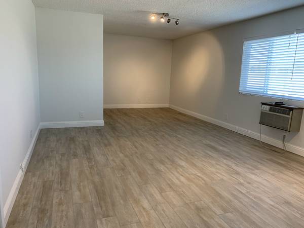

Current Lease Availabilities
NEARBY LISTINGS FOR SALE OR LEASE
Property Detail
229 Polaris Ave
150-22-027
Alma Indust Park
Financialbuilding
Santa Clara
X
California
06085C0039H
0.35 AC
2024
Mountain View
2025
South Bay/San Jose
509202
San Jose-Sunnyvale-Santa Clara, CA
6,016 SF
DEMOGRAPHICS near 229 Polaris Ave
1 Mile
3 Mile
5 Mile
2024 Total Population
37,573
157,998
343,618
2029 Population
36,898
154,029
333,758
Pop Growth 2024-2029
(1.80%)
(2.51%)
(2.87%)
Average Age
38
40
39
2024 Total Households
16,672
62,498
128,782
HH Growth 2024-2029
(2.05%)
(2.63%)
(2.94%)
Median Household Inc
$158,425
$185,800
$179,752
Avg Household Size
2.20
2.50
2.50
2024 Avg HH Vehicles
2.00
2.00
2.00
Median Home Value
$1,121,012
$1,133,283
$1,129,325
Median Year Built
1974
1972
1973
Nearby Places
Map Layers
Map Styles
 Street
 Aerial
- Restaurants
- Banks
- Shops
- Fitness
- Groceries
PUBLIC TRANSPORTATION
TRANSIT/SUBWAY
Mountain View Station (Mountain View - Winchester Line - Santa Clara VTA Light Rail)
DRIVE
WALK
Distance
Mountain View Station (Mountain View - Winchester Line - Santa Clara VTA Light Rail)
2 min
10 min
0.5 mi
Mountain View (Caltrain - Caltrain (Caltrain))
DRIVE
WALK
Distance
Mountain View (Caltrain - Caltrain (Caltrain))
5 min
12 min
0.6 mi
COMMUTER RAIL
DRIVE
WALK
Distance
4 min
12 min
0.6 mi
Mountain View (Caltrain - Caltrain (Caltrain))
DRIVE
WALK
Distance
Mountain View (Caltrain - Caltrain (Caltrain))
5 min
12 min
0.6 mi
AIRPORT
Norman Y Mineta San Jose International
DRIVE
WALK
Distance
Norman Y Mineta San Jose International
16 min
10.4 mi
San Francisco International
DRIVE
WALK
Distance
San Francisco International
34 min
25.1 mi
Metro Oakland International
DRIVE
WALK
Distance
Metro Oakland International
47 min
33.9 mi
Freight Ports
Port of Redwood City
DRIVE
WALK
Distance
Port of Redwood City
19 min
12.0 mi
Nearby Properties
Address
Land Use
TOTAL SIZE
Lot Size
Zoning
Address
Land Use
TOTAL SIZE
Lot Size
Zoning
42.28 AC
PF
Address
Land Use
TOTAL SIZE
Lot Size
Zoning
499,360 SF
31.95 AC
MM40
Address
Land Use
TOTAL SIZE
Lot Size
Zoning
0.33 AC
PF
Address
Land Use
TOTAL SIZE
Lot Size
Zoning
450,575 SF
3.73 AC
P(9)
Address
Land Use
TOTAL SIZE
Lot Size
Zoning
355,490 SF
26.49 AC
P39
Address
Land Use
TOTAL SIZE
Lot Size
Zoning
440,173 SF
25.33 AC
P39
Address
Land Use
TOTAL SIZE
Lot Size
Zoning
73,425 SF
14.20 AC
MS
Address
Land Use
TOTAL SIZE
Lot Size
Zoning
584,389 SF
5.25 AC
P(40)
Address
Land Use
TOTAL SIZE
Lot Size
Zoning
431,256 SF
12.43 AC
PPSP
Address
Land Use
TOTAL SIZE
Lot Size
Zoning
595,000 SF
7.42 AC
P(34)
Address
Land Use
TOTAL SIZE
Lot Size
Zoning
350,633 SF
1.08 AC
MPTOD
Address
Land Use
TOTAL SIZE
Lot Size
Zoning
350,633 SF
1.27 AC
MPTOD
Address
Land Use
TOTAL SIZE
Lot Size
Zoning
350,633 SF
1.08 AC
MPTOD
Address
Land Use
TOTAL SIZE
Lot Size
Zoning
675,100 SF
52.78 AC
RP5
Address
Land Use
TOTAL SIZE
Lot Size
Zoning
353,745 SF
14.82 AC
PPSP
Address
Land Use
TOTAL SIZE
Lot Size
Zoning
233,124 SF
9.18 AC
P(7)
Address
Land Use
TOTAL SIZE
Lot Size
Zoning
4.13 AC
P39
Address
Land Use
TOTAL SIZE
Lot Size
Zoning
23,709 SF
7.48 AC
PPSP
Address
Land Use
TOTAL SIZE
Lot Size
Zoning
350,633 SF
1.27 AC
MPTOD
Address
Land Use
TOTAL SIZE
Lot Size
Zoning
350,633 SF
1.27 AC
MPTOD
Address
Land Use
TOTAL SIZE
Lot Size
Zoning
312,510 SF
23.46 AC
P41
Address
Land Use
TOTAL SIZE
Lot Size
Zoning
372,859 SF
4.71 AC
P
Address
Land Use
TOTAL SIZE
Lot Size
Zoning
298,463 SF
7 AC
P(19)
Address
Land Use
TOTAL SIZE
Lot Size
Zoning
63,131 SF
4.73 AC
P41
Address
Land Use
TOTAL SIZE
Lot Size
Zoning
287,644 SF
10.04 AC
PPSP
Address
Land Use
TOTAL SIZE
Lot Size
Zoning
203,098 SF
7.90 AC
PPSP
Address
Land Use
TOTAL SIZE
Lot Size
Zoning
640,105 SF
7.90 AC
R3-2*
Address
Land Use
TOTAL SIZE
Lot Size
Zoning
340,913 SF
15.64 AC
ML
Address
Land Use
TOTAL SIZE
Lot Size
Zoning
224,505 SF
5.15 AC
CORE
Address
Land Use
TOTAL SIZE
Lot Size
Zoning
33,964 SF
3.95 AC
PPSP
The World's #1 Commercial Real Estate Marketplace
Connect with us
© 2025 CoStar Group
The information above has been obtained from sources believed reliable. While we do not doubt its accuracy we have not verified it and make no guarantee, warranty or representation about it. It is your responsibility to independently confirm its accuracy and completeness. Any projections, opinions, assumptions, or estimates used are for example only and do not represent the current or future performance of the property. The value of this transaction to you depends on tax and other factors which should be evaluated by your tax, financial, and legal advisors. You and your advisors should conduct a careful, independent investigation of the property to determine to your satisfaction the suitability of the property for your needs.